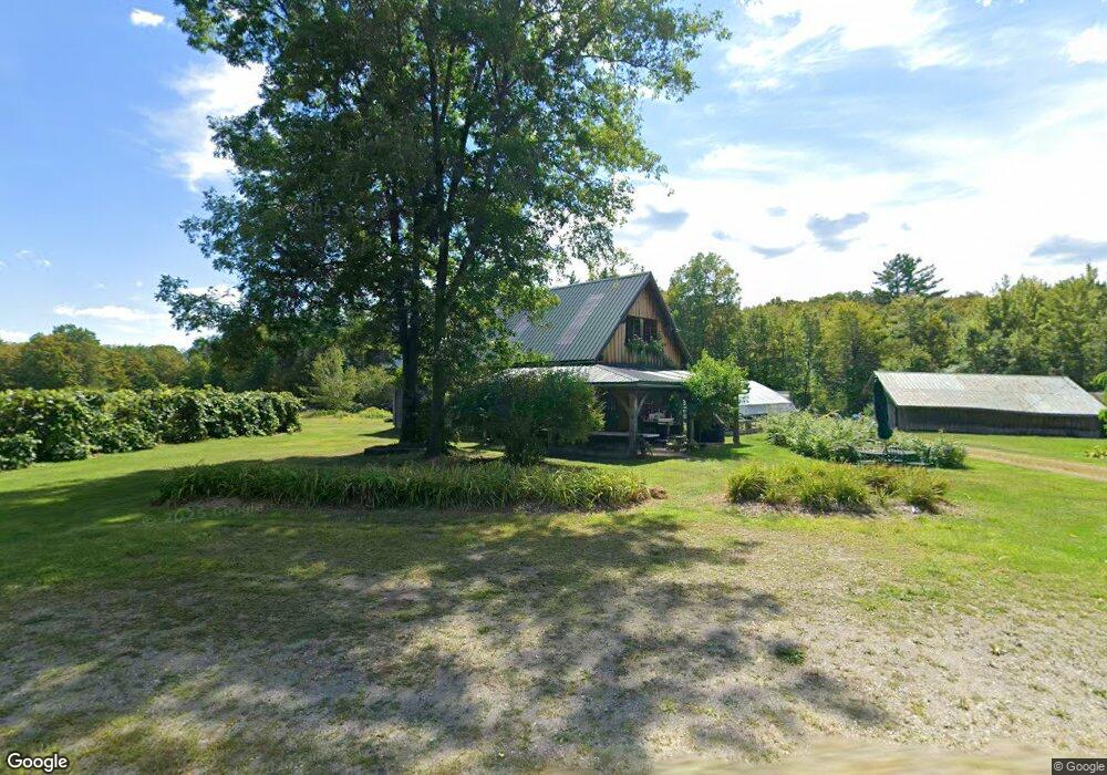
2081 Baptist Corner Rd Shelburne Falls, MA 01370
Ashfield NeighborhoodEstimated Value: $461,000 - $489,000
4
Beds
1
Bath
1,782
Sq Ft
$266/Sq Ft
Est. Value
About This Home
This home is located at 2081 Baptist Corner Rd, Shelburne Falls, MA 01370 and is currently estimated at $473,484, approximately $265 per square foot. 2081 Baptist Corner Rd is a home with nearby schools including Mohawk Trail Regional High School.
Ownership History
Date
Name
Owned For
Owner Type
Purchase Details
Closed on
Jan 29, 2018
Sold by
Davison-Elwell William and Cranmore-Elwell Donna
Bought by
Int W Davison Elwell
Current Estimated Value
Purchase Details
Closed on
Dec 20, 1985
Bought by
Elwell William Davison and Elwell Donna
Create a Home Valuation Report for This Property
The Home Valuation Report is an in-depth analysis detailing your home's value as well as a comparison with similar homes in the area
Home Values in the Area
Average Home Value in this Area
Purchase History
| Date | Buyer | Sale Price | Title Company |
|---|---|---|---|
| Int W Davison Elwell | -- | -- | |
| Davison Elwell Int W | -- | -- | |
| Elwell William Davison | $115,000 | -- |
Source: Public Records
Mortgage History
| Date | Status | Borrower | Loan Amount |
|---|---|---|---|
| Previous Owner | Elwell William Davison | $65,000 | |
| Previous Owner | Elwell William Davison | $23,020 |
Source: Public Records
Tax History Compared to Growth
Tax History
| Year | Tax Paid | Tax Assessment Tax Assessment Total Assessment is a certain percentage of the fair market value that is determined by local assessors to be the total taxable value of land and additions on the property. | Land | Improvement |
|---|---|---|---|---|
| 2025 | $5,107 | $379,393 | $156,093 | $223,300 |
| 2024 | $4,422 | $302,689 | $97,989 | $204,700 |
| 2023 | $4,166 | $236,598 | $80,698 | $155,900 |
| 2022 | $3,981 | $229,033 | $77,533 | $151,500 |
| 2021 | $3,745 | $226,287 | $77,687 | $148,600 |
| 2020 | $3,770 | $226,287 | $77,687 | $148,600 |
| 2019 | $3,708 | $216,102 | $82,902 | $133,200 |
| 2018 | $3,700 | $215,346 | $82,146 | $133,200 |
| 2017 | $3,534 | $217,898 | $84,098 | $133,800 |
| 2016 | $3,424 | $208,267 | $83,967 | $124,300 |
| 2015 | $3,309 | $207,222 | $82,922 | $124,300 |
| 2014 | $3,394 | $209,996 | $76,296 | $133,700 |
Source: Public Records
Map
Nearby Homes
- 581 Pfersick Rd
- 240 Beldingville Rd
- 85 Dacey Rd
- 406 Hart Rd
- 102 Elm St
- 0 Ashfield Rd
- 10 Gardner Falls Rd
- 81 Smith Rd
- 10 Deerfield Ave Unit 5
- 10 Deerfield Ave Unit 2
- 0 Upper St
- 156 Ashfield Rd
- 41 Hog Hollow Rd
- 0 Sears St
- 105 - 107 Bridge St
- 50 State Rd Unit B
- 48 Mechanic St
- 14 River St
- 94 Main St
- 0 Pleasant St
- 69A Pfersick Rd
- 69 Pfersick Rd
- 69 Pfersick Rd
- 1915 Baptist Corner Rd
- 63 Howes Rd
- 69-b Pfersick Rd
- 1932 Baptist Corner Rd
- 1852 Baptist Corner Rd
- 1861 Baptist Corner Rd
- 2304 Baptist Corner Rd
- 1789 Baptist Corner Rd
- 582 Pfersick Rd
- 154 S Warger Rd
- 1789 Baptist Corner Rd
- 214 S Warger Rd
- 177 S Warger Rd
- 77 Elmer Rd
- 1771 Baptist Corner Rd
- 101 N Warger Rd
- 732 Beldingville Rd