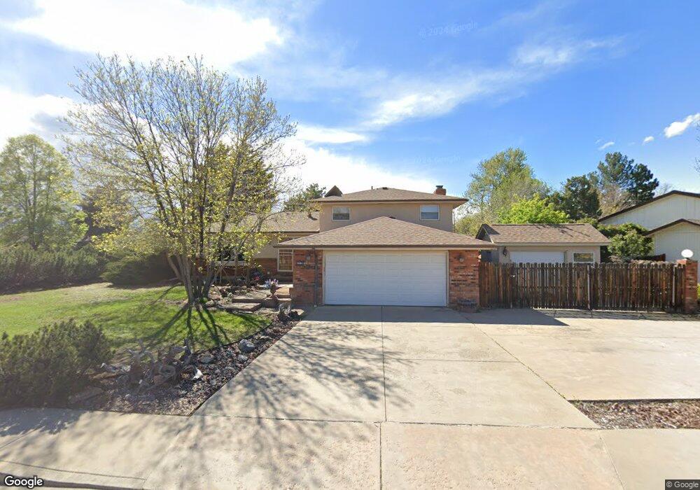
2081 Firestone Ct Loveland, CO 80538
Estimated Value: $530,603 - $575,000
4
Beds
4
Baths
2,950
Sq Ft
$190/Sq Ft
Est. Value
About This Home
This home is located at 2081 Firestone Ct, Loveland, CO 80538 and is currently estimated at $561,151, approximately $190 per square foot. 2081 Firestone Ct is a home located in Larimer County with nearby schools including Ponderosa Elementary School, Walt Clark Middle School, and Thompson Valley High School.
Ownership History
Date
Name
Owned For
Owner Type
Purchase Details
Closed on
Oct 8, 2007
Sold by
Brown Stephen R and Trasser Brown Joanne C
Bought by
Fortin Danae S
Current Estimated Value
Home Financials for this Owner
Home Financials are based on the most recent Mortgage that was taken out on this home.
Original Mortgage
$115,000
Outstanding Balance
$72,806
Interest Rate
6.48%
Mortgage Type
Purchase Money Mortgage
Estimated Equity
$488,345
Purchase Details
Closed on
Jan 24, 2003
Sold by
Brown Stephen R and Tasser Brown Joanne C
Bought by
Brown Stephen R and Trasser Brown Joanne C
Home Financials for this Owner
Home Financials are based on the most recent Mortgage that was taken out on this home.
Original Mortgage
$109,000
Interest Rate
5.41%
Purchase Details
Closed on
Jan 1, 1996
Sold by
Plock Roger K
Bought by
Brown Stephen R
Purchase Details
Closed on
Aug 1, 1992
Sold by
Woodard Theresa
Bought by
Plock Karen M
Create a Home Valuation Report for This Property
The Home Valuation Report is an in-depth analysis detailing your home's value as well as a comparison with similar homes in the area
Home Values in the Area
Average Home Value in this Area
Purchase History
| Date | Buyer | Sale Price | Title Company |
|---|---|---|---|
| Fortin Danae S | $250,000 | None Available | |
| Brown Stephen R | -- | -- | |
| Brown Stephen R | $162,000 | -- | |
| Plock Karen M | $127,500 | -- |
Source: Public Records
Mortgage History
| Date | Status | Borrower | Loan Amount |
|---|---|---|---|
| Open | Fortin Danae S | $115,000 | |
| Previous Owner | Brown Stephen R | $109,000 |
Source: Public Records
Tax History Compared to Growth
Tax History
| Year | Tax Paid | Tax Assessment Tax Assessment Total Assessment is a certain percentage of the fair market value that is determined by local assessors to be the total taxable value of land and additions on the property. | Land | Improvement |
|---|---|---|---|---|
| 2025 | $2,627 | $36,602 | $1,903 | $34,699 |
| 2024 | $2,534 | $36,602 | $1,903 | $34,699 |
| 2022 | $2,198 | $27,626 | $1,974 | $25,652 |
| 2021 | $2,259 | $28,422 | $2,031 | $26,391 |
| 2020 | $2,155 | $27,106 | $2,031 | $25,075 |
| 2019 | $2,119 | $27,106 | $2,031 | $25,075 |
| 2018 | $1,966 | $23,883 | $2,045 | $21,838 |
| 2017 | $1,693 | $23,883 | $2,045 | $21,838 |
| 2016 | $1,504 | $20,505 | $2,261 | $18,244 |
| 2015 | $1,492 | $20,500 | $2,260 | $18,240 |
| 2014 | $1,407 | $18,710 | $2,260 | $16,450 |
Source: Public Records
Map
Nearby Homes
- 2467 Farisita Dr
- 1670 Stove Prairie Cir
- 1682 Stove Prairie Cir
- 2216 Durango Dr
- 2217 Durango Dr
- 2264 Durango Dr
- 2503 N Estrella Ave
- 1942 Lakewood Dr
- 1726 Kennedy Ave
- 1718 Dotsero Ave
- 2628 Hayden Ct
- 2387 W U S 34
- 2002 Falls Ct
- 2030 W 17th St Unit A8
- 1812 Van Buren Ave
- 1633 Van Buren Ave Unit 1
- 1805 W 22nd St
- 1304 Pine St
- 2001 Cameo Ave
- 3363 Cuchara Ct
- 2551 Farisita Dr
- 2093 Firestone Ct
- 2080 Firestone Ct
- 2605 Farisita Dr
- 2550 Farisita Dr
- 2538 Farisita Dr
- 2103 Firestone Ct
- 2092 Firestone Ct
- 2604 Farisita Dr
- 2102 Firestone Ct
- 2526 Farisita Dr
- 2115 Firestone Ct
- 2092 Garo Ct
- 2102 Garo Ct
- 2616 Farisita Dr
- 2114 Firestone Ct
- 1931 Hillrose Dr
- 2114 Garo Ct
- 1954 Hillrose Dr
- 2628 Farisita Dr