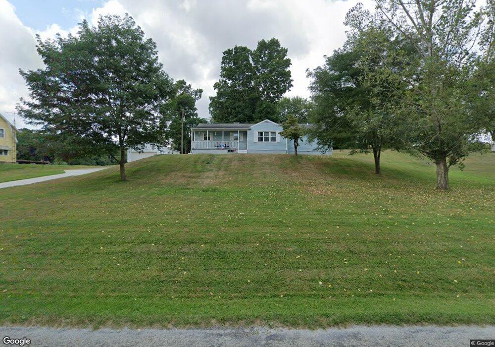
2081 Stringtown Rd NE Lancaster, OH 43130
Estimated Value: $331,000 - $344,000
5
Beds
2
Baths
1,520
Sq Ft
$222/Sq Ft
Est. Value
About This Home
This home is located at 2081 Stringtown Rd NE, Lancaster, OH 43130 and is currently estimated at $337,237, approximately $221 per square foot. 2081 Stringtown Rd NE is a home located in Fairfield County with nearby schools including St Mary Elementary School, Fairfield Christian Academy, and William V Fisher Catholic High School.
Ownership History
Date
Name
Owned For
Owner Type
Purchase Details
Closed on
May 5, 2000
Sold by
Sprouse Robert J
Bought by
Fausnaugh Kevin L and Fausnaugh Peggy J
Current Estimated Value
Home Financials for this Owner
Home Financials are based on the most recent Mortgage that was taken out on this home.
Original Mortgage
$110,000
Outstanding Balance
$38,275
Interest Rate
8.24%
Mortgage Type
New Conventional
Estimated Equity
$298,962
Purchase Details
Closed on
Jan 8, 1992
Sold by
Spencer Richard J
Bought by
Sprouse Robert Jj
Purchase Details
Closed on
May 1, 1987
Create a Home Valuation Report for This Property
The Home Valuation Report is an in-depth analysis detailing your home's value as well as a comparison with similar homes in the area
Home Values in the Area
Average Home Value in this Area
Purchase History
| Date | Buyer | Sale Price | Title Company |
|---|---|---|---|
| Fausnaugh Kevin L | $134,000 | -- | |
| Sprouse Robert Jj | $85,000 | -- | |
| -- | $48,000 | -- |
Source: Public Records
Mortgage History
| Date | Status | Borrower | Loan Amount |
|---|---|---|---|
| Open | Fausnaugh Kevin L | $110,000 |
Source: Public Records
Tax History Compared to Growth
Tax History
| Year | Tax Paid | Tax Assessment Tax Assessment Total Assessment is a certain percentage of the fair market value that is determined by local assessors to be the total taxable value of land and additions on the property. | Land | Improvement |
|---|---|---|---|---|
| 2024 | $6,869 | $70,740 | $18,840 | $51,900 |
| 2023 | $2,846 | $70,740 | $18,840 | $51,900 |
| 2022 | $2,882 | $70,740 | $18,840 | $51,900 |
| 2021 | $2,360 | $56,350 | $17,130 | $39,220 |
| 2020 | $2,269 | $56,350 | $17,130 | $39,220 |
| 2019 | $2,165 | $56,350 | $17,130 | $39,220 |
| 2018 | $1,968 | $48,390 | $17,130 | $31,260 |
| 2017 | $1,969 | $48,390 | $17,130 | $31,260 |
| 2016 | $1,825 | $48,390 | $17,130 | $31,260 |
| 2015 | $1,832 | $47,090 | $17,130 | $29,960 |
| 2014 | $1,747 | $47,090 | $17,130 | $29,960 |
| 2013 | $1,747 | $47,090 | $17,130 | $29,960 |
Source: Public Records
Map
Nearby Homes
- 173 Lakeview Dr NE
- 715 Sherman Bluff Way Unit 14715
- 2149 Pleasantview Dr NE
- 1801 Pleasantview Dr NE
- 1916 Country Place
- 2865 Stringtown Rd NW
- 1700 Rosewood Dr NE
- 0 Coonpath Rd NW Unit Tract 7 224028097
- 0 Coonpath Rd NW Unit Tract 4 224028093
- 626 Rainbow Dr NW
- 0 Tschopp Rd NE Unit Lot 33 225027324
- 0 Tschopp Rd NE Unit Lot 17 225027320
- 980 Coonpath Rd NE
- 3340 Stringtown Rd NE
- 0 Old Millersport Rd NE Unit Lot 10 225033491
- 0 Old Millersport Rd NE Unit 225010386
- 0 Old Millersport Rd NE Unit Tract 8 224028101
- 2444 Sheridan Dr
- 1189 Ridge Rd NE
- 1760 Rainbow Dr NE
- 2105 Stringtown Rd NE
- 2065 Stringtown Rd NE
- 2054 Stringtown Rd NE
- 2040 Stringtown Rd NE
- 1995 Stringtown Rd NE
- 286 Rainbow Dr NE
- 333 Rainbow Dr NE
- 266 Rainbow Dr NE
- 437 Rainbow Dr NE
- 246 Rainbow Dr NE
- 267 Rainbow Dr NE
- 267 Rainbow Dr NE
- 1935 Stringtown Rd NE
- 245 Rainbow Dr NE
- 200 Rainbow Dr NE
- 1865 Stringtown Rd NE
- 1920 Stringtown Rd NE
- 575 Rainbow Dr NE
- 1825 Stringtown Rd NE
- 1845 Stringtown Rd NE