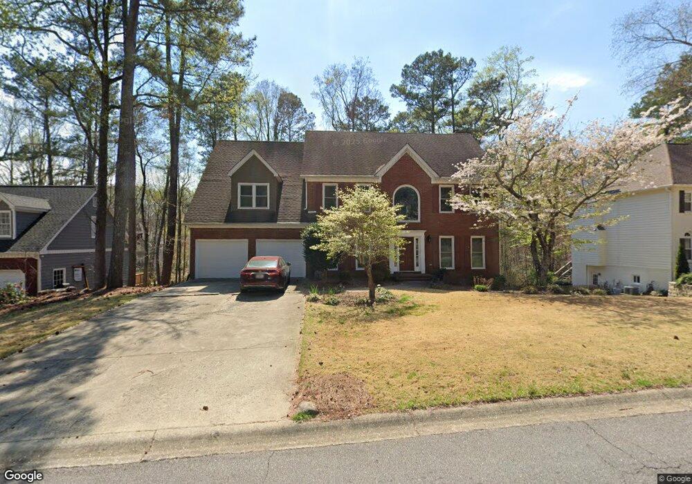
2081 Wilshire Dr SW Unit 5 Marietta, GA 30064
West Cobb NeighborhoodEstimated Value: $486,000 - $567,000
4
Beds
3
Baths
2,978
Sq Ft
$177/Sq Ft
Est. Value
About This Home
This home is located at 2081 Wilshire Dr SW Unit 5, Marietta, GA 30064 and is currently estimated at $528,196, approximately $177 per square foot. 2081 Wilshire Dr SW Unit 5 is a home located in Cobb County with nearby schools including Cheatham Hill Elementary School, Lovinggood Middle School, and Hillgrove High School.
Ownership History
Date
Name
Owned For
Owner Type
Purchase Details
Closed on
Oct 18, 1993
Sold by
Miller Robert M Elaine
Bought by
Race Thomas B Cassa
Current Estimated Value
Home Financials for this Owner
Home Financials are based on the most recent Mortgage that was taken out on this home.
Original Mortgage
$135,000
Interest Rate
6.97%
Create a Home Valuation Report for This Property
The Home Valuation Report is an in-depth analysis detailing your home's value as well as a comparison with similar homes in the area
Home Values in the Area
Average Home Value in this Area
Purchase History
| Date | Buyer | Sale Price | Title Company |
|---|---|---|---|
| Race Thomas B Cassa | $171,900 | -- |
Source: Public Records
Mortgage History
| Date | Status | Borrower | Loan Amount |
|---|---|---|---|
| Closed | Race Thomas B Cassa | $135,000 |
Source: Public Records
Tax History Compared to Growth
Tax History
| Year | Tax Paid | Tax Assessment Tax Assessment Total Assessment is a certain percentage of the fair market value that is determined by local assessors to be the total taxable value of land and additions on the property. | Land | Improvement |
|---|---|---|---|---|
| 2025 | $1,226 | $208,292 | $40,000 | $168,292 |
| 2024 | $1,223 | $206,072 | $16,000 | $190,072 |
| 2023 | $1,017 | $206,072 | $16,000 | $190,072 |
| 2022 | $1,082 | $158,940 | $16,000 | $142,940 |
| 2021 | $1,010 | $134,884 | $16,000 | $118,884 |
| 2020 | $3,176 | $125,992 | $16,000 | $109,992 |
| 2019 | $3,034 | $119,504 | $16,000 | $103,504 |
| 2018 | $2,729 | $105,588 | $16,000 | $89,588 |
| 2017 | $2,618 | $105,588 | $16,000 | $89,588 |
| 2016 | $2,261 | $89,256 | $16,000 | $73,256 |
| 2015 | $2,316 | $89,256 | $16,000 | $73,256 |
| 2014 | $2,077 | $78,744 | $0 | $0 |
Source: Public Records
Map
Nearby Homes
- 1646 Desford Ct SW
- 2040 Hardwood Cir SW Unit 3
- 2093 Breconridge Dr SW
- 1830 MacLand Rd SW
- 1533 Fallen Leaf Dr SW
- 1946 MacLand Rd SW
- 1505 Old John Ward Rd SW
- 2002 MacLand Square Dr Unit 1
- 1952 Freestone Way
- Monteluce Plan at Freestone Station
- Hillside Plan at Freestone Station
- Oakshire Plan at Freestone Station
- Hendricks Plan at Freestone Station
- Hedgerow Plan at Freestone Station
- Antioch Plan at Freestone Station
- 2028 MacLand Square Dr Unit 4
- 1985 Freestone Way
- 1537 Mcadoo Dr SW
- 1830 Kolb Farm Cir SW Unit 7
- 2009 Freestone Way
- 2083 Wilshire Dr SW
- 2083 Wilshire Dr SW Unit 5
- 2083 Wilshire Dr SW Unit 45
- 2083 Wilshire Dr SW
- 2079 Wilshire Dr SW
- 1756 Benningfield Dr SW
- 2085 Wilshire Dr SW
- 2077 Wilshire Dr SW
- 1670 Windcrest Dr SW
- 1758 Benningfield Dr SW
- 1755 Benningfield Dr SW
- 2078 Wilshire Dr SW
- 1669 Windcrest Dr SW
- 1760 Benningfield Dr SW
- 2075 Wilshire Dr SW
- 1850 Westbury Ln SW
- 1814 Windcrest Cir SW
- 1816 Windcrest Cir SW
- 1812 Windcrest Cir SW
- 1757 Benningfield Dr SW Unit 5