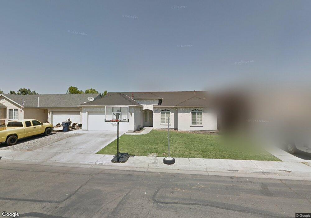
2082 Mcintyre St Dos Palos, CA 93620
Estimated Value: $180,000 - $358,000
3
Beds
2
Baths
1,325
Sq Ft
$230/Sq Ft
Est. Value
About This Home
This home is located at 2082 Mcintyre St, Dos Palos, CA 93620 and is currently estimated at $304,765, approximately $230 per square foot. 2082 Mcintyre St is a home located in Merced County with nearby schools including Bernhard Marks Elementary School, Dos Palos Elementary School, and Bryant Middle School.
Ownership History
Date
Name
Owned For
Owner Type
Purchase Details
Closed on
Jun 8, 2009
Sold by
Secretary Of Housing & Urban Development
Bought by
Andrade Juan C
Current Estimated Value
Home Financials for this Owner
Home Financials are based on the most recent Mortgage that was taken out on this home.
Original Mortgage
$87,000
Outstanding Balance
$55,145
Interest Rate
4.83%
Mortgage Type
Purchase Money Mortgage
Estimated Equity
$249,620
Purchase Details
Closed on
Jan 7, 2009
Sold by
Countrywide Home Loans Servicing Lp
Bought by
The Secretary Of Housing & Urban Develop
Purchase Details
Closed on
May 19, 2003
Sold by
Muir Estates Llc
Bought by
Brown Daniel R and Brown Marilyn D
Home Financials for this Owner
Home Financials are based on the most recent Mortgage that was taken out on this home.
Original Mortgage
$168,174
Interest Rate
5.75%
Mortgage Type
FHA
Create a Home Valuation Report for This Property
The Home Valuation Report is an in-depth analysis detailing your home's value as well as a comparison with similar homes in the area
Home Values in the Area
Average Home Value in this Area
Purchase History
| Date | Buyer | Sale Price | Title Company |
|---|---|---|---|
| Andrade Juan C | $83,000 | Fidelity National Title Co | |
| The Secretary Of Housing & Urban Develop | -- | None Available | |
| Countrywide Home Loans Servicing Lp | $169,389 | First American Title Company | |
| Brown Daniel R | $171,000 | Fidelity Title Company |
Source: Public Records
Mortgage History
| Date | Status | Borrower | Loan Amount |
|---|---|---|---|
| Open | Andrade Juan C | $87,000 | |
| Previous Owner | Brown Daniel R | $168,174 |
Source: Public Records
Tax History Compared to Growth
Tax History
| Year | Tax Paid | Tax Assessment Tax Assessment Total Assessment is a certain percentage of the fair market value that is determined by local assessors to be the total taxable value of land and additions on the property. | Land | Improvement |
|---|---|---|---|---|
| 2025 | $1,105 | $106,867 | $25,746 | $81,121 |
| 2024 | $1,105 | $104,773 | $25,242 | $79,531 |
| 2023 | $1,069 | $102,720 | $24,748 | $77,972 |
| 2022 | $1,022 | $100,707 | $24,263 | $76,444 |
| 2021 | $1,024 | $98,734 | $23,788 | $74,946 |
| 2020 | $1,012 | $97,723 | $23,545 | $74,178 |
| 2019 | $994 | $95,808 | $23,084 | $72,724 |
| 2018 | $970 | $93,931 | $22,632 | $71,299 |
| 2017 | $951 | $92,090 | $22,189 | $69,901 |
| 2016 | $936 | $90,285 | $21,754 | $68,531 |
| 2015 | $924 | $88,930 | $21,428 | $67,502 |
| 2014 | $905 | $87,189 | $21,009 | $66,180 |
Source: Public Records
Map
Nearby Homes
- 1951 McDonald Ave
- 2021 Madera Ave
- 1830 Valeria St
- 1734 Golden Gate Ave
- 1725 California Ave
- 0 Christian Ave Unit MC25192664
- 0 Christian Ave Unit MC25192705
- 0 Christian Ave Unit MC25192693
- 0 Christian Ave Unit MC25192654
- 37 Christian Ave
- 21188 Elgin Ave
- 1602 Lucerne Ave
- 1410 Frank Ave
- 1333 Frank Ave
- 1325 Norton Ave
- 2373 Olive St
- 1256 California Ave
- 1666 Oliver St
- 21627 State Highway 33
- 1274 Dos Palos Ave
- 2074 Mcintyre St
- 2090 Mcintyre St
- 2050 S Mctaggart Ave
- 2050 Mctaggart Ave
- 2051 Mccullough Ave
- 2043 Mccullough Ave
- 2042 Mctaggart Ave
- 2083 Mcintyre St
- 2091 Mcintyre St
- 2075 Mcintyre St
- 2118 Mcintyre St
- 2059 Mctaggart Ave
- 2107 Mcintyre St
- 2051 Mctaggart Ave
- 2119 Mccurdy St
- 2067 Mctaggart Ave
- 2043 Mctaggart Ave
- 2075 Mctaggart Ave
- 2119 Mcintyre St
- 2126 Mcintyre St