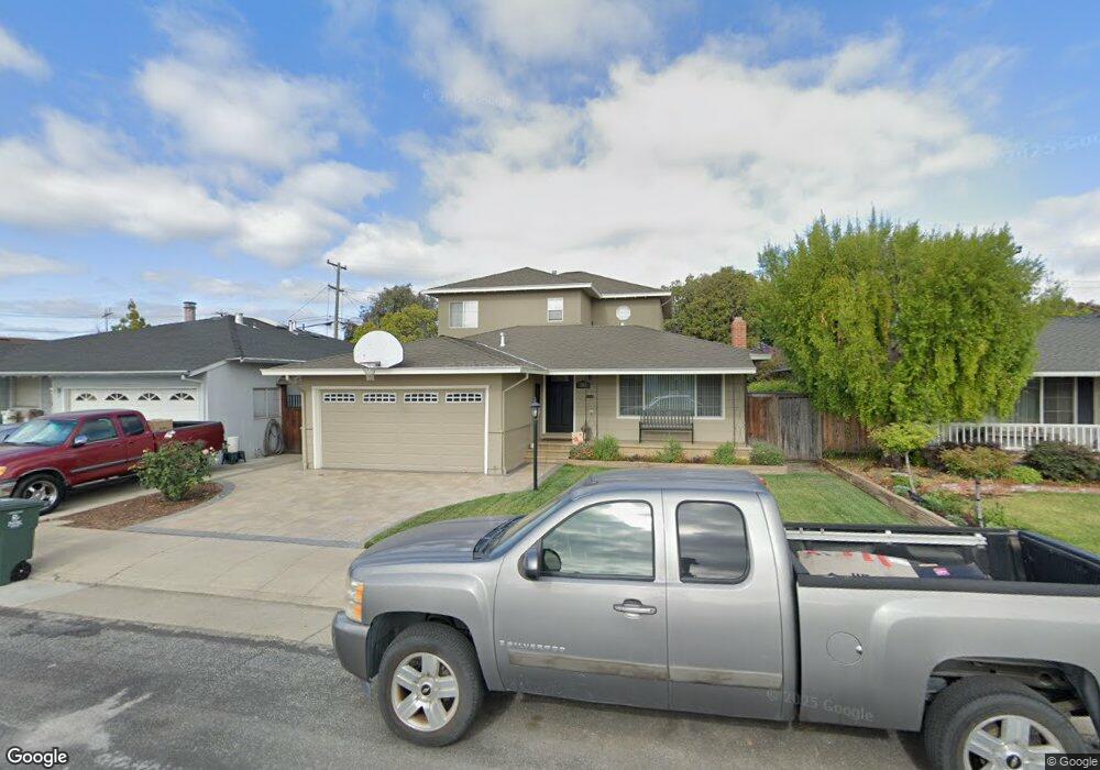
2082 Sullivan St San Mateo, CA 94403
Hillsdale NeighborhoodEstimated Value: $1,549,000 - $1,842,000
3
Beds
2
Baths
1,280
Sq Ft
$1,308/Sq Ft
Est. Value
About This Home
This home is located at 2082 Sullivan St, San Mateo, CA 94403 and is currently estimated at $1,674,208, approximately $1,307 per square foot. 2082 Sullivan St is a home located in San Mateo County with nearby schools including Sunnybrae Elementary School, Borel Middle School, and Hillsdale High School.
Ownership History
Date
Name
Owned For
Owner Type
Purchase Details
Closed on
Nov 9, 1994
Sold by
Smith Jeffrey D
Bought by
Smith Jeffrey D and Smith Anne M
Current Estimated Value
Home Financials for this Owner
Home Financials are based on the most recent Mortgage that was taken out on this home.
Original Mortgage
$160,000
Interest Rate
8.42%
Create a Home Valuation Report for This Property
The Home Valuation Report is an in-depth analysis detailing your home's value as well as a comparison with similar homes in the area
Home Values in the Area
Average Home Value in this Area
Purchase History
| Date | Buyer | Sale Price | Title Company |
|---|---|---|---|
| Smith Jeffrey D | -- | North American Title Insuran |
Source: Public Records
Mortgage History
| Date | Status | Borrower | Loan Amount |
|---|---|---|---|
| Closed | Smith Jeffrey D | $160,000 |
Source: Public Records
Tax History
| Year | Tax Paid | Tax Assessment Tax Assessment Total Assessment is a certain percentage of the fair market value that is determined by local assessors to be the total taxable value of land and additions on the property. | Land | Improvement |
|---|---|---|---|---|
| 2025 | $6,799 | $418,578 | $139,375 | $279,203 |
| 2023 | $6,799 | $402,326 | $133,964 | $268,362 |
| 2022 | $6,738 | $394,438 | $131,338 | $263,100 |
| 2021 | $6,540 | $386,705 | $128,763 | $257,942 |
| 2020 | $6,194 | $382,741 | $127,443 | $255,298 |
| 2019 | $5,698 | $375,238 | $124,945 | $250,293 |
| 2018 | $5,427 | $367,882 | $122,496 | $245,386 |
| 2017 | $5,220 | $360,670 | $120,095 | $240,575 |
| 2016 | $4,900 | $353,599 | $117,741 | $235,858 |
| 2015 | $4,924 | $348,289 | $115,973 | $232,316 |
| 2014 | $4,807 | $341,468 | $113,702 | $227,766 |
Source: Public Records
Map
Nearby Homes
- 678 Connie Ave
- 406 E 28th Ave
- 418 Chapman Ln
- 2862 Baze Rd
- 1931 Palm Ave
- 379 Derby Ave
- 1927 Palm Ave
- 1211 Wayne Way
- 2315 Holland St
- 25 Mcaker Ct Unit 103
- 2655 Edison St Unit 102
- 637 Vanessa Dr
- 3044 Mawing Rd
- 35 W 20th Ave Unit 203
- 35 W 20th Ave Unit 109
- 35 W 20th Ave Unit 105
- 1787 Brooks St
- 1662 Washington St
- 35 28th Ave Unit 307
- 88 17th Ave Unit 201
- 2074 Sullivan St
- 2090 Sullivan St
- 2066 Sullivan St
- 2081 Trinity St
- 921 Fiesta Dr
- 2073 Trinity St
- 2089 Trinity St
- 2065 Trinity St
- 903 Fiesta Dr
- 2058 Sullivan St
- 2083 Sullivan St
- 2097 Sullivan St
- 2057 Trinity St
- 2067 Sullivan St
- 1009 Fiesta Dr
- 2050 Sullivan St
- 2059 Sullivan St
- 2049 Trinity St
- 922 Fiesta Dr
- 916 Fiesta Dr
Your Personal Tour Guide
Ask me questions while you tour the home.