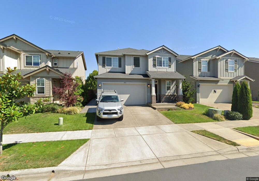
2083 35th Ave Forest Grove, OR 97116
Estimated Value: $551,000 - $623,000
4
Beds
3
Baths
2,325
Sq Ft
$255/Sq Ft
Est. Value
About This Home
This home is located at 2083 35th Ave, Forest Grove, OR 97116 and is currently estimated at $592,689, approximately $254 per square foot. 2083 35th Ave is a home located in Washington County with nearby schools including Harvey Clarke Elementary School, Tom McCall Upper Elementary School, and Neil Armstrong Middle School.
Ownership History
Date
Name
Owned For
Owner Type
Purchase Details
Closed on
Mar 3, 2021
Sold by
Naranjo Gallardo Geovani
Bought by
Daino Michael M and Daino Stefanie M
Current Estimated Value
Home Financials for this Owner
Home Financials are based on the most recent Mortgage that was taken out on this home.
Original Mortgage
$476,999
Outstanding Balance
$425,648
Interest Rate
2.7%
Mortgage Type
New Conventional
Estimated Equity
$167,041
Purchase Details
Closed on
May 22, 2019
Sold by
Lennar Northwest Inc
Bought by
Naranjo Gallardo Geovani
Home Financials for this Owner
Home Financials are based on the most recent Mortgage that was taken out on this home.
Original Mortgage
$423,605
Interest Rate
4.1%
Mortgage Type
New Conventional
Create a Home Valuation Report for This Property
The Home Valuation Report is an in-depth analysis detailing your home's value as well as a comparison with similar homes in the area
Home Values in the Area
Average Home Value in this Area
Purchase History
| Date | Buyer | Sale Price | Title Company |
|---|---|---|---|
| Daino Michael M | $529,999 | Lawyers Title | |
| Naranjo Gallardo Geovani | $445,900 | First American |
Source: Public Records
Mortgage History
| Date | Status | Borrower | Loan Amount |
|---|---|---|---|
| Open | Daino Michael M | $476,999 | |
| Previous Owner | Naranjo Gallardo Geovani | $423,605 |
Source: Public Records
Tax History Compared to Growth
Tax History
| Year | Tax Paid | Tax Assessment Tax Assessment Total Assessment is a certain percentage of the fair market value that is determined by local assessors to be the total taxable value of land and additions on the property. | Land | Improvement |
|---|---|---|---|---|
| 2026 | $6,179 | $346,970 | -- | -- |
| 2025 | $6,179 | $336,870 | -- | -- |
| 2024 | $5,961 | $327,060 | -- | -- |
| 2023 | $5,961 | $317,540 | $0 | $0 |
| 2022 | $5,212 | $317,540 | $0 | $0 |
| 2021 | $5,145 | $299,330 | $0 | $0 |
| 2020 | $5,117 | $290,620 | $0 | $0 |
| 2019 | $2,374 | $133,910 | $0 | $0 |
| 2018 | $753 | $42,510 | $0 | $0 |
Source: Public Records
Map
Nearby Homes
- 2091 35th Ave
- 2043 35th Ave
- 2035 35th Ave
- 3594 Ash St Unit Lot 25
- 2149 36th Unit Lot 59
- 2081 Silverstone Dr
- 3610 Ash St Unit Lot 17
- Pacific Plan at Davis Estates
- Newport Plan at Davis Estates
- Dahlia Plan at Davis Estates
- Azalea Plan at Davis Estates
- 3609 Main St
- 3559 Chestnut St Unit Lot 43
- 2129 Colby Ln Unit Lot 75
- 3605 Main St
- 2123 Colby Ln Unit Lot 74
- 3613 Chestnut St Unit Lot 48
- 2002 Aspen Ln
- 3522 Arleen Ct
- 3300 N Main St Unit 110
- 2083 35th Ave
- 2083 35th Ave
- 2083 35th Ave Unit Lot36
- 2075 35th Ave
- 2075 35th Ave Unit Lot37
- 2067 35th Ave
- 2067 35th Ave Unit Lot38
- 2105 35th Ave
- 2059 35th Ave
- 2113 35th Ave
- 3456 Birch St
- 3456 Birch St Unit Lot56
- 3456 Birch Lot 56
- 2051 35th Ave
- 2121 35th Ave
- 3448 Birch St
- 3455 Birch St
- 3457 Ash St
- 2129 35th Ave
- 2043 35th Ave