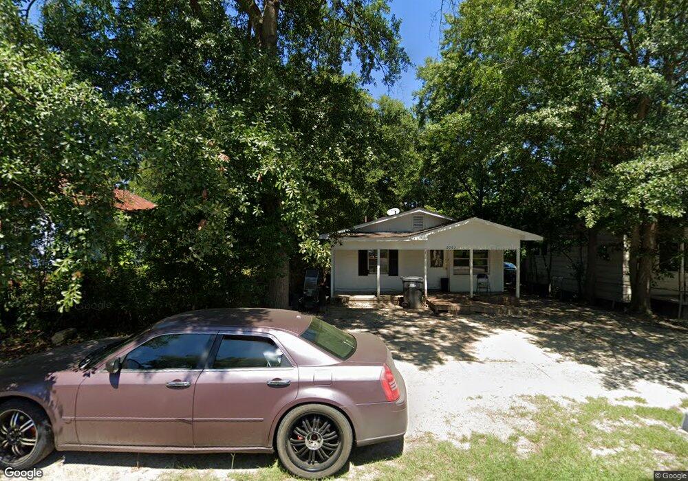
2083 Ellis St Augusta, GA 30904
West End NeighborhoodEstimated Value: $62,394 - $76,000
3
Beds
2
Baths
1,104
Sq Ft
$63/Sq Ft
Est. Value
About This Home
This home is located at 2083 Ellis St, Augusta, GA 30904 and is currently estimated at $69,131, approximately $62 per square foot. 2083 Ellis St is a home located in Richmond County with nearby schools including Lamar Elementary School, W.S. Hornsby K-8 School, and Johnson Magnet.
Ownership History
Date
Name
Owned For
Owner Type
Purchase Details
Closed on
Aug 3, 2023
Sold by
2021 Dozier Wcp Living Trust
Bought by
Had Homes Llc
Current Estimated Value
Purchase Details
Closed on
May 17, 2016
Sold by
Dozier & Dunagan Properties Llc
Bought by
W C Properties
Purchase Details
Closed on
Feb 26, 1999
Sold by
Norwest Bank Minnesota National Assn
Bought by
Dunagan David A
Purchase Details
Closed on
May 12, 1988
Sold by
Gregg John A
Bought by
May Glenn E
Purchase Details
Closed on
May 3, 1988
Sold by
Federal Home Loan Mortgage Corporation
Bought by
Gregg John A
Purchase Details
Closed on
Jan 9, 1984
Sold by
Blackwell Doris K
Bought by
Hartfield Phyllis
Purchase Details
Closed on
Jan 19, 1983
Sold by
Phillips Philip John
Bought by
Blackwell Doris K
Create a Home Valuation Report for This Property
The Home Valuation Report is an in-depth analysis detailing your home's value as well as a comparison with similar homes in the area
Home Values in the Area
Average Home Value in this Area
Purchase History
| Date | Buyer | Sale Price | Title Company |
|---|---|---|---|
| Had Homes Llc | $35,000 | -- | |
| Wc Properties | -- | -- | |
| W C Properties | -- | -- | |
| Dunagan David A | $14,000 | -- | |
| May Glenn E | $28,800 | -- | |
| Gregg John A | $13,700 | -- | |
| Hartfield Phyllis | $30,800 | -- | |
| Blackwell Doris K | $22,000 | -- |
Source: Public Records
Tax History Compared to Growth
Tax History
| Year | Tax Paid | Tax Assessment Tax Assessment Total Assessment is a certain percentage of the fair market value that is determined by local assessors to be the total taxable value of land and additions on the property. | Land | Improvement |
|---|---|---|---|---|
| 2024 | $990 | $14,000 | $1,560 | $12,440 |
| 2023 | $993 | $18,753 | $1,966 | $16,787 |
| 2022 | $977 | $18,753 | $1,958 | $16,795 |
| 2021 | $602 | $8,667 | $1,966 | $6,701 |
| 2020 | $664 | $10,701 | $4,000 | $6,701 |
| 2019 | $689 | $10,701 | $4,000 | $6,701 |
| 2018 | $693 | $10,701 | $4,000 | $6,701 |
| 2017 | $691 | $10,701 | $4,000 | $6,701 |
| 2016 | $691 | $10,701 | $4,000 | $6,701 |
| 2015 | $694 | $10,701 | $4,000 | $6,701 |
| 2014 | $694 | $10,701 | $4,000 | $6,701 |
Source: Public Records
Map
Nearby Homes
- 2025 Ellis St
- 2021 Ellis St
- 2063 Broad St
- 2048 Edgar St
- 2056 Telfair St
- 2006 Division St
- 1918 Division St Unit 3
- 2156 Telfair St
- 250 Milledge Rd
- 1940 Telfair St
- 2164 Telfair St
- 1913 Ellis St
- 542 Hickman Rd
- 1968 Battle Row
- 1929 Watkins St
- 1916 Battle Row
- 1918 Walker St
- 1916 Walker St
- 608 Eve St
- 1915 Watkins St