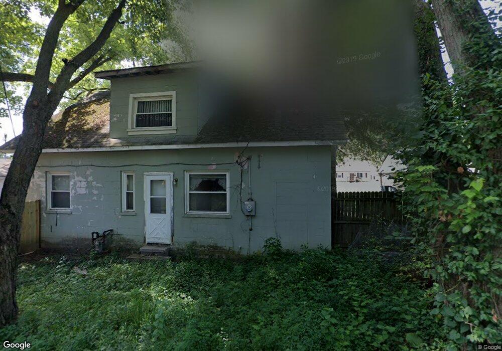
2084 E Cooke Rd Columbus, OH 43224
North Linden NeighborhoodEstimated Value: $172,789 - $226,000
3
Beds
1
Bath
1,434
Sq Ft
$147/Sq Ft
Est. Value
About This Home
This home is located at 2084 E Cooke Rd, Columbus, OH 43224 and is currently estimated at $211,197, approximately $147 per square foot. 2084 E Cooke Rd is a home located in Franklin County with nearby schools including North Linden Elementary School, Medina Middle School, and Mifflin High School.
Ownership History
Date
Name
Owned For
Owner Type
Purchase Details
Closed on
May 21, 2025
Sold by
Mccoy Family Trust and Mccoy William L
Bought by
Franklin County Commissioners Franklin County
Current Estimated Value
Purchase Details
Closed on
Apr 29, 2003
Sold by
Mccoy William L
Bought by
Mccoy William L and Mccoy Diana L
Purchase Details
Closed on
Mar 1, 1980
Create a Home Valuation Report for This Property
The Home Valuation Report is an in-depth analysis detailing your home's value as well as a comparison with similar homes in the area
Home Values in the Area
Average Home Value in this Area
Purchase History
| Date | Buyer | Sale Price | Title Company |
|---|---|---|---|
| Franklin County Commissioners Franklin County | $4,057 | None Listed On Document | |
| Mccoy William L | -- | -- | |
| -- | $30,300 | -- |
Source: Public Records
Tax History
| Year | Tax Paid | Tax Assessment Tax Assessment Total Assessment is a certain percentage of the fair market value that is determined by local assessors to be the total taxable value of land and additions on the property. | Land | Improvement |
|---|---|---|---|---|
| 2025 | $2,882 | $48,940 | $11,730 | $37,210 |
| 2024 | $2,882 | $48,940 | $11,730 | $37,210 |
| 2023 | $2,852 | $48,940 | $11,730 | $37,210 |
| 2022 | $2,277 | $30,600 | $7,950 | $22,650 |
| 2021 | $2,281 | $30,600 | $7,950 | $22,650 |
| 2020 | $2,284 | $30,600 | $7,950 | $22,650 |
| 2019 | $1,997 | $24,710 | $6,370 | $18,340 |
| 2018 | $998 | $24,710 | $6,370 | $18,340 |
| 2017 | $1,995 | $24,710 | $6,370 | $18,340 |
| 2016 | $1,611 | $18,030 | $4,480 | $13,550 |
| 2015 | $706 | $18,030 | $4,480 | $13,550 |
| 2014 | $1,413 | $18,030 | $4,480 | $13,550 |
| 2013 | $770 | $20,020 | $4,970 | $15,050 |
Source: Public Records
Map
Nearby Homes
- 2010 Melrose Ave
- 2081 Ormond Ave
- 2045 Sale Rd
- 2023 Ferris Rd
- 2196 Ferris Rd
- 2267 Ferris Rd
- 3750 Dresden St
- 3508 Kenlawn St
- 1863 Ward Rd
- 3583 Dresden St
- 4090 Cleveland Ave
- 3426 Oaklawn St
- 1812 Audrey Rd
- 2299 Belcher Dr
- 2298 Belcher Dr
- 4123 Arbury Ln
- 3137 Westerville Rd Unit 4
- 3137 Westerville Rd Unit 91
- 3585 Gerbert Rd
- 1711 Piedmont Rd
- 2094 E Cooke Rd
- 2074 E Cooke Rd
- 2066 E Cooke Rd
- 2099 Radnor Ave
- 2089 E Cooke Rd
- 2106 E Cooke Rd
- 2056 E Cooke Rd
- 2081 E Cooke Rd
- 2071 Radnor Ave
- 2071 E Cooke Rd
- 2063 E Cooke Rd
- 2063 Radnor Ave
- 2117 Radnor Ave
- 2048 E Cooke Rd
- 3723 Cleveland Ave
- 2053 E Cooke Rd
- 2053 Radnor Ave
- 3719 Cleveland Ave Unit 2
- 3719 Cleveland Ave
- 2127 Radnor Ave
Your Personal Tour Guide
Ask me questions while you tour the home.