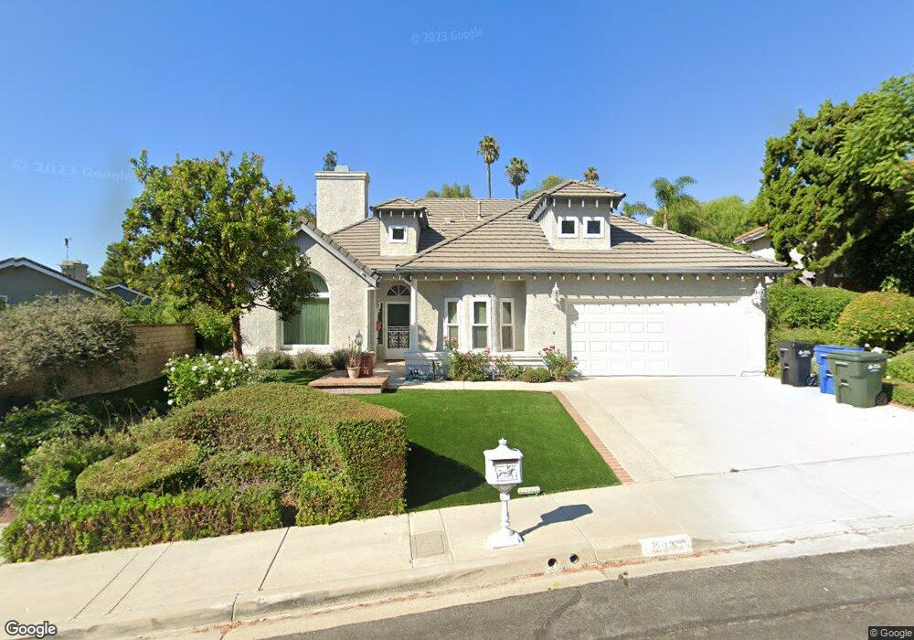
2085 Brookfield Dr Thousand Oaks, CA 91362
Estimated Value: $1,238,770 - $1,442,000
4
Beds
3
Baths
2,558
Sq Ft
$525/Sq Ft
Est. Value
About This Home
This home is located at 2085 Brookfield Dr, Thousand Oaks, CA 91362 and is currently estimated at $1,343,193, approximately $525 per square foot. 2085 Brookfield Dr is a home located in Ventura County with nearby schools including Lang Ranch, Los Cerritos Middle School, and Westlake High School.
Ownership History
Date
Name
Owned For
Owner Type
Purchase Details
Closed on
Mar 7, 2014
Sold by
Grossmann Robert F and Grossmann Adrienne J
Bought by
Grossman Family 1998 Living Trust and Grossmann Adrienne J
Current Estimated Value
Purchase Details
Closed on
Dec 2, 1998
Sold by
Grossman Robert F and Grossman Adrienne J
Bought by
Grossman Robert F and Grossman Adrienne J
Purchase Details
Closed on
Sep 8, 1997
Sold by
Butler James J and Butler Susan J
Bought by
Grossmann Robert F and Grossmann Adrienne J
Home Financials for this Owner
Home Financials are based on the most recent Mortgage that was taken out on this home.
Original Mortgage
$170,000
Interest Rate
7.45%
Purchase Details
Closed on
Mar 18, 1997
Sold by
Cheresh Mark F and Cheresh Phyllis J
Bought by
Butler James J and Butler Susan J
Purchase Details
Closed on
May 24, 1994
Sold by
Cheresh Phyllis J
Bought by
Cheresh Mark F
Create a Home Valuation Report for This Property
The Home Valuation Report is an in-depth analysis detailing your home's value as well as a comparison with similar homes in the area
Home Values in the Area
Average Home Value in this Area
Purchase History
| Date | Buyer | Sale Price | Title Company |
|---|---|---|---|
| Grossman Family 1998 Living Trust | -- | None Available | |
| Grossman Robert F | -- | -- | |
| Grossmann Robert F | $321,000 | First American Title Ins Co | |
| Butler James J | $255,000 | First American Title Ins Co | |
| Cheresh Mark F | -- | -- |
Source: Public Records
Mortgage History
| Date | Status | Borrower | Loan Amount |
|---|---|---|---|
| Previous Owner | Grossmann Robert F | $170,000 |
Source: Public Records
Tax History Compared to Growth
Tax History
| Year | Tax Paid | Tax Assessment Tax Assessment Total Assessment is a certain percentage of the fair market value that is determined by local assessors to be the total taxable value of land and additions on the property. | Land | Improvement |
|---|---|---|---|---|
| 2025 | $4,752 | $376,743 | $150,692 | $226,051 |
| 2024 | $4,752 | $369,356 | $147,737 | $221,619 |
| 2023 | $4,600 | $362,114 | $144,840 | $217,274 |
| 2022 | $4,501 | $355,014 | $142,000 | $213,014 |
| 2021 | $4,401 | $348,053 | $139,215 | $208,838 |
| 2020 | $3,984 | $344,487 | $137,789 | $206,698 |
| 2019 | $3,877 | $337,734 | $135,088 | $202,646 |
| 2018 | $3,793 | $331,113 | $132,440 | $198,673 |
| 2017 | $3,714 | $324,622 | $129,844 | $194,778 |
| 2016 | $3,673 | $318,258 | $127,299 | $190,959 |
| 2015 | $3,605 | $313,480 | $125,388 | $188,092 |
| 2014 | $3,549 | $307,341 | $122,933 | $184,408 |
Source: Public Records
Map
Nearby Homes
- 2001 Brookfield Dr
- 2535 Rikkard Dr
- 1825 Sweet Briar Place
- 3128 Casino Dr
- 2252 Northpark St
- 2311 Gillingham Cir
- 2847 Cedar Wood Place
- 2848 Bayham Cir
- 2347 Laurelwood Dr
- 3180 Versaille Ct
- 3182 Toulouse Cir
- 3225 Futura Point
- 1764 Shady Brook Dr
- 1669 Woodside Dr
- 3240 Casino Dr
- 1972 Olivewood Ct
- 2321 Sunny Point St
- 3100 Woodgreen Ct
- 2225 Calle Riscoso
- 1541 Eucalyptus Cir
- 2097 Brookfield Dr
- 2742 Delpha Ct
- 2754 Delpha Ct
- 2795 Jason Ct
- 2766 Delpha Ct
- 2783 Jason Ct
- 2109 Brookfield Dr
- 2807 Jason Ct
- 2098 Brookfield Dr
- 2074 Brookfield Dr
- 2110 Brookfield Dr
- 2778 Delpha Ct
- 2049 Brookfield Dr
- 2819 Jason Ct
- 2086 Brookfield Dr
- 2062 Brookfield Dr
- 2755 Delpha Ct
- 2736 Jason Ct
- 2790 Delpha Ct
- 2874 Jason Ct