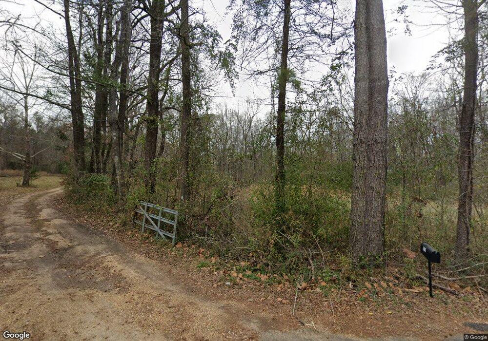
2085 Byrdtown Rd Hazlehurst, MS 39083
Estimated Value: $81,661 - $159,000
Studio
1
Bath
1,370
Sq Ft
$88/Sq Ft
Est. Value
About This Home
This home is located at 2085 Byrdtown Rd, Hazlehurst, MS 39083 and is currently estimated at $120,331, approximately $87 per square foot. 2085 Byrdtown Rd is a home located in Copiah County with nearby schools including Hazlehurst Middle School, Hazlehurst High School, and Copiah Educational Foundation.
Ownership History
Date
Name
Owned For
Owner Type
Purchase Details
Closed on
Mar 21, 2023
Sold by
Wright Virginia H
Bought by
Peggys Creek Timber Llc
Current Estimated Value
Purchase Details
Closed on
May 25, 2017
Sold by
Cole Harrison Carol Ann and Cole Glen Stewart
Bought by
Wright Michelle
Home Financials for this Owner
Home Financials are based on the most recent Mortgage that was taken out on this home.
Original Mortgage
$55,967
Interest Rate
3.99%
Mortgage Type
FHA
Create a Home Valuation Report for This Property
The Home Valuation Report is an in-depth analysis detailing your home's value as well as a comparison with similar homes in the area
Purchase History
| Date | Buyer | Sale Price | Title Company |
|---|---|---|---|
| Peggys Creek Timber Llc | -- | None Listed On Document | |
| Wright Michelle | -- | None Available |
Source: Public Records
Mortgage History
| Date | Status | Borrower | Loan Amount |
|---|---|---|---|
| Previous Owner | Wright Michelle | $55,967 |
Source: Public Records
Tax History
| Year | Tax Paid | Tax Assessment Tax Assessment Total Assessment is a certain percentage of the fair market value that is determined by local assessors to be the total taxable value of land and additions on the property. | Land | Improvement |
|---|---|---|---|---|
| 2025 | $550 | $5,098 | $0 | $0 |
| 2024 | $550 | $4,576 | $0 | $0 |
| 2023 | $550 | $4,576 | $0 | $0 |
| 2022 | $550 | $4,577 | $0 | $0 |
| 2021 | $554 | $4,580 | $0 | $0 |
| 2020 | $548 | $4,532 | $0 | $0 |
| 2019 | $555 | $4,535 | $0 | $0 |
| 2018 | $817 | $6,672 | $0 | $0 |
| 2017 | $0 | $6,676 | $0 | $0 |
| 2016 | $0 | $4,461 | $0 | $0 |
| 2015 | -- | $4,447 | $0 | $0 |
| 2014 | -- | $4,435 | $0 | $0 |
Source: Public Records
Map
Nearby Homes
- 21032 Us-51
- 1142 Henley Cir
- 1022 Mcdaniel Ln
- 0 Sumrall Rd Unit 4124313
- 0 Sumrall Rd Unit 24629679
- 0 Sumrall Rd Unit 4124314
- 0 Sumrall Rd Unit 24629680
- 0 Sumrall Rd Unit 24629682
- 0 Sumrall Rd Unit 4124309
- 0 Sumrall Rd Unit 24629681
- 0 Sumrall Rd Unit 4124310
- 0 Sumrall Rd Unit 24638375
- 0 Sumrall Rd Unit 4124311
- 0 Byron Paul Ln
- 131 E Damascus St
- 1015 Herbert Ln
- 0 Mississippi 28 Unit 4137066
- 0 Mississippi 28 Unit 4138240
- 256 Pinehurst Cir
- 613 Georgetown St
- 2099 Byrdtown Rd
- 2063 Byrdtown Rd
- 7818 Raymond Rd
- 7051 Raymond Rd
- 8019 Raymond Rd
- 2043 Byrdtown Rd
- 7035 Raymond Rd
- 8034 Raymond Rd
- 7036 Raymond Rd
- 1013 Wheeler Ln
- 1087 Byrdtown Rd
- 0 Byrdtown Rd
- 7028 Raymond Rd
- 7015 Raymond Rd
- 1028 W Gallman Rd
- 0 Heard Rd
- 1118 Byrdtown Rd
- 1081 W Gallman Rd
- 1018 Jeffrys Ln
- 1097 Heard Rd
Your Personal Tour Guide
Ask me questions while you tour the home.
