Estimated Value: $204,000 - $376,000
--
Bed
1
Bath
2,313
Sq Ft
$128/Sq Ft
Est. Value
About This Home
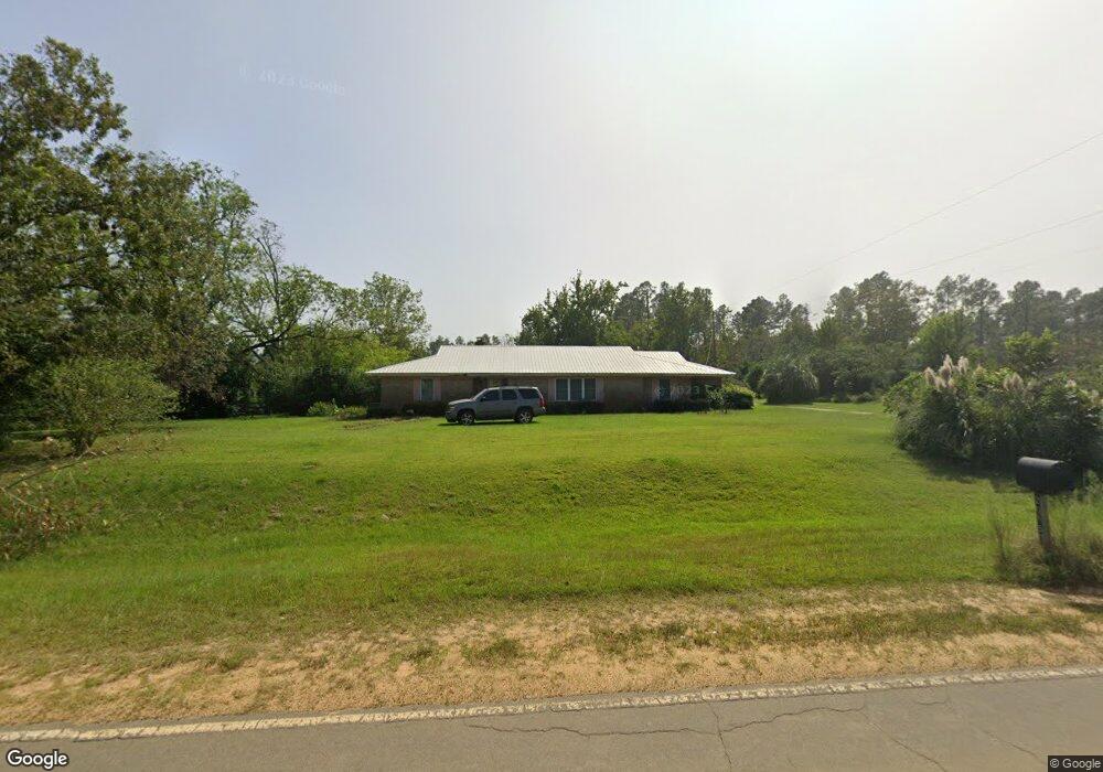
This home is located at 2085 Empire Rd, Jesup, GA 31545 and is currently estimated at $296,951, approximately $128 per square foot. 2085 Empire Rd is a home located in Wayne County with nearby schools including Bacon Elementary School, Martha Puckett Middle School, and Wayne County High School.
Ownership History
Date
Name
Owned For
Owner Type
Purchase Details
Closed on
Jun 1, 2002
Sold by
Bradford Elaine Y
Bought by
Rubiera Elaine Y
Current Estimated Value
Purchase Details
Closed on
Aug 1, 1997
Bought by
Bradford Elaine Y
Purchase Details
Closed on
Feb 1, 1987
Create a Home Valuation Report for This Property
The Home Valuation Report is an in-depth analysis detailing your home's value as well as a comparison with similar homes in the area
Home Values in the Area
Average Home Value in this Area
Purchase History
| Date | Buyer | Sale Price | Title Company |
|---|---|---|---|
| Rubiera Elaine Y | -- | -- | |
| Bradford Elaine Y | -- | -- | |
| -- | $74,000 | -- |
Source: Public Records
Tax History Compared to Growth
Tax History
| Year | Tax Paid | Tax Assessment Tax Assessment Total Assessment is a certain percentage of the fair market value that is determined by local assessors to be the total taxable value of land and additions on the property. | Land | Improvement |
|---|---|---|---|---|
| 2024 | $1,180 | $101,552 | $8,386 | $93,166 |
| 2023 | $2,719 | $90,621 | $8,386 | $82,235 |
| 2022 | $1,049 | $75,316 | $8,386 | $66,930 |
| 2021 | $948 | $63,331 | $8,386 | $54,945 |
| 2020 | $1,001 | $64,141 | $9,196 | $54,945 |
| 2019 | $1,060 | $64,141 | $9,196 | $54,945 |
| 2018 | $1,060 | $64,141 | $9,196 | $54,945 |
| 2017 | $819 | $68,361 | $13,416 | $54,945 |
| 2016 | $687 | $62,648 | $13,416 | $49,232 |
| 2014 | $686 | $62,648 | $13,416 | $49,232 |
| 2013 | -- | $62,647 | $13,416 | $49,231 |
Source: Public Records
Map
Nearby Homes
- 188 Bennetts Cir
- 1351 Old Screven Rd
- 129 Norris Dr
- 675 Foxwood Cir
- 1435 Bennett Crossing
- 3808 Waycross Hwy
- 4848 Holmesville Rd
- 7014 Waycross Hwy
- 7114 Waycross Hwy
- 7132 Waycross Hwy
- 168 Nature Cir
- 1435 E Lake Dr
- 1361 Joey Williamson Rd
- 1361 Joey Williamson Rd Jesup Ga
- 9009 Waycross Hwy
- 00 Photonia Ave
- 113 Tift St
- 125 Sugar Maple St
- TRACT 1 Sunset Blvd
- 00 Sunset Blvd
- 2070 Empire Rd
- 22 Bennetts Cir
- 88 Bennetts Cir
- 88 Bennetts Cir
- 2189 Empire Rd
- 120 Bennetts Cir
- 151 Bennetts Cir
- 1984 Empire Rd
- 154 Bennetts Cir
- 2235 Empire Rd
- 1925 New Bethel Rd
- 54 Skylark Rd
- 145 Skylark Rd
- 88 Skylark Rd
- 2267 Empire Rd
- 116 Skylark Rd
- 116 Sky Lark Dr
- 144 Sky Lark Dr
- 144 Skylark Rd
- 179 Skylark Rd