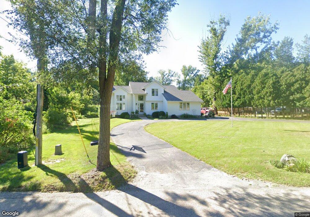
2085 Memorial Dr SE Cedar Rapids, IA 52403
Cedar Valley NeighborhoodEstimated Value: $315,000 - $442,000
3
Beds
4
Baths
1,592
Sq Ft
$244/Sq Ft
Est. Value
About This Home
This home is located at 2085 Memorial Dr SE, Cedar Rapids, IA 52403 and is currently estimated at $388,319, approximately $243 per square foot. 2085 Memorial Dr SE is a home located in Linn County with nearby schools including Erskine Elementary School, McKinley STEAM Academy, and George Washington High School.
Ownership History
Date
Name
Owned For
Owner Type
Purchase Details
Closed on
Feb 11, 2021
Sold by
Weerd Thomas Vande and Weerd Tami Lee
Bought by
Reader Kathleen L and Lokenvitz John
Current Estimated Value
Home Financials for this Owner
Home Financials are based on the most recent Mortgage that was taken out on this home.
Original Mortgage
$287,000
Outstanding Balance
$256,468
Interest Rate
2.65%
Mortgage Type
New Conventional
Estimated Equity
$131,851
Create a Home Valuation Report for This Property
The Home Valuation Report is an in-depth analysis detailing your home's value as well as a comparison with similar homes in the area
Home Values in the Area
Average Home Value in this Area
Purchase History
| Date | Buyer | Sale Price | Title Company |
|---|---|---|---|
| Reader Kathleen L | $327,000 | None Available |
Source: Public Records
Mortgage History
| Date | Status | Borrower | Loan Amount |
|---|---|---|---|
| Open | Reader Kathleen L | $287,000 |
Source: Public Records
Tax History Compared to Growth
Tax History
| Year | Tax Paid | Tax Assessment Tax Assessment Total Assessment is a certain percentage of the fair market value that is determined by local assessors to be the total taxable value of land and additions on the property. | Land | Improvement |
|---|---|---|---|---|
| 2025 | $5,608 | $358,400 | $65,800 | $292,600 |
| 2024 | $6,652 | $350,300 | $65,800 | $284,500 |
| 2023 | $6,652 | $327,400 | $65,800 | $261,600 |
| 2022 | $6,018 | $324,300 | $54,900 | $269,400 |
| 2021 | $5,630 | $299,500 | $53,900 | $245,600 |
| 2020 | $5,630 | $263,800 | $42,400 | $221,400 |
| 2019 | $4,992 | $240,100 | $42,400 | $197,700 |
| 2018 | $4,850 | $240,100 | $42,400 | $197,700 |
| 2017 | $5,063 | $240,500 | $42,400 | $198,100 |
| 2016 | $5,063 | $238,200 | $42,400 | $195,800 |
| 2015 | $5,227 | $245,625 | $42,425 | $203,200 |
| 2014 | $5,042 | $245,625 | $42,425 | $203,200 |
| 2013 | $4,928 | $245,625 | $42,425 | $203,200 |
Source: Public Records
Map
Nearby Homes
- 0 Rompot St SE
- 1649 Memorial Dr SE
- 2940 Otis Ave SE
- 1524 Memorial Dr SE
- Lot 53 Kestrel Dr SE
- Lot 52 Kestrel Dr SE
- Lot 49 Kestrel Dr SE
- Lot 48 Kestrel Dr SE
- Lot 51 Kestrel Dr SE
- Lot 46 Kestrel Dr SE
- Lot 50 Kestrel Dr SE
- Lot 45 Kestrel Dr SE
- Lot 44 Kestrel Dr SE
- Lot 43 Kestrel Dr SE
- Lot 38 Kestrel Dr SE
- 1635 31st St SE
- 1507 26th St SE
- 2073 Memorial Dr SE
- 2125 Memorial Dr SE
- 2061 Memorial Dr SE
- 2140 Memorial Dr SE
- 2035 Memorial Dr SE
- 2086 High Dr SE
- 2082 High Dr SE
- 2106 High Dr SE
- LOT101 High Dr SE
- 0 Lot 101 High Dr SE Unit 2903158
- LOT 101 High Dr SE
- 2500 Otis Rd SE
- 2050 Memorial Dr SE
- 2015 Memorial Dr SE
- 2076 High Dr SE
- 2095 High Dr SE
- 2112 High Dr SE
- 2087 High Dr SE
- 2009 Memorial Dr SE
- 2420 Otis Rd SE