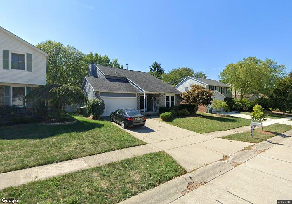
2085 Millrow Loop Dublin, OH 43016
Estimated Value: $380,000 - $394,000
3
Beds
3
Baths
1,742
Sq Ft
$221/Sq Ft
Est. Value
About This Home
This home is located at 2085 Millrow Loop, Dublin, OH 43016 and is currently estimated at $385,148, approximately $221 per square foot. 2085 Millrow Loop is a home located in Franklin County with nearby schools including Granby Elementary School, McCord Middle School, and Worthington Kilbourne High School.
Ownership History
Date
Name
Owned For
Owner Type
Purchase Details
Closed on
Dec 15, 1998
Sold by
Amsler Helen D and Amsler Danals Helen D
Bought by
Tolbert Jimmie D
Current Estimated Value
Home Financials for this Owner
Home Financials are based on the most recent Mortgage that was taken out on this home.
Original Mortgage
$129,934
Outstanding Balance
$27,201
Interest Rate
6.96%
Mortgage Type
FHA
Estimated Equity
$357,947
Purchase Details
Closed on
May 28, 1993
Bought by
Amsler Helen D
Purchase Details
Closed on
May 18, 1989
Purchase Details
Closed on
May 1, 1984
Create a Home Valuation Report for This Property
The Home Valuation Report is an in-depth analysis detailing your home's value as well as a comparison with similar homes in the area
Home Values in the Area
Average Home Value in this Area
Purchase History
| Date | Buyer | Sale Price | Title Company |
|---|---|---|---|
| Tolbert Jimmie D | $130,000 | Chicago Title | |
| Amsler Helen D | $111,000 | -- | |
| -- | $105,900 | -- | |
| -- | $87,300 | -- |
Source: Public Records
Mortgage History
| Date | Status | Borrower | Loan Amount |
|---|---|---|---|
| Open | Tolbert Jimmie D | $129,934 |
Source: Public Records
Tax History
| Year | Tax Paid | Tax Assessment Tax Assessment Total Assessment is a certain percentage of the fair market value that is determined by local assessors to be the total taxable value of land and additions on the property. | Land | Improvement |
|---|---|---|---|---|
| 2025 | $6,979 | $113,680 | $36,750 | $76,930 |
| 2024 | $6,979 | $113,680 | $36,750 | $76,930 |
| 2023 | $6,674 | $113,680 | $36,750 | $76,930 |
| 2022 | $5,850 | $79,070 | $17,010 | $62,060 |
| 2021 | $5,397 | $79,070 | $17,010 | $62,060 |
| 2020 | $5,199 | $79,070 | $17,010 | $62,060 |
| 2019 | $4,792 | $65,770 | $14,180 | $51,590 |
| 2018 | $2,933 | $65,770 | $14,180 | $51,590 |
| 2017 | $4,294 | $65,770 | $14,180 | $51,590 |
| 2016 | $4,026 | $56,700 | $13,860 | $42,840 |
| 2015 | $2,625 | $56,700 | $13,860 | $42,840 |
| 2014 | $4,025 | $56,700 | $13,860 | $42,840 |
| 2013 | $2,002 | $56,700 | $13,860 | $42,840 |
Source: Public Records
Map
Nearby Homes
- 2000 Dina Ct
- 1810 Calico Ct
- 1908 Lost Valley Rd
- 1751 Darrow Dr
- 7685 Starmont Ct
- 8213 Longhorn Rd
- 8377 Waco Ln
- 8205 Longhorn Rd
- 2514 Tevis Ann Ct
- 1729 Laredo Ct
- 8207 Copperfield Dr
- 7965 Boothbay Ct Unit 20
- 7755 Tripoli Ct
- 7480 Gardenview Place
- 1539 Clubview Blvd S
- 7735 Schoolway Ct
- 8245 Markhaven Ct
- 1448 Clubview Blvd N
- 8292 Breckenridge Way
- 2074 Hard Rd
- 2089 Millrow Loop
- 2081 Millrow Loop
- 2093 Millrow Loop
- 2077 Millrow Loop
- 2086 Millrow Loop
- 2092 Millrow Loop
- 2100 Millrow Loop
- 2070 Millrow Loop
- 2073 Millrow Loop
- 2099 Millrow Loop
- 2094 Stowbridge Rd
- 2082 Stowbridge Rd
- 7988 Stokemont Ct
- 2106 Millrow Loop
- 7996 Stokemont Ct
- 2058 Millrow Loop
- 2074 Stowbridge Rd
- 2069 Millrow Loop
- 2065 Smokymill Rd
- 2073 Smokymill Rd
Your Personal Tour Guide
Ask me questions while you tour the home.