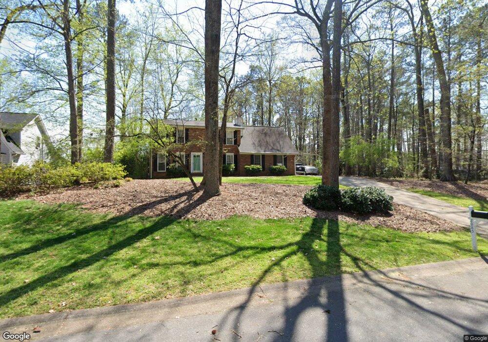
2085 Moccasin Way SW Marietta, GA 30064
West Cobb NeighborhoodEstimated Value: $388,000 - $455,852
3
Beds
3
Baths
2,199
Sq Ft
$196/Sq Ft
Est. Value
About This Home
This home is located at 2085 Moccasin Way SW, Marietta, GA 30064 and is currently estimated at $429,963, approximately $195 per square foot. 2085 Moccasin Way SW is a home located in Cobb County with nearby schools including Dowell Elementary School, Lovinggood Middle School, and Hillgrove High School.
Ownership History
Date
Name
Owned For
Owner Type
Purchase Details
Closed on
Jun 26, 2009
Sold by
Hsbc Mortgage Services Inc
Bought by
Lewis Timothy and Lewis Zelda
Current Estimated Value
Purchase Details
Closed on
Apr 7, 2009
Sold by
Roca Enrique
Bought by
Hsbc Mortgage Services Inc
Purchase Details
Closed on
Oct 31, 2003
Sold by
Pilotti Christine D
Bought by
Roca Enrique
Home Financials for this Owner
Home Financials are based on the most recent Mortgage that was taken out on this home.
Original Mortgage
$174,450
Interest Rate
6%
Mortgage Type
FHA
Purchase Details
Closed on
Jun 23, 1995
Sold by
Schulman Danny G Rebecca
Bought by
Pilotti Thomas
Create a Home Valuation Report for This Property
The Home Valuation Report is an in-depth analysis detailing your home's value as well as a comparison with similar homes in the area
Home Values in the Area
Average Home Value in this Area
Purchase History
| Date | Buyer | Sale Price | Title Company |
|---|---|---|---|
| Lewis Timothy | $103,900 | -- | |
| Hsbc Mortgage Services Inc | $115,000 | -- | |
| Roca Enrique | $175,900 | -- | |
| Pilotti Thomas | $99,600 | -- |
Source: Public Records
Mortgage History
| Date | Status | Borrower | Loan Amount |
|---|---|---|---|
| Previous Owner | Roca Enrique | $174,450 | |
| Closed | Pilotti Thomas | $0 |
Source: Public Records
Tax History Compared to Growth
Tax History
| Year | Tax Paid | Tax Assessment Tax Assessment Total Assessment is a certain percentage of the fair market value that is determined by local assessors to be the total taxable value of land and additions on the property. | Land | Improvement |
|---|---|---|---|---|
| 2025 | $979 | $158,696 | $36,000 | $122,696 |
| 2024 | $957 | $150,260 | $12,800 | $137,460 |
| 2023 | $751 | $150,260 | $12,800 | $137,460 |
| 2022 | $911 | $134,860 | $12,800 | $122,060 |
| 2021 | $813 | $102,284 | $12,800 | $89,484 |
| 2020 | $813 | $102,284 | $12,800 | $89,484 |
| 2019 | $2,392 | $94,720 | $12,800 | $81,920 |
| 2018 | $2,257 | $88,572 | $12,800 | $75,772 |
| 2017 | $1,965 | $79,496 | $14,000 | $65,496 |
| 2016 | $1,710 | $68,384 | $14,000 | $54,384 |
| 2015 | $1,754 | $68,384 | $14,000 | $54,384 |
| 2014 | $1,112 | $46,244 | $0 | $0 |
Source: Public Records
Map
Nearby Homes
- 2040 Hardwood Cir SW Unit 3
- 1985 Freestone Way
- 1952 Freestone Way
- Monteluce Plan at Freestone Station
- Hillside Plan at Freestone Station
- Oakshire Plan at Freestone Station
- Hendricks Plan at Freestone Station
- Hedgerow Plan at Freestone Station
- Antioch Plan at Freestone Station
- 1946 MacLand Rd SW
- 2009 Freestone Way
- 1995 Carithers Way
- 1830 MacLand Rd SW
- 2409 Caneridge Point SW
- 2002 MacLand Square Dr Unit 1
- 2028 MacLand Square Dr Unit 4
- 2117 Caneridge Dr SW
- 2040 Freestone Way
- 1976 Grove Field Ln
- 1976 Grove Field Ln Unit BLDG 33
- 2083 Moccasin Way SW
- 2081 Moccasin Way SW
- 1950 Rollingwoods Way SW
- 1817 Walker Ridge Dr SW
- 1815 Walker Ridge Dr SW Unit 4
- 1813 Walker Ridge Dr SW
- 2079 Moccasin Way SW
- 2090 MacLand Rd SW
- 1948 Rollingwoods Way SW Unit 1
- 2090 Moccasin Way SW
- 2094 MacLand Rd
- 1811 Walker Ridge Dr SW
- 1942 Rollingwoods Way SW
- 1941 Rollingwoods Way SW
- 1814 Walker Ridge Dr SW
- 2130 MacLand Rd SW
- 2080 Moccasin Way SW
- 2075 Moccasin Way SW
- 1810 Walker Ridge Dr SW Unit 4
- 1809 Walker Ridge Dr SW