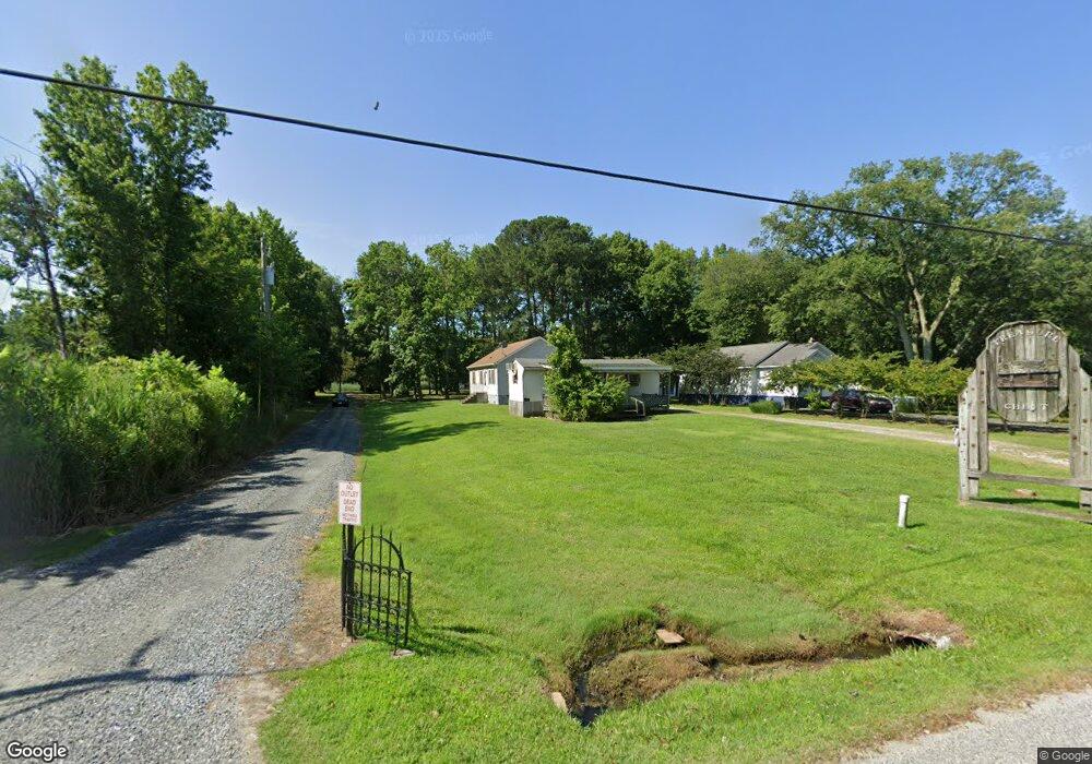
20855 Rock Hall Ave Rock Hall, MD 21661
Estimated Value: $255,000 - $340,000
--
Bed
1
Bath
1,040
Sq Ft
$273/Sq Ft
Est. Value
About This Home
This home is located at 20855 Rock Hall Ave, Rock Hall, MD 21661 and is currently estimated at $284,170, approximately $273 per square foot. 20855 Rock Hall Ave is a home located in Kent County with nearby schools including Center for Innovation, Kent County Middle School, and Kent County High School.
Ownership History
Date
Name
Owned For
Owner Type
Purchase Details
Closed on
Nov 4, 2020
Sold by
Elbourn Bennett Edward and Estate Of Elinor Ann Elbourn
Bought by
Elbourn Brandy Lee
Current Estimated Value
Purchase Details
Closed on
Jun 25, 1999
Sold by
Elbourn Mabel Lee
Bought by
Elbourn Mabel Lee and Elbourn Paul C
Purchase Details
Closed on
Aug 30, 1994
Sold by
Elbourn Mabel Lee
Bought by
Elbourn Mabel Lee and Elbourn Paul C
Purchase Details
Closed on
Jul 2, 1991
Sold by
Elbourn Mabel Lee
Bought by
Elbourn Mabel Lee
Create a Home Valuation Report for This Property
The Home Valuation Report is an in-depth analysis detailing your home's value as well as a comparison with similar homes in the area
Home Values in the Area
Average Home Value in this Area
Purchase History
| Date | Buyer | Sale Price | Title Company |
|---|---|---|---|
| Elbourn Brandy Lee | -- | None Available | |
| Elbourn Mabel Lee | -- | -- | |
| Elbourn Mabel Lee | -- | -- | |
| Elbourn Mabel Lee | $19,500 | -- |
Source: Public Records
Tax History Compared to Growth
Tax History
| Year | Tax Paid | Tax Assessment Tax Assessment Total Assessment is a certain percentage of the fair market value that is determined by local assessors to be the total taxable value of land and additions on the property. | Land | Improvement |
|---|---|---|---|---|
| 2025 | $2,716 | $190,733 | $0 | $0 |
| 2024 | $2,562 | $168,100 | $84,200 | $83,900 |
| 2023 | $2,544 | $166,933 | $0 | $0 |
| 2022 | $2,493 | $165,767 | $0 | $0 |
| 2021 | $4,639 | $164,600 | $84,200 | $80,400 |
| 2020 | $2,424 | $164,467 | $0 | $0 |
| 2019 | $2,422 | $164,333 | $0 | $0 |
| 2018 | $2,387 | $164,200 | $84,200 | $80,000 |
| 2017 | $2,387 | $164,200 | $0 | $0 |
| 2016 | -- | $164,200 | $0 | $0 |
| 2015 | $2,675 | $170,800 | $0 | $0 |
| 2014 | $2,675 | $170,800 | $0 | $0 |
Source: Public Records
Map
Nearby Homes
- 5750 Walnut St
- 5697 Walnut St
- 5791 S Hawthorne Ave
- 6119 New St Unit 2
- 21090 W Sharp St Unit 133
- 21090 W Sharp St Unit 112
- #2 Lawton Ave
- 5980 Lawton Ave
- 21119 Striper Run
- 21131 Striper Run
- 21133 Striper Run
- 21139 Striper Run
- 21141 Striper Run
- 21163 Chesapeake Ave
- 5829 N Main St
- 21305 Haven Rd
- 5898 Williams St
- 5686 S Main St
- 21336 Haven Rd
- 21332 E Sharp St
- 20849 Rock Hall Ave
- 20835 Rock Hall Ave
- 20877 Rock Hall Ave
- 20825 Rock Hall Ave
- 20875 Rock Hall Ave
- 22884 Col Leonard Rd
- 5836 Haven Ct
- 0 Rock Hall Ave Unit KE7661820
- 20873 Rock Hall Ave
- 20878 Rock Hall Ave
- 20832 Rock Hall Ave
- 5826 Haven Ct
- 20824 Rock Hall Ave
- 5822 Haven Ct
- 5851 Haven Ct
- 20807 Rock Hall Ave
- 5833 Haven Ct
- 20828 Rock Hall Ave
- 20904 Rock Hall Ave
- 20820 Rock Hall Ave