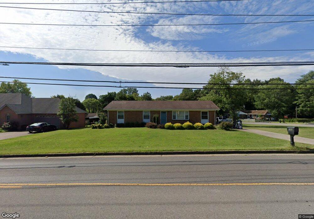
2086 Memorial Dr Unit B Clarksville, TN 37043
Estimated Value: $428,000 - $451,000
4
Beds
3
Baths
2,392
Sq Ft
$184/Sq Ft
Est. Value
About This Home
This home is located at 2086 Memorial Dr Unit B, Clarksville, TN 37043 and is currently estimated at $440,412, approximately $184 per square foot. 2086 Memorial Dr Unit B is a home located in Montgomery County with nearby schools including Barksdale Elementary School, Richview Middle School, and Clarksville High School.
Ownership History
Date
Name
Owned For
Owner Type
Purchase Details
Closed on
Jul 11, 2025
Sold by
Stamps Billy R and Stamps Patricia G
Bought by
Daniel Robert S and Daniel Sally P
Current Estimated Value
Purchase Details
Closed on
Aug 29, 2014
Sold by
Shelby H Paul
Bought by
Stamps Billy R and Stamps Patricia G
Home Financials for this Owner
Home Financials are based on the most recent Mortgage that was taken out on this home.
Original Mortgage
$66,000
Interest Rate
4.19%
Mortgage Type
New Conventional
Purchase Details
Closed on
Dec 15, 1997
Sold by
Crocker Harry E
Bought by
Winn Ellis Michael
Purchase Details
Closed on
Mar 20, 1996
Sold by
Herald & Phillips Builders
Bought by
Crocker Harry E
Purchase Details
Closed on
Mar 5, 1996
Sold by
Hand Charles W
Bought by
Herald & Phillips Builders
Create a Home Valuation Report for This Property
The Home Valuation Report is an in-depth analysis detailing your home's value as well as a comparison with similar homes in the area
Home Values in the Area
Average Home Value in this Area
Purchase History
| Date | Buyer | Sale Price | Title Company |
|---|---|---|---|
| Daniel Robert S | $450,000 | Stewart Title Company | |
| Stamps Billy R | $216,000 | -- | |
| Winn Ellis Michael | $10,000 | -- | |
| Crocker Harry E | $10,000 | -- | |
| Herald & Phillips Builders | $1,000 | -- |
Source: Public Records
Mortgage History
| Date | Status | Borrower | Loan Amount |
|---|---|---|---|
| Previous Owner | Stamps Billy R | $66,000 |
Source: Public Records
Tax History Compared to Growth
Tax History
| Year | Tax Paid | Tax Assessment Tax Assessment Total Assessment is a certain percentage of the fair market value that is determined by local assessors to be the total taxable value of land and additions on the property. | Land | Improvement |
|---|---|---|---|---|
| 2024 | $3,204 | $107,500 | $0 | $0 |
| 2023 | $3,204 | $66,600 | $0 | $0 |
| 2022 | $2,810 | $66,600 | $0 | $0 |
| 2021 | $2,810 | $66,600 | $0 | $0 |
| 2020 | $2,677 | $66,600 | $0 | $0 |
| 2019 | $2,685 | $66,775 | $0 | $0 |
| 2018 | $2,338 | $43,025 | $0 | $0 |
| 2017 | $673 | $54,250 | $0 | $0 |
| 2016 | $1,665 | $54,250 | $0 | $0 |
| 2015 | $2,289 | $54,300 | $0 | $0 |
| 2014 | $2,258 | $54,300 | $0 | $0 |
| 2013 | $2,508 | $57,275 | $0 | $0 |
Source: Public Records
Map
Nearby Homes
- 210 Essex Dr
- 221 Paddock Rd
- 335 Hampshire Dr
- 323 Clearview Dr
- 2027 Montgomery Pkwy
- 306 Hampshire Ct
- 1877 Pardue Ct
- 2153 N Meadow Dr
- 222 E Meadow Cir
- 123 Maxwell Dr
- 147 Keith Dr
- 111 Lois Ln
- 1818 Memorial Dr Unit 41
- 2172 Memorial Dr Unit C3
- 313 Fairway Dr
- 1853 Madison St Unit 12
- 4 Thayer Ln
- 2281 Dewitt Dr
- 35 Coventry Cir
- 1675 Valley Rd
- 2086 Memorial Dr
- 205 Essex Dr
- 2088 Memorial Dr
- 203 Essex Dr
- 2090 Memorial Dr
- 301 Partridge Ct
- 302 Peartree Dr
- 335 Partridge Ct
- 208 Essex Dr
- 303 Partridge Ct
- 2091 Landon Rd
- 2092 Memorial Dr
- 304 Peartree Dr
- 206 Essex Dr
- 364 Peartree Dr
- 2093 Landon Rd
- 333 Partridge Ct
- 204 Essex Dr
- 362 Peartree Dr
- 306 Peartree Dr