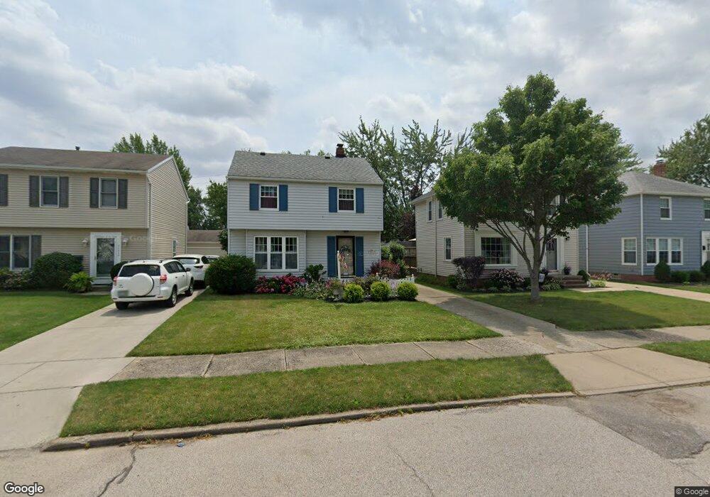
20861 Stanford Ave Cleveland, OH 44126
Estimated Value: $223,000 - $270,000
3
Beds
1
Bath
1,116
Sq Ft
$218/Sq Ft
Est. Value
About This Home
This home is located at 20861 Stanford Ave, Cleveland, OH 44126 and is currently estimated at $243,654, approximately $218 per square foot. 20861 Stanford Ave is a home located in Cuyahoga County with nearby schools including Gilles-Sweet Elementary School, Lewis F Mayer Middle School, and Fairview High School.
Ownership History
Date
Name
Owned For
Owner Type
Purchase Details
Closed on
Dec 17, 1992
Sold by
Pavia Michael A
Bought by
Dickey Robert B
Current Estimated Value
Purchase Details
Closed on
Mar 5, 1990
Sold by
Pavia Michael A
Bought by
Pavia Michael A
Purchase Details
Closed on
Jan 8, 1990
Sold by
Pavia Pauline M
Bought by
Pavia Michael A
Purchase Details
Closed on
Mar 22, 1989
Sold by
Pavia Anthony P and Pavia Pauline M
Bought by
Pavia Pauline M
Purchase Details
Closed on
Jan 1, 1975
Bought by
Pavia Anthony P and Pavia Pauline M
Create a Home Valuation Report for This Property
The Home Valuation Report is an in-depth analysis detailing your home's value as well as a comparison with similar homes in the area
Home Values in the Area
Average Home Value in this Area
Purchase History
| Date | Buyer | Sale Price | Title Company |
|---|---|---|---|
| Dickey Robert B | $92,000 | -- | |
| Pavia Michael A | -- | -- | |
| Pavia Michael A | -- | -- | |
| Pavia Pauline M | -- | -- | |
| Pavia Anthony P | -- | -- |
Source: Public Records
Tax History Compared to Growth
Tax History
| Year | Tax Paid | Tax Assessment Tax Assessment Total Assessment is a certain percentage of the fair market value that is determined by local assessors to be the total taxable value of land and additions on the property. | Land | Improvement |
|---|---|---|---|---|
| 2024 | $4,754 | $68,600 | $11,795 | $56,805 |
| 2023 | $4,654 | $57,580 | $10,540 | $47,040 |
| 2022 | $4,539 | $57,580 | $10,540 | $47,040 |
| 2021 | $4,630 | $57,580 | $10,540 | $47,040 |
| 2020 | $4,262 | $46,450 | $8,510 | $37,940 |
| 2019 | $3,791 | $132,700 | $24,300 | $108,400 |
| 2018 | $3,384 | $46,450 | $8,510 | $37,940 |
| 2017 | $3,727 | $42,210 | $7,560 | $34,650 |
| 2016 | $3,702 | $42,210 | $7,560 | $34,650 |
| 2015 | $3,498 | $42,210 | $7,560 | $34,650 |
| 2014 | $3,498 | $40,220 | $7,210 | $33,010 |
Source: Public Records
Map
Nearby Homes
- 20778 Woodstock Ave
- 3959 W 210th St
- 20688 Belvidere Ave
- 3826 W 210th St
- 21236 Northwood Ave
- 21143 Westwood Rd
- 3712 Addington Ct
- 21237 Westwood Rd
- 4243 W 212th St
- 20187 Grannis Rd
- 3420 W 210th St
- 3340 W 210th St
- 3733 River Ln
- 21872 Addington Blvd Unit 15
- 4291 W 215th St
- 3167 Linden Rd Unit 503
- 3167 Linden Rd Unit 508
- 3167 Linden Rd Unit 103
- 3167 Linden Rd Unit 309
- 4036 W 219th St
- 20869 Stanford Ave
- 20853 Stanford Ave
- 20877 Stanford Ave
- 20845 Stanford Ave
- 20885 Stanford Ave
- 20765 Stanford Ave
- 20868 Woodstock Ave
- 20856 Woodstock Ave
- 20886 Woodstock Ave
- 20844 Woodstock Ave
- 20937 Stanford Ave
- 20898 Woodstock Ave
- 20862 Stanford Ave
- 20854 Stanford Ave
- 20870 Stanford Ave
- 20878 Stanford Ave
- 20747 Stanford Ave
- 20945 Stanford Ave
- 20766 Woodstock Ave
- 20764 Stanford Ave