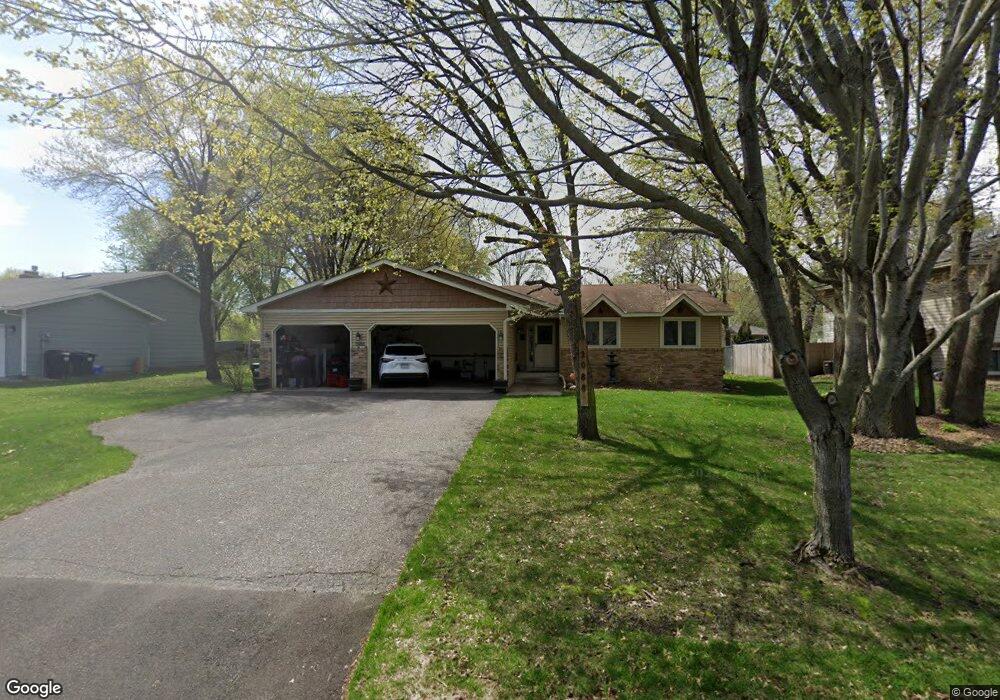
2088 129th Ln NW Coon Rapids, MN 55448
Estimated Value: $326,000 - $410,000
4
Beds
2
Baths
2,392
Sq Ft
$159/Sq Ft
Est. Value
About This Home
This home is located at 2088 129th Ln NW, Coon Rapids, MN 55448 and is currently estimated at $381,151, approximately $159 per square foot. 2088 129th Ln NW is a home located in Anoka County with nearby schools including Lucile Bruner Elementary School, Morris Bye Elementary School, and Laughlin Junior/Senior High School.
Ownership History
Date
Name
Owned For
Owner Type
Purchase Details
Closed on
Jan 4, 2013
Sold by
Federal National Mortgage Association
Bought by
Thon Neil A and Thon Lois R
Current Estimated Value
Purchase Details
Closed on
Jun 20, 2012
Sold by
Thor Neil A and Thor Lois R
Bought by
Johnson Kathryn
Purchase Details
Closed on
Jun 21, 1996
Sold by
Baumgartner Kurt A and Baumgartner Donna J
Bought by
Thon Neil A and Thon Lois R
Create a Home Valuation Report for This Property
The Home Valuation Report is an in-depth analysis detailing your home's value as well as a comparison with similar homes in the area
Home Values in the Area
Average Home Value in this Area
Purchase History
| Date | Buyer | Sale Price | Title Company |
|---|---|---|---|
| Thon Neil A | -- | None Available | |
| Johnson Kathryn | $120,000 | -- | |
| Thon Neil A | $127,000 | -- |
Source: Public Records
Tax History Compared to Growth
Tax History
| Year | Tax Paid | Tax Assessment Tax Assessment Total Assessment is a certain percentage of the fair market value that is determined by local assessors to be the total taxable value of land and additions on the property. | Land | Improvement |
|---|---|---|---|---|
| 2025 | $3,428 | $363,600 | $90,000 | $273,600 |
| 2024 | $3,428 | $354,900 | $87,000 | $267,900 |
| 2023 | $3,226 | $344,900 | $72,000 | $272,900 |
| 2022 | $2,869 | $356,200 | $72,000 | $284,200 |
| 2021 | $2,782 | $290,400 | $56,000 | $234,400 |
| 2020 | $2,699 | $277,400 | $56,000 | $221,400 |
| 2019 | $2,555 | $261,200 | $56,000 | $205,200 |
| 2018 | $2,353 | $243,700 | $0 | $0 |
| 2017 | $1,990 | $222,700 | $0 | $0 |
| 2016 | $2,021 | $192,600 | $0 | $0 |
| 2015 | $1,969 | $192,600 | $50,000 | $142,600 |
| 2014 | -- | $162,400 | $35,400 | $127,000 |
Source: Public Records
Map
Nearby Homes
- 12888 Nightingale St NW
- 12760 Raven St NW
- 1930 127th Cir NW
- 2147 125th Ln NW
- 12759 Ibis St NW
- 2068 124th Ln NW
- 1687 131st Ln NW
- 12554 Grouse St NW
- 13416 Swallow St NW
- 1776 133rd Ave NW
- 1593 126th Ln NW
- 12365 Jay St NW
- 1520 129th Ave NW
- 13182 Zion St NW
- 2675 128th Ave NW
- 13182 Crane St NW
- 13519 Partridge Cir NW
- 1450 126th Ln NW
- 12463 Drake St NW
- 2740 132nd Ln NW
- 2074 129th Ln NW
- 2102 129th Ln NW
- 2091 129th Ave NW
- 2105 129th Ave NW
- 2116 129th Ln NW
- 2077 129th Ave NW
- 2089 129th Ln NW
- 2103 129th Ln NW
- 2075 129th Ln NW
- 2119 129th Ave NW
- 2117 129th Ln NW
- 2130 129th Ln NW
- 2133 129th Ave NW
- 12930 Nightingale St NW
- 12902 Nightingale St NW
- 2092 129th Ave NW
- 2106 129th Ave NW
- 2144 129th Ln NW
- 2131 129th Ln NW
- 12944 Nightingale St NW