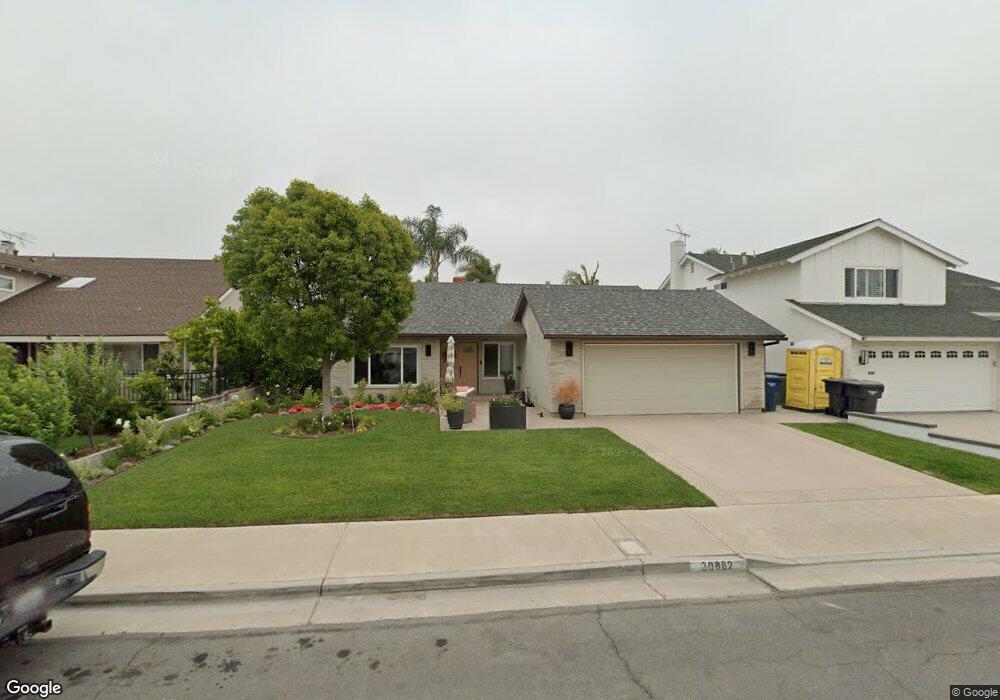
20882 Balgair Cir Huntington Beach, CA 92646
Southeast NeighborhoodEstimated Value: $1,484,058 - $1,638,000
4
Beds
2
Baths
1,640
Sq Ft
$939/Sq Ft
Est. Value
About This Home
This home is located at 20882 Balgair Cir, Huntington Beach, CA 92646 and is currently estimated at $1,540,765, approximately $939 per square foot. 20882 Balgair Cir is a home located in Orange County with nearby schools including Ralph E. Hawes Elementary School, Isaac L. Sowers Middle School, and Edison High School.
Ownership History
Date
Name
Owned For
Owner Type
Purchase Details
Closed on
Oct 31, 2023
Sold by
Avalos Carol J
Bought by
Carol J Avalos Revocable Trust and Avalos
Current Estimated Value
Purchase Details
Closed on
Sep 3, 2010
Sold by
Kushell Joel R and Kushell Sheila M
Bought by
Avalos Carol J
Home Financials for this Owner
Home Financials are based on the most recent Mortgage that was taken out on this home.
Original Mortgage
$540,000
Interest Rate
4.35%
Mortgage Type
New Conventional
Purchase Details
Closed on
Jun 2, 2010
Sold by
Myles Grossman Paula
Bought by
Kushell Joel R and Kushell Sheila M
Purchase Details
Closed on
Feb 11, 2004
Sold by
Grossman Wallace C
Bought by
Grossman Wallace C and Wallace C Grossman Trust
Create a Home Valuation Report for This Property
The Home Valuation Report is an in-depth analysis detailing your home's value as well as a comparison with similar homes in the area
Home Values in the Area
Average Home Value in this Area
Purchase History
| Date | Buyer | Sale Price | Title Company |
|---|---|---|---|
| Carol J Avalos Revocable Trust | -- | None Listed On Document | |
| Avalos Carol J | $675,000 | Investors Title Company | |
| Kushell Joel R | $450,000 | Investors Title Company | |
| Grossman Wallace C | -- | -- |
Source: Public Records
Mortgage History
| Date | Status | Borrower | Loan Amount |
|---|---|---|---|
| Previous Owner | Avalos Carol J | $540,000 |
Source: Public Records
Tax History Compared to Growth
Tax History
| Year | Tax Paid | Tax Assessment Tax Assessment Total Assessment is a certain percentage of the fair market value that is determined by local assessors to be the total taxable value of land and additions on the property. | Land | Improvement |
|---|---|---|---|---|
| 2025 | $9,878 | $884,699 | $748,145 | $136,554 |
| 2024 | $9,878 | $867,352 | $733,475 | $133,877 |
| 2023 | $9,656 | $850,346 | $719,094 | $131,252 |
| 2022 | $9,403 | $833,673 | $704,994 | $128,679 |
| 2021 | $9,227 | $817,327 | $691,171 | $126,156 |
| 2020 | $9,167 | $808,947 | $684,084 | $124,863 |
| 2019 | $9,056 | $793,086 | $670,671 | $122,415 |
| 2018 | $8,915 | $777,536 | $657,521 | $120,015 |
| 2017 | $8,795 | $762,291 | $644,629 | $117,662 |
| 2016 | $8,402 | $747,345 | $631,990 | $115,355 |
| 2015 | $8,321 | $736,120 | $622,497 | $113,623 |
| 2014 | $7,813 | $691,170 | $583,952 | $107,218 |
Source: Public Records
Map
Nearby Homes
- 20862 Lancelot Ln
- 21022 Manessa Cir
- 9412 Hingham Dr
- 10092 Dana Dr
- 21072 Galbar Cir
- 9221 Belcaro Dr
- 10101 Theseus Dr
- 21382 Lemontree Ln
- 21221 Hillsdale Ln
- 20392 Redwood Ln
- 9522 Yellowstone Dr
- 20442 Craimer Ln
- 10172 Stonybrook Dr
- 8932 Amador Cir Unit 1309B
- 2175 Pacific Ave Unit C1
- 9171 Regatta Dr
- 21662 Brookhurst St Unit D
- 2205 Pacific Ave Unit 101
- 21211 Poston Ln
- 1269 Westreef
- 20872 Balgair Cir
- 20892 Balgair Cir
- 20881 Queens Park Ln
- 20891 Queens Park Ln
- 20871 Queens Park Ln
- 20862 Balgair Cir
- 20881 Balgair Cir
- 20901 Queens Park Ln
- 20861 Queens Park Ln
- 20891 Balgair Cir
- 20871 Balgair Cir
- 20912 Balgair Cir
- 20901 Balgair Cir
- 20861 Balgair Cir
- 20911 Queens Park Ln
- 20911 Balgair Cir
- 20932 Balgair Cir
- 20882 Hunter Ln
- 20882 Queens Park Ln
- 20872 Queens Park Ln