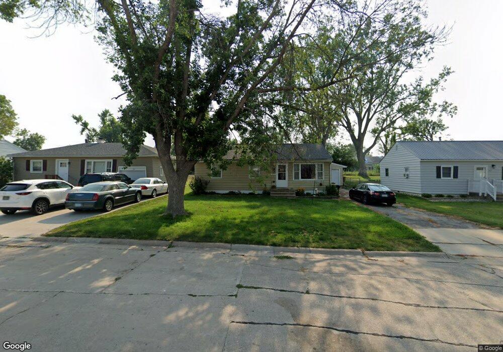
209 2nd Ave Hiawatha, IA 52233
Estimated Value: $143,000 - $182,000
3
Beds
1
Bath
988
Sq Ft
$156/Sq Ft
Est. Value
About This Home
This home is located at 209 2nd Ave, Hiawatha, IA 52233 and is currently estimated at $154,178, approximately $156 per square foot. 209 2nd Ave is a home located in Linn County with nearby schools including T.C. Cherry Elementary School, Nixon Elementary School, and Ponderosa Elementary School.
Ownership History
Date
Name
Owned For
Owner Type
Purchase Details
Closed on
May 8, 2023
Sold by
Sorenson Brent D
Bought by
Sorenson Kristine N
Current Estimated Value
Home Financials for this Owner
Home Financials are based on the most recent Mortgage that was taken out on this home.
Original Mortgage
$108,000
Outstanding Balance
$105,316
Interest Rate
7%
Mortgage Type
Credit Line Revolving
Estimated Equity
$48,862
Purchase Details
Closed on
Mar 22, 2023
Sold by
Sorenson Brent D
Bought by
Sorenson Brent D and Sorenson Kristine N
Home Financials for this Owner
Home Financials are based on the most recent Mortgage that was taken out on this home.
Original Mortgage
$108,000
Outstanding Balance
$105,316
Interest Rate
7%
Mortgage Type
Credit Line Revolving
Estimated Equity
$48,862
Purchase Details
Closed on
Apr 28, 2022
Sold by
Richards Crystal L
Bought by
Richards Scott Allen
Purchase Details
Closed on
Mar 26, 2004
Sold by
Platten Jeff A and Platten Michelle L
Bought by
Sorenson Brent D
Home Financials for this Owner
Home Financials are based on the most recent Mortgage that was taken out on this home.
Original Mortgage
$89,294
Interest Rate
5.65%
Mortgage Type
FHA
Purchase Details
Closed on
Aug 2, 1999
Sold by
Brown Todd K and Brown Amy E
Bought by
Platten Jeff A
Home Financials for this Owner
Home Financials are based on the most recent Mortgage that was taken out on this home.
Original Mortgage
$66,500
Interest Rate
7.68%
Create a Home Valuation Report for This Property
The Home Valuation Report is an in-depth analysis detailing your home's value as well as a comparison with similar homes in the area
Home Values in the Area
Average Home Value in this Area
Purchase History
| Date | Buyer | Sale Price | Title Company |
|---|---|---|---|
| Sorenson Kristine N | -- | None Listed On Document | |
| Sorenson Brent D | -- | -- | |
| Richards Scott Allen | -- | None Listed On Document | |
| Sorenson Brent D | $89,500 | -- | |
| Platten Jeff A | $69,500 | -- |
Source: Public Records
Mortgage History
| Date | Status | Borrower | Loan Amount |
|---|---|---|---|
| Open | Sorenson Kristine N | $108,000 | |
| Previous Owner | Sorenson Brent D | $89,294 | |
| Previous Owner | Platten Jeff A | $66,500 |
Source: Public Records
Tax History Compared to Growth
Tax History
| Year | Tax Paid | Tax Assessment Tax Assessment Total Assessment is a certain percentage of the fair market value that is determined by local assessors to be the total taxable value of land and additions on the property. | Land | Improvement |
|---|---|---|---|---|
| 2025 | $1,806 | $133,000 | $19,300 | $113,700 |
| 2024 | $1,954 | $120,300 | $19,300 | $101,000 |
| 2023 | $1,954 | $120,300 | $19,300 | $101,000 |
| 2022 | $1,928 | $105,200 | $19,300 | $85,900 |
| 2021 | $1,872 | $105,200 | $19,300 | $85,900 |
| 2020 | $1,872 | $95,900 | $19,300 | $76,600 |
| 2019 | $1,728 | $89,600 | $19,300 | $70,300 |
| 2018 | $1,694 | $89,600 | $19,300 | $70,300 |
| 2017 | $1,904 | $89,200 | $19,300 | $69,900 |
| 2016 | $1,904 | $89,200 | $19,300 | $69,900 |
| 2015 | $1,910 | $89,200 | $19,300 | $69,900 |
| 2014 | $1,724 | $89,200 | $19,300 | $69,900 |
| 2013 | $1,674 | $89,200 | $19,300 | $69,900 |
Source: Public Records
Map
Nearby Homes
- 5455 Blairs Ferry Rd NE
- 1 N Center Point Rd
- 3 N Center Point Rd
- 109 E Willman St
- 114 Northwood Dr
- 306 10th Ave
- 780 Ryan Ave
- 4642 Aspen Ln NE
- 2602 Towne House Dr NE
- 6701 Stonybrook Ln NE
- 4609 White Pine Dr NE
- 0 Council St NE
- 4761 Westchester Dr NE Unit C
- 4745 Westchester Dr NE Unit A
- 1213 Raney St
- 1213 Bowler St
- 4545 Westchester Dr NE Unit D
- 4460 Westchester Dr NE Unit C
- 1006 Messina Dr NE
- 1138 Messina Dr NE