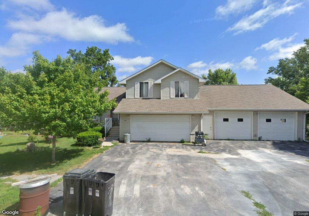
209 Broadway St West Branch, IA 52358
Estimated Value: $191,000 - $325,000
3
Beds
4
Baths
1,765
Sq Ft
$145/Sq Ft
Est. Value
About This Home
This home is located at 209 Broadway St, West Branch, IA 52358 and is currently estimated at $256,502, approximately $145 per square foot. 209 Broadway St is a home located in Cedar County with nearby schools including Hoover Elementary School, West Branch Middle School, and West Branch High School.
Ownership History
Date
Name
Owned For
Owner Type
Purchase Details
Closed on
Dec 14, 2021
Sold by
Hamer June G and Hamer Michael J
Bought by
Gray Diane L and Gray George
Current Estimated Value
Home Financials for this Owner
Home Financials are based on the most recent Mortgage that was taken out on this home.
Original Mortgage
$108,000
Outstanding Balance
$98,909
Interest Rate
3.1%
Estimated Equity
$157,593
Create a Home Valuation Report for This Property
The Home Valuation Report is an in-depth analysis detailing your home's value as well as a comparison with similar homes in the area
Home Values in the Area
Average Home Value in this Area
Purchase History
| Date | Buyer | Sale Price | Title Company |
|---|---|---|---|
| Gray Diane L | $120,000 | None Listed On Document |
Source: Public Records
Mortgage History
| Date | Status | Borrower | Loan Amount |
|---|---|---|---|
| Open | Gray Diane L | $108,000 |
Source: Public Records
Tax History Compared to Growth
Tax History
| Year | Tax Paid | Tax Assessment Tax Assessment Total Assessment is a certain percentage of the fair market value that is determined by local assessors to be the total taxable value of land and additions on the property. | Land | Improvement |
|---|---|---|---|---|
| 2025 | $3,214 | $327,580 | $76,500 | $251,080 |
| 2024 | $3,214 | $280,610 | $35,780 | $244,830 |
| 2023 | $3,090 | $269,110 | $35,780 | $233,330 |
| 2022 | $3,232 | $241,600 | $31,650 | $209,950 |
| 2021 | $3,088 | $241,600 | $31,650 | $209,950 |
| 2020 | $3,002 | $214,750 | $28,130 | $186,620 |
| 2019 | $2,454 | $196,640 | $0 | $0 |
| 2018 | $2,402 | $196,640 | $0 | $0 |
| 2017 | $2,402 | $183,790 | $0 | $0 |
| 2016 | $2,470 | $183,790 | $0 | $0 |
| 2015 | $2,496 | $183,790 | $0 | $0 |
| 2014 | $2,496 | $185,510 | $0 | $0 |
Source: Public Records
Map
Nearby Homes
- 102 Broadway St
- 2263 Eureka Ave
- 1118 120th St
- 5424 400th St SE
- 1904 Charles Ave
- 314 Sycamore Dr
- 312 Sycamore Dr
- 316 Sycamore Dr
- 360 Cookson Dr
- 316 S Maple St
- 1932 Charles Ave Lot 8
- 1928 Charles Ave Lot 7
- 1924 Charles Ave Lot 6
- 1912 Charles Ave Lot 3
- 168 290th St
- 120 N Downey St
- 127 N Downey St
- 1908 Charles Ave Lot 2
- 173 Hilltop Dr
- 212 Dawson Dr