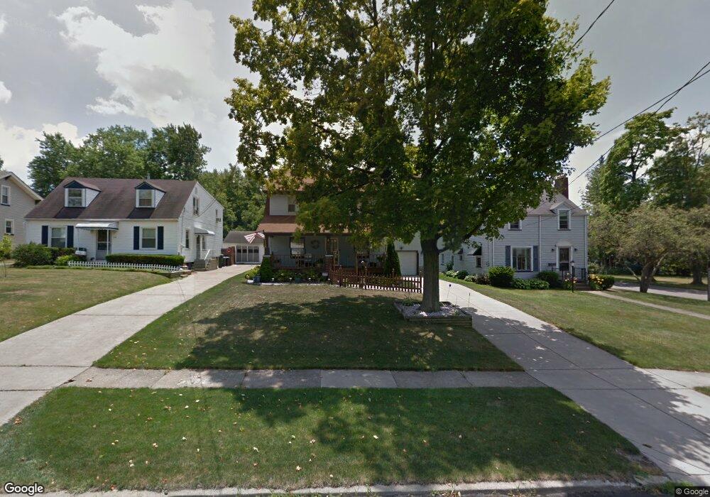
209 Erskine Ave Youngstown, OH 44512
Estimated Value: $160,672 - $189,000
4
Beds
2
Baths
2,008
Sq Ft
$86/Sq Ft
Est. Value
About This Home
This home is located at 209 Erskine Ave, Youngstown, OH 44512 and is currently estimated at $173,668, approximately $86 per square foot. 209 Erskine Ave is a home located in Mahoning County with nearby schools including Boardman Glenwood Junior High School, Boardman High School, and Horizon Science Academy - Youngstown.
Ownership History
Date
Name
Owned For
Owner Type
Purchase Details
Closed on
Oct 22, 2009
Sold by
Tartir Jamal K and Tartir Janette G
Bought by
Conner Donna
Current Estimated Value
Purchase Details
Closed on
Jul 11, 2000
Sold by
Farrell Andrew C and Farrell Julia M
Bought by
Tartir Jamal K and Tartir Janette G
Purchase Details
Closed on
Dec 28, 1998
Sold by
Setz Thomas A
Bought by
Farrell Andrew C and Farrell Julia M
Home Financials for this Owner
Home Financials are based on the most recent Mortgage that was taken out on this home.
Original Mortgage
$78,375
Interest Rate
7.02%
Purchase Details
Closed on
Sep 3, 1980
Bought by
Setz Thomas A
Create a Home Valuation Report for This Property
The Home Valuation Report is an in-depth analysis detailing your home's value as well as a comparison with similar homes in the area
Home Values in the Area
Average Home Value in this Area
Purchase History
| Date | Buyer | Sale Price | Title Company |
|---|---|---|---|
| Conner Donna | $82,000 | Attorney | |
| Tartir Jamal K | $88,000 | -- | |
| Farrell Andrew C | $82,500 | -- | |
| Setz Thomas A | -- | -- |
Source: Public Records
Mortgage History
| Date | Status | Borrower | Loan Amount |
|---|---|---|---|
| Previous Owner | Farrell Andrew C | $78,375 |
Source: Public Records
Tax History Compared to Growth
Tax History
| Year | Tax Paid | Tax Assessment Tax Assessment Total Assessment is a certain percentage of the fair market value that is determined by local assessors to be the total taxable value of land and additions on the property. | Land | Improvement |
|---|---|---|---|---|
| 2024 | $1,619 | $41,470 | $4,180 | $37,290 |
| 2023 | $1,628 | $41,470 | $4,180 | $37,290 |
| 2022 | $1,283 | $28,110 | $3,860 | $24,250 |
| 2021 | $1,284 | $28,110 | $3,860 | $24,250 |
| 2020 | $1,291 | $28,110 | $3,860 | $24,250 |
| 2019 | $1,164 | $24,030 | $3,300 | $20,730 |
| 2018 | $1,000 | $24,030 | $3,300 | $20,730 |
| 2017 | $983 | $24,030 | $3,300 | $20,730 |
| 2016 | $1,070 | $25,240 | $3,690 | $21,550 |
| 2015 | $1,049 | $25,240 | $3,690 | $21,550 |
| 2014 | -- | $25,240 | $3,690 | $21,550 |
| 2013 | $1,039 | $25,240 | $3,690 | $21,550 |
Source: Public Records
Map
Nearby Homes
- 167 Afton Ave
- 149 Argyle Ave
- 127 Melrose Ave
- 329 Afton Ave
- 0 Indianola Rd
- 81 Melrose Ave
- 0 Mathews Rd Unit 5038026
- 175 Homestead Dr
- 197 Mathews Rd Unit B
- 44 Gertrude Ave
- 429 Tudor Ln
- 0 Cranberry Ln Unit 5170595
- 6001 Applecrest Dr
- 148 Clifton Dr
- 4715 Euclid Blvd
- 424 Mathews Rd
- 83 Beechwood Dr
- 28 Terrace Dr
- 94 Beechwood Dr
- 4552 New England Blvd
- 215 Erskine Ave
- 203 Erskine Ave
- 219 Erskine Ave
- 225 Erskine Ave
- 191 Erskine Ave
- 208 Afton Ave
- 204 Afton Ave
- 214 Afton Ave
- 189 Erskine Ave
- 229 Erskine Ave
- 210 Erskine Ave
- 196 Afton Ave
- 214 Erskine Ave
- 204 Erskine Ave
- 226 Afton Ave
- 185 Erskine Ave
- 235 Erskine Ave
- 194 Afton Ave
- 228 Erskine Ave
- 194 Erskine Ave