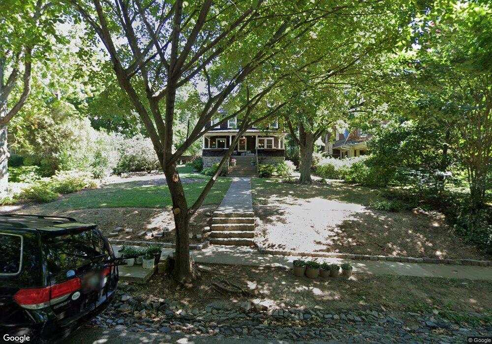
209 Hawthorne Rd Baltimore, MD 21210
Evergreen NeighborhoodEstimated Value: $692,809 - $882,000
5
Beds
3
Baths
2,350
Sq Ft
$335/Sq Ft
Est. Value
About This Home
This home is located at 209 Hawthorne Rd, Baltimore, MD 21210 and is currently estimated at $787,405, approximately $335 per square foot. 209 Hawthorne Rd is a home located in Baltimore City with nearby schools including Roland Park Elementary/Middle School, Booker T. Washington Middle School, and Frederick Douglass High School.
Ownership History
Date
Name
Owned For
Owner Type
Purchase Details
Closed on
Apr 19, 2010
Sold by
Temple Eunice J
Bought by
Harvey Todd James and Gill Harvey Katherine Mara
Current Estimated Value
Home Financials for this Owner
Home Financials are based on the most recent Mortgage that was taken out on this home.
Original Mortgage
$408,000
Outstanding Balance
$272,011
Interest Rate
5.02%
Mortgage Type
New Conventional
Estimated Equity
$515,394
Purchase Details
Closed on
Jul 8, 1999
Sold by
Temple Lloyd L
Bought by
Temple Lloyd L and Temple Eunice J
Create a Home Valuation Report for This Property
The Home Valuation Report is an in-depth analysis detailing your home's value as well as a comparison with similar homes in the area
Home Values in the Area
Average Home Value in this Area
Purchase History
| Date | Buyer | Sale Price | Title Company |
|---|---|---|---|
| Harvey Todd James | $510,000 | -- | |
| Temple Lloyd L | -- | -- |
Source: Public Records
Mortgage History
| Date | Status | Borrower | Loan Amount |
|---|---|---|---|
| Open | Harvey Todd James | $408,000 |
Source: Public Records
Tax History
| Year | Tax Paid | Tax Assessment Tax Assessment Total Assessment is a certain percentage of the fair market value that is determined by local assessors to be the total taxable value of land and additions on the property. | Land | Improvement |
|---|---|---|---|---|
| 2025 | $10,015 | $476,233 | -- | -- |
| 2024 | $10,015 | $454,100 | $202,400 | $251,700 |
| 2023 | $9,933 | $451,500 | $0 | $0 |
| 2022 | $9,897 | $448,900 | $0 | $0 |
| 2021 | $10,533 | $446,300 | $202,400 | $243,900 |
| 2020 | $9,576 | $435,000 | $0 | $0 |
| 2019 | $9,262 | $423,700 | $0 | $0 |
| 2018 | $9,208 | $412,400 | $202,400 | $210,000 |
| 2017 | $9,275 | $412,400 | $0 | $0 |
| 2016 | $10,164 | $412,400 | $0 | $0 |
| 2015 | $10,164 | $412,400 | $0 | $0 |
| 2014 | $10,164 | $412,400 | $0 | $0 |
Source: Public Records
Map
Nearby Homes
- 225 Hawthorne Rd
- 304 W Cold Spring Ln
- 4503 Roland Ave
- 4408 Sedgwick Rd
- 4401 Roland Ave Unit 307
- 607 Somerset Rd Unit 4
- 607 Somerset Rd Unit 5
- 1007 Roland Heights Ave
- 520 Woodlawn Rd
- 903 W University Pkwy Unit 402
- 5001 Roland Ave
- 1040 Deer Ridge Dr Unit 402
- 1040 Deer Ridge Dr Unit 516
- 1040 Deer Ridge Dr Unit 208
- 818 W University Pkwy
- 4202 Roland Ave Unit 208
- 5009 Roland Ave
- 1120 Roland Heights Ave
- 10 Overhill Rd
- 4289 Falls Rd
- 207 Hawthorne Rd
- 211 Hawthorne Rd
- 205 Hawthorne Rd
- 217 Hawthorne Rd
- 203 Hawthorne Rd
- 4614 Schenley Rd
- 4616 Schenley Rd
- 4612 Schenley Rd
- 4618 Schenley Rd
- 4610 Schenley Rd
- 4608 Schenley Rd
- 210 Hawthorne Rd
- 208 Hawthorne Rd
- 219 Hawthorne Rd
- 4606 Schenley Rd
- 212 Hawthorne Rd
- 201 Hawthorne Rd
- 206 Hawthorne Rd
- 4604 Schenley Rd
- 204 Hawthorne Rd
Your Personal Tour Guide
Ask me questions while you tour the home.