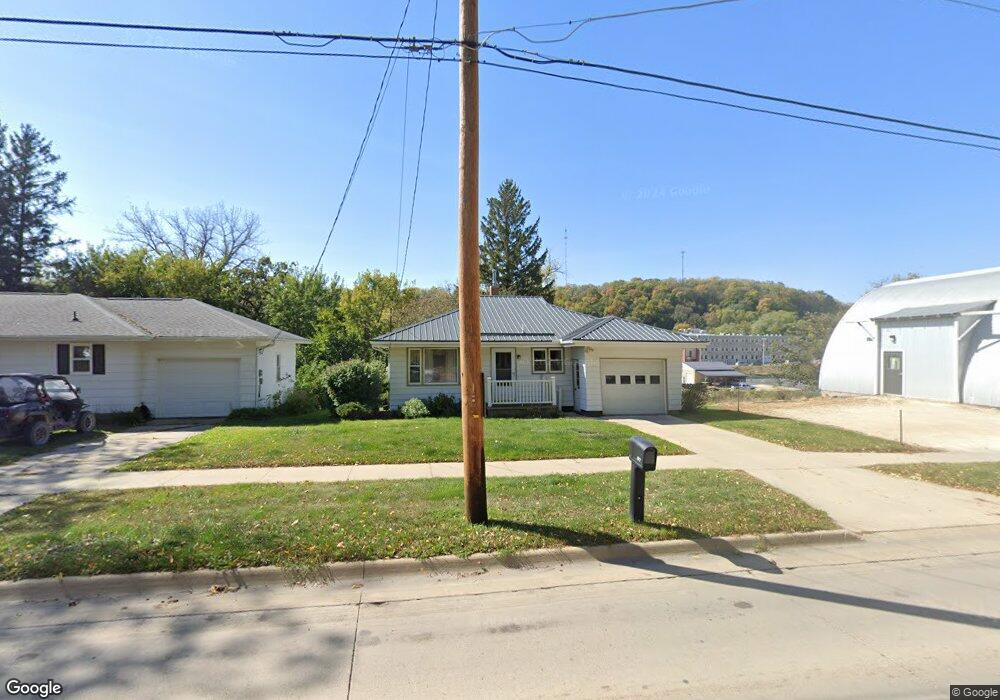
209 High St NE Elkader, IA 52043
Estimated Value: $101,000 - $121,922
2
Beds
2
Baths
924
Sq Ft
$120/Sq Ft
Est. Value
About This Home
This home is located at 209 High St NE, Elkader, IA 52043 and is currently estimated at $110,481, approximately $119 per square foot. 209 High St NE is a home located in Clayton County with nearby schools including Central Elementary School and Central Middle School/High School.
Ownership History
Date
Name
Owned For
Owner Type
Purchase Details
Closed on
May 15, 2024
Sold by
Moore Charlotte L
Bought by
Keppler Cletus G and Keppler Tanya L
Current Estimated Value
Home Financials for this Owner
Home Financials are based on the most recent Mortgage that was taken out on this home.
Original Mortgage
$150,000
Outstanding Balance
$147,873
Interest Rate
6.82%
Mortgage Type
Credit Line Revolving
Estimated Equity
-$37,392
Purchase Details
Closed on
Jun 29, 2013
Sold by
Speer Donald L and Donald L Speer Trust
Bought by
Moore Charlotte
Create a Home Valuation Report for This Property
The Home Valuation Report is an in-depth analysis detailing your home's value as well as a comparison with similar homes in the area
Home Values in the Area
Average Home Value in this Area
Purchase History
| Date | Buyer | Sale Price | Title Company |
|---|---|---|---|
| Keppler Cletus G | $107,500 | None Listed On Document | |
| Keppler Cletus G | $107,500 | None Listed On Document | |
| Moore Charlotte | $60,000 | None Available |
Source: Public Records
Mortgage History
| Date | Status | Borrower | Loan Amount |
|---|---|---|---|
| Open | Keppler Cletus G | $150,000 | |
| Closed | Keppler Cletus G | $150,000 |
Source: Public Records
Tax History Compared to Growth
Tax History
| Year | Tax Paid | Tax Assessment Tax Assessment Total Assessment is a certain percentage of the fair market value that is determined by local assessors to be the total taxable value of land and additions on the property. | Land | Improvement |
|---|---|---|---|---|
| 2024 | $1,612 | $88,398 | $20,028 | $68,370 |
| 2023 | $1,652 | $88,398 | $20,028 | $68,370 |
| 2022 | $1,528 | $72,154 | $18,207 | $53,947 |
| 2021 | $1,424 | $72,154 | $18,207 | $53,947 |
| 2020 | $1,424 | $70,169 | $18,207 | $51,962 |
| 2019 | $1,336 | $70,169 | $18,207 | $51,962 |
| 2018 | $1,336 | $67,640 | $18,207 | $49,433 |
| 2017 | $1,312 | $67,640 | $18,207 | $49,433 |
| 2015 | $1,120 | $57,503 | $10,996 | $46,507 |
| 2014 | $1,202 | $57,503 | $10,996 | $46,507 |
Source: Public Records
Map
Nearby Homes
- 201 N Main St
- 302 N 3rd St
- 117 S Main St
- 305 Oak Ave NW
- 707 N 1st St
- 0 E Bridge St
- 502 Volga Rd SW
- 710 Woodland Dr NW
- 113 Reimer St SW
- 26642 Iowa 13
- 247 Franzen Ridge Rd
- 249 Franzen Ridge Rd
- 27766 Highway 13
- 101 N Main St
- 27455 Harbor Rd
- 16313 Big Spring Rd
- TBD Country Rd
- 501 S Main St
- TBD Birch Rd
- 112 Cass St