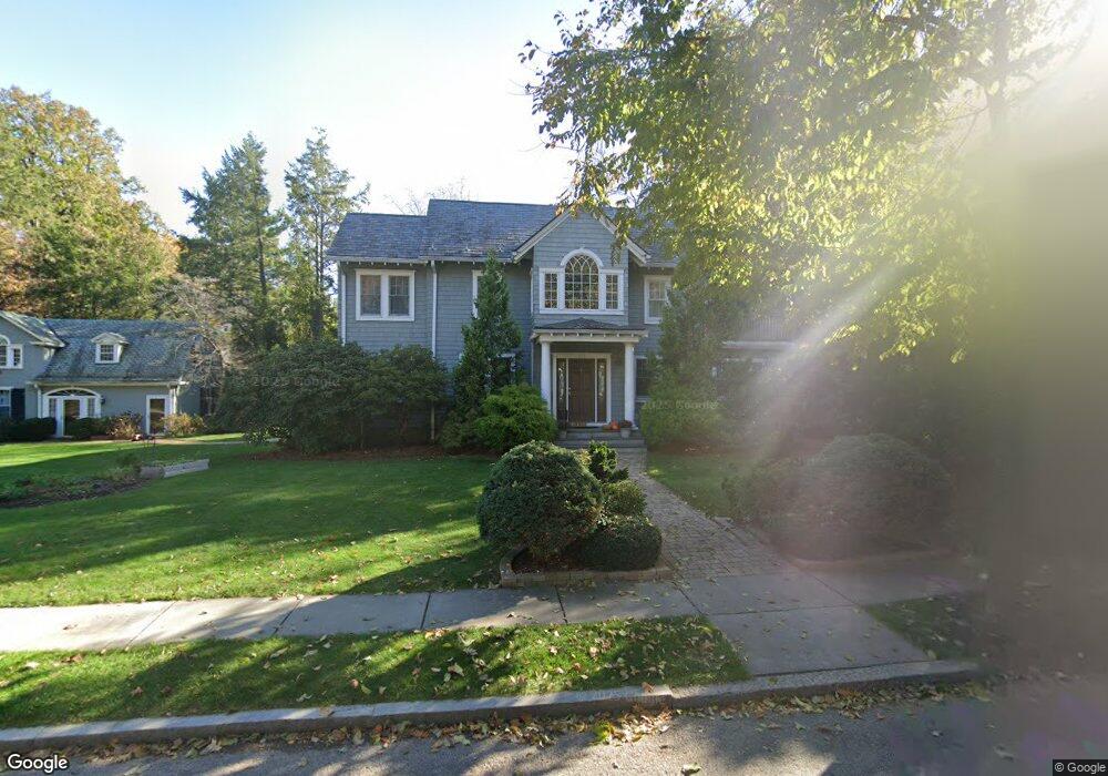
209 Middlesex Rd Unit 215 Chestnut Hill, MA 02467
Chestnut Hill NeighborhoodEstimated Value: $3,488,000 - $4,592,000
4
Beds
5
Baths
9,999
Sq Ft
$403/Sq Ft
Est. Value
About This Home
This home is located at 209 Middlesex Rd Unit 215, Chestnut Hill, MA 02467 and is currently estimated at $4,032,289, approximately $403 per square foot. 209 Middlesex Rd Unit 215 is a home located in Norfolk County with nearby schools including Heath Elementary School, Brimmer & May School, and The Chestnut Hill School.
Ownership History
Date
Name
Owned For
Owner Type
Purchase Details
Closed on
Aug 8, 2003
Sold by
Wang Paul J and Wu Gloria
Bought by
Yu Erik and Yu Lily L
Current Estimated Value
Purchase Details
Closed on
Jul 30, 1993
Sold by
Gittinger John W and Gittinger Diane
Bought by
Wang Paul J and Wu Gloria
Create a Home Valuation Report for This Property
The Home Valuation Report is an in-depth analysis detailing your home's value as well as a comparison with similar homes in the area
Home Values in the Area
Average Home Value in this Area
Purchase History
| Date | Buyer | Sale Price | Title Company |
|---|---|---|---|
| Yu Erik | $1,200,000 | -- | |
| Wang Paul J | $612,000 | -- |
Source: Public Records
Mortgage History
| Date | Status | Borrower | Loan Amount |
|---|---|---|---|
| Open | Wang Paul J | $367,500 | |
| Closed | Wang Paul J | $523,000 | |
| Closed | Wang Paul J | $500,000 |
Source: Public Records
Tax History Compared to Growth
Tax History
| Year | Tax Paid | Tax Assessment Tax Assessment Total Assessment is a certain percentage of the fair market value that is determined by local assessors to be the total taxable value of land and additions on the property. | Land | Improvement |
|---|---|---|---|---|
| 2025 | $39,140 | $3,965,600 | $1,760,100 | $2,205,500 |
| 2024 | $37,275 | $3,815,200 | $1,692,300 | $2,122,900 |
| 2023 | $32,416 | $3,251,400 | $1,209,100 | $2,042,300 |
| 2022 | $31,552 | $3,096,400 | $1,151,500 | $1,944,900 |
| 2021 | $29,178 | $2,977,300 | $1,107,200 | $1,870,100 |
| 2020 | $27,184 | $2,876,600 | $1,006,500 | $1,870,100 |
| 2019 | $25,671 | $2,739,700 | $958,600 | $1,781,100 |
| 2018 | $25,583 | $2,704,300 | $975,000 | $1,729,300 |
| 2017 | $24,826 | $2,512,800 | $919,800 | $1,593,000 |
| 2016 | $24,471 | $2,348,500 | $859,600 | $1,488,900 |
| 2015 | $23,533 | $2,203,500 | $803,400 | $1,400,100 |
| 2014 | $24,184 | $2,123,300 | $730,400 | $1,392,900 |
Source: Public Records
Map
Nearby Homes
- 174 Middlesex Rd
- 142 Crafts Rd
- 76 Norfolk Rd
- 1014 Boylston St
- 2400 Beacon St Unit 112
- 85 Gate House Rd
- 59 Ackers Ave Unit 1
- 335 Heath St
- 30 Ackers Ave
- 130 Cabot St
- 88 Cutler Ln
- 540 Chestnut Hill Ave
- 6 Sutherland Rd Unit 41
- 55 Reservoir Rd Unit 2
- 9 Willard Rd
- 44 Orkney Rd Unit 3
- 41 Orkney Rd
- 31 Orkney Rd Unit 54
- 675 Chestnut Hill Ave
- 19-21 Orkney Rd
- 72 Spooner Rd
- 84 Spooner Rd
- 206 Middlesex Rd
- 210 Middlesex Rd
- 64 Spooner Rd
- 195 Middlesex Rd
- 92 Spooner Rd
- 56 Spooner Rd
- 218 Middlesex Rd
- 190 Middlesex Rd
- 81 Spooner Rd
- 71 Spooner Rd
- 230 Middlesex Rd
- 183 Middlesex Rd
- 233 Middlesex Rd
- 98 Spooner Rd
- 50 Spooner Rd
- 234 Middlesex Rd
- 61 Spooner Rd
- 91 Spooner Rd