Estimated Value: $190,000 - $250,000
4
Beds
3
Baths
1,436
Sq Ft
$156/Sq Ft
Est. Value
About This Home
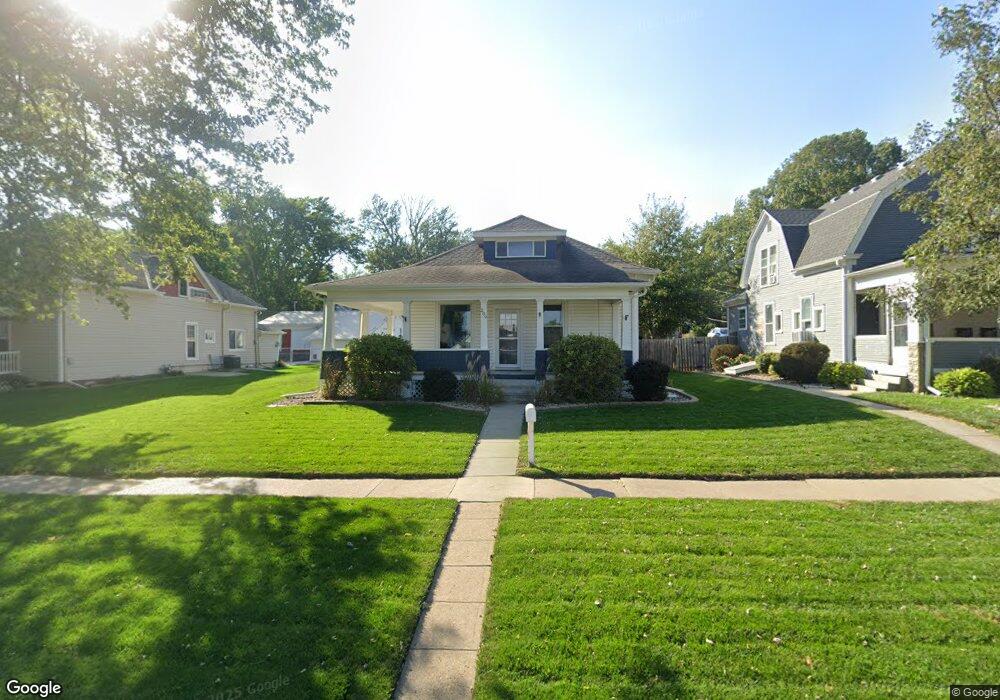
This home is located at 209 N Maple Ave, Logan, IA 51546 and is currently estimated at $223,599, approximately $155 per square foot. 209 N Maple Ave is a home located in Harrison County with nearby schools including Logan-Magnolia Elementary School and Logan-Magnolia Junior/Senior High School.
Ownership History
Date
Name
Owned For
Owner Type
Purchase Details
Closed on
Apr 3, 2013
Sold by
Navarrette Rebecca A and Busing Michael B
Bought by
Foutch Ryan M and Anderson Jessica N
Current Estimated Value
Home Financials for this Owner
Home Financials are based on the most recent Mortgage that was taken out on this home.
Original Mortgage
$121,380
Outstanding Balance
$85,577
Interest Rate
3.52%
Mortgage Type
New Conventional
Estimated Equity
$138,022
Purchase Details
Closed on
Feb 28, 2005
Sold by
Federal Home Loan Mortgage Corporation
Bought by
Navarrette Rebecca A and Busing Debra S
Create a Home Valuation Report for This Property
The Home Valuation Report is an in-depth analysis detailing your home's value as well as a comparison with similar homes in the area
Home Values in the Area
Average Home Value in this Area
Purchase History
| Date | Buyer | Sale Price | Title Company |
|---|---|---|---|
| Foutch Ryan M | $119,000 | None Available | |
| Navarrette Rebecca A | -- | None Available |
Source: Public Records
Mortgage History
| Date | Status | Borrower | Loan Amount |
|---|---|---|---|
| Open | Foutch Ryan M | $121,380 |
Source: Public Records
Tax History Compared to Growth
Tax History
| Year | Tax Paid | Tax Assessment Tax Assessment Total Assessment is a certain percentage of the fair market value that is determined by local assessors to be the total taxable value of land and additions on the property. | Land | Improvement |
|---|---|---|---|---|
| 2025 | $3,490 | $222,030 | $13,500 | $208,530 |
| 2024 | $3,490 | $198,630 | $13,500 | $185,130 |
| 2023 | $3,368 | $198,630 | $13,500 | $185,130 |
| 2022 | $2,786 | $142,867 | $13,500 | $129,367 |
| 2021 | $2,786 | $142,867 | $13,500 | $129,367 |
| 2020 | $2,508 | $132,320 | $13,500 | $118,820 |
| 2019 | $2,538 | $132,320 | $13,500 | $118,820 |
| 2018 | $2,486 | $126,678 | $0 | $0 |
| 2017 | $2,486 | $126,678 | $0 | $0 |
| 2016 | $2,606 | $126,678 | $0 | $0 |
| 2015 | $2,606 | $114,124 | $0 | $0 |
| 2014 | $1,670 | $82,932 | $0 | $0 |
Source: Public Records
Map
Nearby Homes
- 311 W 7th St
- 114 E 10th St
- 721 Glen Rd
- 1010 Skyline Dr
- 415 Wessar Dr
- Lot 18 Mulligan Trail
- 2607 220th St
- LOT 27 Mulligan Trail
- 2484 280th St
- LOT 26 Lmvcc Estates
- 2144 Norton Ave
- 2464 Mulligan Trail
- LOT 20 Lmvcc Estates
- LOT 17 Lmvcc Estates
- Lot 17 Lmvcc Estates Trail
- LOT 15 Mulligan Trail
- 2853 Preston Place
- 2740 Whitetail Dr
- LOT D Fieldcrest Dr
- LOT E & K Fieldcrest Dr