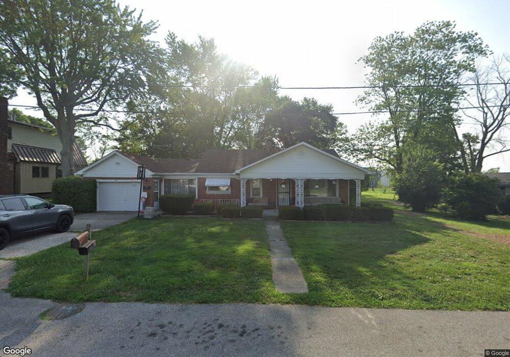
209 N State St Whiteland, IN 46184
Estimated Value: $185,000 - $221,000
3
Beds
1
Bath
800
Sq Ft
$263/Sq Ft
Est. Value
About This Home
This home is located at 209 N State St, Whiteland, IN 46184 and is currently estimated at $210,120, approximately $262 per square foot. 209 N State St is a home located in Johnson County with nearby schools including Whiteland Elementary School, Clark-Pleasant Middle School, and Whiteland Community High School.
Ownership History
Date
Name
Owned For
Owner Type
Purchase Details
Closed on
Oct 3, 2016
Sold by
Brockman Eula M
Bought by
Sells Gary W
Current Estimated Value
Home Financials for this Owner
Home Financials are based on the most recent Mortgage that was taken out on this home.
Original Mortgage
$52,250
Outstanding Balance
$41,888
Interest Rate
3.46%
Mortgage Type
New Conventional
Estimated Equity
$168,232
Create a Home Valuation Report for This Property
The Home Valuation Report is an in-depth analysis detailing your home's value as well as a comparison with similar homes in the area
Home Values in the Area
Average Home Value in this Area
Purchase History
| Date | Buyer | Sale Price | Title Company |
|---|---|---|---|
| Sells Gary W | -- | Chicago Title Company | |
| Sells Gary W | -- | Chicago Title Company |
Source: Public Records
Mortgage History
| Date | Status | Borrower | Loan Amount |
|---|---|---|---|
| Open | Sells Gary W | $52,250 |
Source: Public Records
Tax History Compared to Growth
Tax History
| Year | Tax Paid | Tax Assessment Tax Assessment Total Assessment is a certain percentage of the fair market value that is determined by local assessors to be the total taxable value of land and additions on the property. | Land | Improvement |
|---|---|---|---|---|
| 2025 | $1,680 | $190,900 | $60,400 | $130,500 |
| 2024 | $1,680 | $172,400 | $60,400 | $112,000 |
| 2023 | $1,869 | $173,100 | $60,400 | $112,700 |
| 2022 | $939 | $102,300 | $48,900 | $53,400 |
| 2021 | $552 | $83,700 | $43,600 | $40,100 |
| 2020 | $386 | $67,000 | $26,900 | $40,100 |
| 2019 | $391 | $67,000 | $26,900 | $40,100 |
| 2018 | $880 | $67,000 | $20,600 | $46,400 |
| 2017 | $1,356 | $67,000 | $20,600 | $46,400 |
| 2016 | $1,886 | $67,000 | $20,600 | $46,400 |
| 2014 | $358 | $87,400 | $23,600 | $63,800 |
| 2013 | $358 | $91,500 | $23,600 | $67,900 |
Source: Public Records
Map
Nearby Homes
- 630 Walnut St
- 650 E Pearl St
- Henley Plan at Saddlebrook Farms
- Fairfax Plan at Saddlebrook Farms - North
- 841 E Pearl St
- Henley Plan at Saddlebrook Farms - North
- Freeport Plan at Saddlebrook Farms - North
- Johnstown Plan at Saddlebrook Farms - North
- Dayton Plan at Saddlebrook Farms - North
- Chatham Plan at Saddlebrook Farms - North
- Dayton Plan at Saddlebrook Farms
- Harmony Plan at Saddlebrook Farms - North
- Johnstown Plan at Saddlebrook Farms
- Stamford Plan at Saddlebrook Farms - North
- 0 N 200 (Honey Creek Rd ) W Unit MBR21845718
- 905 Saddlebrook Farms Blvd
- 935 Saddlebrook Farms Blvd
- 930 Saddlebrook Farms Blvd
- 60 Benfield Dr
- 50 Benfield Dr