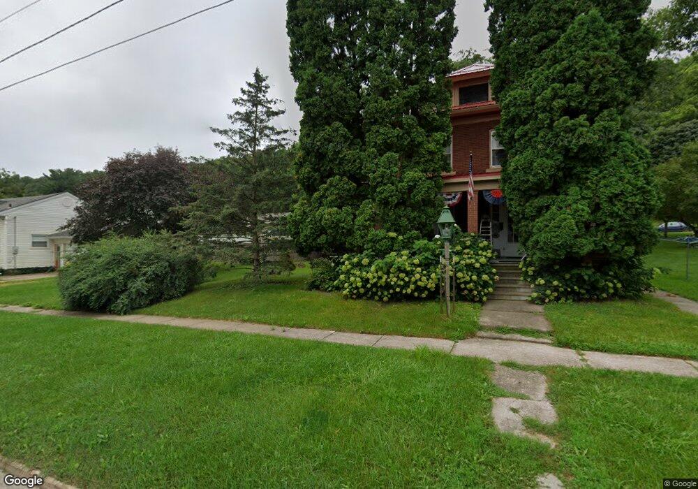
209 Oak Ave NW Elkader, IA 52043
Estimated Value: $120,000 - $149,068
3
Beds
4
Baths
1,364
Sq Ft
$99/Sq Ft
Est. Value
About This Home
This home is located at 209 Oak Ave NW, Elkader, IA 52043 and is currently estimated at $134,517, approximately $98 per square foot. 209 Oak Ave NW is a home located in Clayton County with nearby schools including Central Elementary School and Central Middle School/High School.
Ownership History
Date
Name
Owned For
Owner Type
Purchase Details
Closed on
Aug 25, 2025
Sold by
Stendel Stephen W and Stendel Sally J
Bought by
Dechenne Michael
Current Estimated Value
Home Financials for this Owner
Home Financials are based on the most recent Mortgage that was taken out on this home.
Original Mortgage
$121,500
Outstanding Balance
$121,500
Interest Rate
6.72%
Mortgage Type
Credit Line Revolving
Estimated Equity
$13,017
Purchase Details
Closed on
Jun 25, 2025
Sold by
Muckler Trent M L and Muckler Jill C
Bought by
Stendel Stephen W and Stendel Sally J
Create a Home Valuation Report for This Property
The Home Valuation Report is an in-depth analysis detailing your home's value as well as a comparison with similar homes in the area
Home Values in the Area
Average Home Value in this Area
Purchase History
| Date | Buyer | Sale Price | Title Company |
|---|---|---|---|
| Dechenne Michael | $135,000 | None Listed On Document | |
| Stendel Stephen W | -- | None Listed On Document |
Source: Public Records
Mortgage History
| Date | Status | Borrower | Loan Amount |
|---|---|---|---|
| Open | Dechenne Michael | $121,500 |
Source: Public Records
Tax History Compared to Growth
Tax History
| Year | Tax Paid | Tax Assessment Tax Assessment Total Assessment is a certain percentage of the fair market value that is determined by local assessors to be the total taxable value of land and additions on the property. | Land | Improvement |
|---|---|---|---|---|
| 2025 | $2,614 | $117,737 | $12,396 | $105,341 |
| 2024 | $2,520 | $104,628 | $10,779 | $93,849 |
| 2023 | $2,046 | $110,884 | $10,779 | $100,105 |
| 2022 | $1,892 | $90,629 | $9,764 | $80,865 |
| 2021 | $1,716 | $90,629 | $9,764 | $80,865 |
| 2020 | $1,716 | $86,121 | $9,764 | $76,357 |
| 2019 | $1,618 | $86,121 | $9,764 | $76,357 |
| 2018 | $1,618 | $83,361 | $9,764 | $73,597 |
| 2017 | $1,588 | $83,361 | $9,764 | $73,597 |
| 2015 | $1,812 | $91,003 | $10,240 | $80,763 |
| 2014 | $1,698 | $91,003 | $10,240 | $80,763 |
Source: Public Records
Map
Nearby Homes
- 301 N 1st St
- 209 2nd St SW
- 117 S Main St
- 702 N Main St
- 707 N Main St
- 302 N 3rd St
- 710 Woodland Dr NW
- 0 E Bridge St
- 26642 Iowa 13
- 247 Franzen Ridge Rd
- 249 Franzen Ridge Rd
- 27766 Highway 13
- 0 13 Hwy Unit NBR20255145
- 14149 Iowa 56
- 27455 Harbor Rd
- 0 Grandview Rd
- TBD Country Rd
- TBD Birch Rd
- 305 S Russell St
- 108 Adams Ct