Estimated Value: $405,000
Studio
2
Baths
2,597
Sq Ft
$156/Sq Ft
Est. Value
About This Home
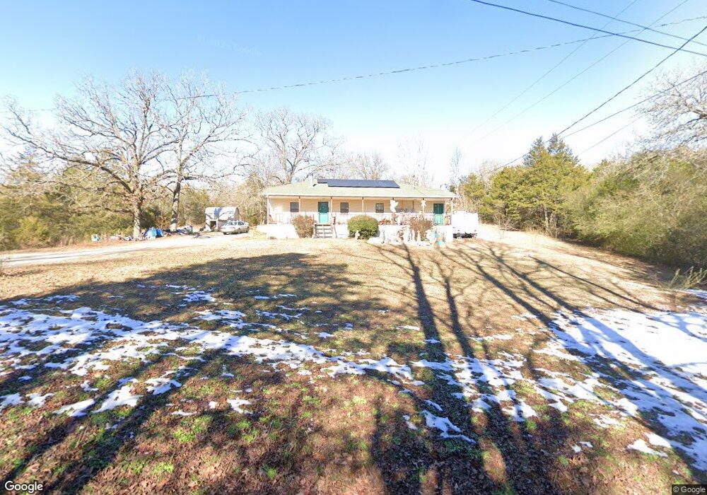
This home is located at 209 Rocky Branch Rd, Beebe, AR 72012 and is currently estimated at $405,000, approximately $155 per square foot. 209 Rocky Branch Rd is a home located in White County with nearby schools including Beebe Elementary School, Beebe Junior High School, and Beebe Middle School.
Ownership History
Date
Name
Owned For
Owner Type
Purchase Details
Closed on
Apr 6, 2000
Bought by
Crain Willard E and Crain Irene
Current Estimated Value
Purchase Details
Closed on
Mar 29, 2000
Bought by
Crain Willard E and Crain Irene
Purchase Details
Closed on
Mar 27, 2000
Bought by
Crain Willard E and Crain Irene
Purchase Details
Closed on
Oct 12, 1998
Bought by
Crain Philex and Doris % Crain W
Purchase Details
Closed on
Jul 9, 1998
Bought by
State
Purchase Details
Closed on
Sep 1, 1994
Bought by
Crain Willard and Crain Irene
Create a Home Valuation Report for This Property
The Home Valuation Report is an in-depth analysis detailing your home's value as well as a comparison with similar homes in the area
Purchase History
| Date | Buyer | Sale Price | Title Company |
|---|---|---|---|
| Crain Willard E | -- | -- | |
| Crain Willard E | -- | -- | |
| Crain Willard E | -- | -- | |
| Crain Philex | -- | -- | |
| State | -- | -- | |
| Crain Willard | $40,000 | -- |
Source: Public Records
Tax History
| Year | Tax Paid | Tax Assessment Tax Assessment Total Assessment is a certain percentage of the fair market value that is determined by local assessors to be the total taxable value of land and additions on the property. | Land | Improvement |
|---|---|---|---|---|
| 2025 | $1,940 | $47,656 | $2,724 | $44,932 |
| 2024 | $27 | $670 | $670 | -- |
| 2023 | $33 | $670 | $670 | $0 |
| 2022 | $33 | $670 | $670 | $0 |
| 2021 | $355 | $24,330 | $5,300 | $19,030 |
| 2020 | $331 | $21,130 | $3,170 | $17,960 |
| 2019 | $327 | $21,590 | $3,630 | $17,960 |
| 2018 | $326 | $21,590 | $3,630 | $17,960 |
| 2017 | $615 | $21,590 | $3,630 | $17,960 |
| 2016 | $615 | $15,100 | $3,630 | $11,470 |
| 2015 | $573 | $14,080 | $2,760 | $11,320 |
| 2014 | $552 | $13,570 | $2,760 | $10,810 |
Source: Public Records
Map
Nearby Homes
- 108 Powder River Dr
- 123 Powder River Dr
- 114 Powder River Dr
- 125 Powder River Dr
- 112 Powder River Dr
- 102 Powder River Dr
- 118 Powder River Dr
- 120 Powder River Dr
- 115 Powder River Dr
- 106 Powder River Dr
- 127 Powder River Dr
- 104 Powder River Dr
- 110 Powder River Dr
- 121 Powder River Dr
- 116 Powder River Dr
- 119 Powder River Dr
- 117 Big Mountain Rd
- 444 Blue Hole Rd
- LOT 8 S Ashley Horton Ln
- LOT 6 S Ashley Horton Ln
- 207 Rocky Branch Rd
- 7 Rocky Branch Rd
- Lot 7 Rocky Branch Estates
- 141 Rocky Branch Rd
- 264 Rocky Branch Rd
- 112 Rocky Branch Rd
- 283 Rocky Branch Rd Unit 289
- 105 Kenzie Cove
- 282 Rocky Branch Rd
- 282 Rocky Branch Rd
- 117 Powder River Dr
- 111 Powder River Dr
- 113 Powder River Dr
- 310 Blue Hole Rd
- 0 Lot 5 Kenzie Cove Unit 16033799
- 207 Liles Rd
- 179 Rocky Branch Rd
- Lot 2 Kenzie Rd Rocky Branch Estates
- 247 O C Gassaway Ln
- LOT 4 Kenzie Cove
Your Personal Tour Guide
Ask me questions while you tour the home.