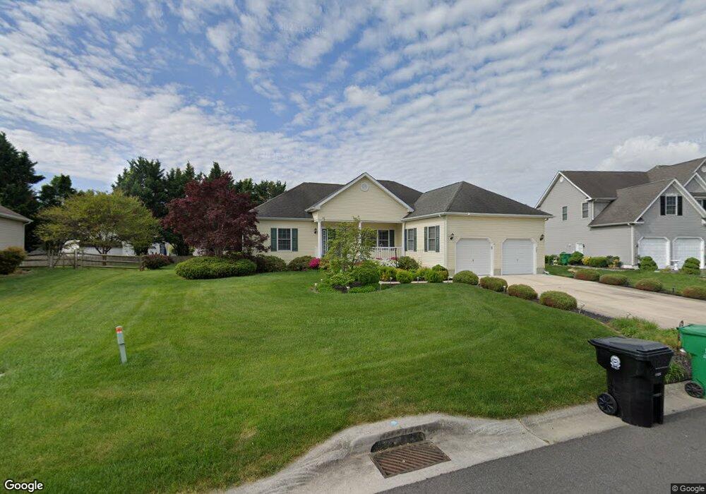
209 Sandhill Way Camden Wyoming, DE 19934
Estimated Value: $401,592 - $434,000
3
Beds
2
Baths
1,734
Sq Ft
$241/Sq Ft
Est. Value
About This Home
This home is located at 209 Sandhill Way, Camden Wyoming, DE 19934 and is currently estimated at $417,898, approximately $241 per square foot. 209 Sandhill Way is a home located in Kent County with nearby schools including Allen Frear Elementary School, F. Niel Postlethwait Middle School, and Caesar Rodney High School.
Ownership History
Date
Name
Owned For
Owner Type
Purchase Details
Closed on
Jan 10, 2005
Sold by
Stover Homes Llc
Bought by
Scott Gary M and Scott Johanna M
Current Estimated Value
Home Financials for this Owner
Home Financials are based on the most recent Mortgage that was taken out on this home.
Original Mortgage
$162,300
Outstanding Balance
$81,726
Interest Rate
5.71%
Mortgage Type
New Conventional
Estimated Equity
$336,172
Create a Home Valuation Report for This Property
The Home Valuation Report is an in-depth analysis detailing your home's value as well as a comparison with similar homes in the area
Home Values in the Area
Average Home Value in this Area
Purchase History
| Date | Buyer | Sale Price | Title Company |
|---|---|---|---|
| Scott Gary M | -- | None Available |
Source: Public Records
Mortgage History
| Date | Status | Borrower | Loan Amount |
|---|---|---|---|
| Open | Scott Gary M | $162,300 |
Source: Public Records
Tax History Compared to Growth
Tax History
| Year | Tax Paid | Tax Assessment Tax Assessment Total Assessment is a certain percentage of the fair market value that is determined by local assessors to be the total taxable value of land and additions on the property. | Land | Improvement |
|---|---|---|---|---|
| 2025 | $2,054 | $380,500 | $95,300 | $285,200 |
| 2024 | $2,054 | $380,500 | $95,300 | $285,200 |
| 2023 | $2,036 | $61,000 | $12,100 | $48,900 |
| 2022 | $1,918 | $61,000 | $12,100 | $48,900 |
| 2021 | $1,911 | $61,000 | $12,100 | $48,900 |
| 2020 | $1,855 | $61,000 | $12,100 | $48,900 |
| 2019 | $1,793 | $61,000 | $12,100 | $48,900 |
| 2018 | $1,754 | $61,000 | $12,100 | $48,900 |
| 2017 | $1,719 | $61,000 | $0 | $0 |
| 2016 | $1,623 | $61,000 | $0 | $0 |
| 2015 | $1,406 | $61,000 | $0 | $0 |
| 2014 | $1,424 | $61,000 | $0 | $0 |
Source: Public Records
Map
Nearby Homes
- 102 Gardengate Rd
- 45 Brookfield Dr
- 42 Brookfield Dr
- 5 Drew Ct
- 464 Orchard Grove Dr
- 80 N High Hill Rd
- 55 Orchard Grove Ct
- 215 Sandy Hill Trail
- 83 Homestead Dr
- 96 Pear Blossom Ln
- 256 Headstart Ln
- 4 King Henry Ct
- 160 Humphreys Dr
- 201 Homestead Dr
- 1286 Rising Sun Rd
- 103 King Henry Ct
- Garrett Plan at Brookfield
- Linden Plan at Brookfield
- Red Maple Plan at Brookfield
- Beech Plan at Brookfield
- 207 Sandhill Way
- 211 Sandhill Way
- 312 Pebble Dr
- 322 Pebble Dr
- 318 Pebble Dr
- 206 Sandhill Way
- 310 Pebble Dr
- 210 Sandhill Way
- 213 Sandhill Way
- 327 Pebble Dr
- 202 Sandhill Way
- 212 Sandhill Way
- 325 Pebble Dr
- 308 Pebble Dr
- 223 Stonepitch Ct
- 323 Pebble Dr
- 215 Sandhill Way
- 313 Pebble Dr
- 315 Pebble Dr
- 319 Pebble Dr