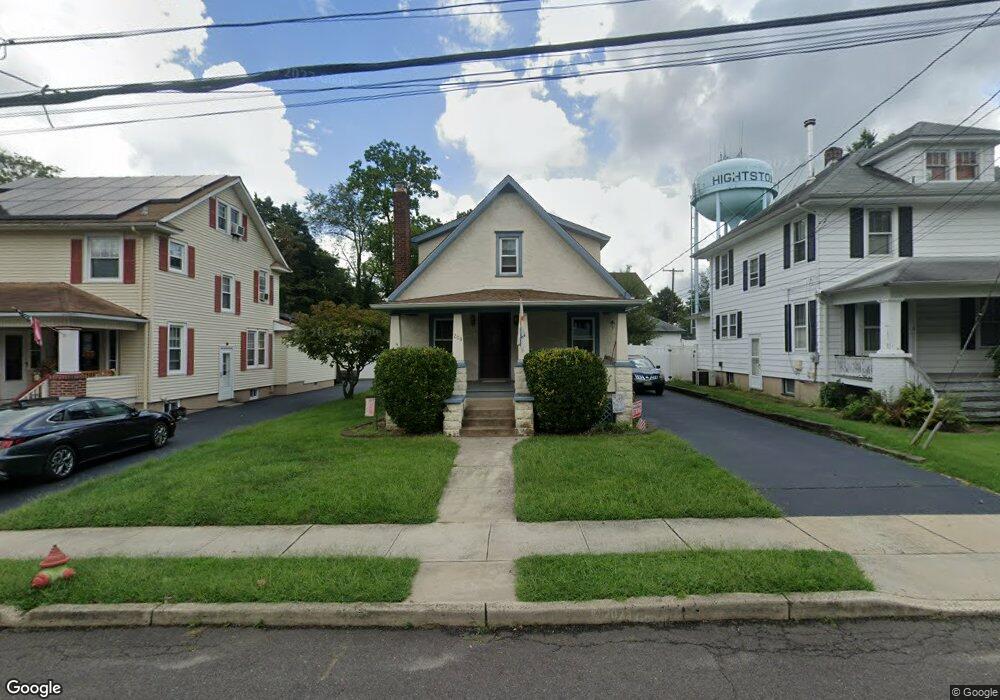
209 Summit St Hightstown, NJ 08520
Estimated Value: $344,643 - $471,000
Studio
--
Bath
1,243
Sq Ft
$340/Sq Ft
Est. Value
About This Home
This home is located at 209 Summit St, Hightstown, NJ 08520 and is currently estimated at $423,161, approximately $340 per square foot. 209 Summit St is a home located in Mercer County with nearby schools including Melvin H. Kreps Middle School, Hightstown High School, and SciCore Academy.
Ownership History
Date
Name
Owned For
Owner Type
Purchase Details
Closed on
Jun 25, 1999
Sold by
Ewart Frieda
Bought by
Horner Robert
Current Estimated Value
Home Financials for this Owner
Home Financials are based on the most recent Mortgage that was taken out on this home.
Original Mortgage
$75,000
Outstanding Balance
$20,580
Interest Rate
7.54%
Estimated Equity
$402,581
Create a Home Valuation Report for This Property
The Home Valuation Report is an in-depth analysis detailing your home's value as well as a comparison with similar homes in the area
Home Values in the Area
Average Home Value in this Area
Purchase History
| Date | Buyer | Sale Price | Title Company |
|---|---|---|---|
| Horner Robert | $68,000 | -- |
Source: Public Records
Mortgage History
| Date | Status | Borrower | Loan Amount |
|---|---|---|---|
| Open | Horner Robert | $75,000 |
Source: Public Records
Tax History
| Year | Tax Paid | Tax Assessment Tax Assessment Total Assessment is a certain percentage of the fair market value that is determined by local assessors to be the total taxable value of land and additions on the property. | Land | Improvement |
|---|---|---|---|---|
| 2025 | $8,482 | $173,000 | $68,800 | $104,200 |
| 2024 | $8,396 | $173,000 | $68,800 | $104,200 |
Source: Public Records
Map
Nearby Homes
Your Personal Tour Guide
Ask me questions while you tour the home.