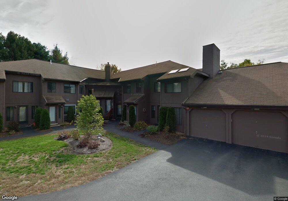
209 Trailside Way Ashland, MA 01721
Estimated Value: $348,000 - $465,000
1
Bed
1
Bath
1,043
Sq Ft
$387/Sq Ft
Est. Value
About This Home
This home is located at 209 Trailside Way, Ashland, MA 01721 and is currently estimated at $403,291, approximately $386 per square foot. 209 Trailside Way is a home located in Middlesex County with nearby schools including William Pittaway Elementary School, Henry E. Warren Elementary School, and David Mindess Elementary School.
Ownership History
Date
Name
Owned For
Owner Type
Purchase Details
Closed on
Mar 7, 2020
Sold by
Rose David J Est
Bought by
Lingala Priyanka and Beedanagari Sudheer
Current Estimated Value
Home Financials for this Owner
Home Financials are based on the most recent Mortgage that was taken out on this home.
Original Mortgage
$203,250
Outstanding Balance
$179,664
Interest Rate
3.4%
Mortgage Type
New Conventional
Estimated Equity
$223,627
Purchase Details
Closed on
Oct 14, 2015
Sold by
Covell Rt
Bought by
Rose David J
Home Financials for this Owner
Home Financials are based on the most recent Mortgage that was taken out on this home.
Original Mortgage
$164,000
Interest Rate
3.88%
Mortgage Type
New Conventional
Purchase Details
Closed on
Nov 18, 2011
Sold by
Covell Ronald F
Bought by
Covell 2011 Rt and Covell Michael S
Purchase Details
Closed on
Nov 23, 2010
Sold by
Skog Darlene E
Bought by
Covell Ronald F
Purchase Details
Closed on
Dec 24, 1992
Sold by
Herb Jane E
Bought by
Sher Elizabeth D
Home Financials for this Owner
Home Financials are based on the most recent Mortgage that was taken out on this home.
Original Mortgage
$35,000
Interest Rate
8.31%
Mortgage Type
Purchase Money Mortgage
Purchase Details
Closed on
Sep 26, 1989
Sold by
Sullivan John R
Bought by
Ertmann John M
Home Financials for this Owner
Home Financials are based on the most recent Mortgage that was taken out on this home.
Original Mortgage
$97,600
Interest Rate
9.82%
Mortgage Type
Purchase Money Mortgage
Purchase Details
Closed on
Mar 30, 1989
Sold by
Bamforth Joseph S
Bought by
Serra Leenie
Home Financials for this Owner
Home Financials are based on the most recent Mortgage that was taken out on this home.
Original Mortgage
$117,600
Interest Rate
10.63%
Mortgage Type
Purchase Money Mortgage
Purchase Details
Closed on
Jan 31, 1989
Sold by
Levy David J
Bought by
Parker John M
Home Financials for this Owner
Home Financials are based on the most recent Mortgage that was taken out on this home.
Original Mortgage
$117,600
Interest Rate
10.63%
Mortgage Type
Purchase Money Mortgage
Purchase Details
Closed on
Jul 17, 1987
Sold by
Reynolds James E
Bought by
Baird Barbara M
Create a Home Valuation Report for This Property
The Home Valuation Report is an in-depth analysis detailing your home's value as well as a comparison with similar homes in the area
Home Values in the Area
Average Home Value in this Area
Purchase History
| Date | Buyer | Sale Price | Title Company |
|---|---|---|---|
| Lingala Priyanka | $271,000 | None Available | |
| Rose David J | $205,000 | -- | |
| Covell 2011 Rt | -- | -- | |
| Covell Ronald F | $194,000 | -- | |
| Sher Elizabeth D | $70,000 | -- | |
| Ertmann John M | $122,000 | -- | |
| Serra Leenie | $147,000 | -- | |
| Parker John M | $151,000 | -- | |
| Baird Barbara M | $132,900 | -- |
Source: Public Records
Mortgage History
| Date | Status | Borrower | Loan Amount |
|---|---|---|---|
| Open | Lingala Priyanka | $203,250 | |
| Previous Owner | Rose David J | $164,000 | |
| Previous Owner | Baird Barbara M | $35,000 | |
| Previous Owner | Baird Barbara M | $97,600 | |
| Previous Owner | Baird Barbara M | $117,600 | |
| Previous Owner | Baird Barbara M | $131,000 |
Source: Public Records
Tax History
| Year | Tax Paid | Tax Assessment Tax Assessment Total Assessment is a certain percentage of the fair market value that is determined by local assessors to be the total taxable value of land and additions on the property. | Land | Improvement |
|---|---|---|---|---|
| 2025 | $4,315 | $337,900 | $0 | $337,900 |
| 2024 | $4,139 | $312,600 | $0 | $312,600 |
| 2023 | $4,050 | $294,100 | $0 | $294,100 |
| 2022 | $4,041 | $254,500 | $0 | $254,500 |
| 2021 | $3,888 | $244,062 | $0 | $244,062 |
| 2020 | $3,709 | $229,500 | $0 | $229,500 |
| 2019 | $3,499 | $214,900 | $0 | $214,900 |
| 2018 | $3,430 | $206,500 | $0 | $206,500 |
| 2017 | $3,413 | $204,400 | $0 | $204,400 |
| 2016 | $3,405 | $200,300 | $0 | $200,300 |
| 2015 | $3,176 | $183,568 | $0 | $183,568 |
| 2014 | $3,120 | $179,400 | $0 | $179,400 |
Source: Public Records
Map
Nearby Homes
- 241 Trailside Way
- 306 Trailside Way
- 26 Meeting House Path Unit 26
- 74 Meeting House Path
- 147 Turner Rd Unit 80
- 363 Eliot St
- 152 Turner Rd Unit 13
- 2 Adams Rd Unit 2
- 207 Eliot St
- 1 Adams Rd
- 9 Adams Rd
- 8 Raymond Way
- 102 Captain Eames Cir
- 45 Half Crown Cir
- 3 Danforth Dr
- 1 Danforth Dr
- 140 Algonquin Trail
- 37 James Rd
- 158 Algonquin Trail
- 269 Concord St
- 213 Trailside Way
- 217 Trailside Way
- 221 Trailside Way
- 223 Trailside Way
- 215 Trailside Way
- 211 Trailside Way
- 215 Trailside Way Unit 215
- 209 Trailside Way Unit 209
- 239 Trailside Way
- 235 Trailside Way
- 231 Trailside Way
- 227 Trailside Way
- 225 Trailside Way
- 229 Trailside Way
- 233 Trailside Way
- 237 Trailside Way
- 229 Trailside Way Unit 229
- 227 Trailside Way Unit 227
- 225 Trailside Way Unit 225
- 231 Trailside Way Unit 231
Your Personal Tour Guide
Ask me questions while you tour the home.