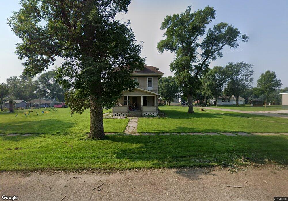
209 W Calumet Ave George, IA 51237
Estimated Value: $81,000 - $152,000
4
Beds
2
Baths
1,728
Sq Ft
$62/Sq Ft
Est. Value
About This Home
This home is located at 209 W Calumet Ave, George, IA 51237 and is currently estimated at $107,816, approximately $62 per square foot. 209 W Calumet Ave is a home located in Lyon County with nearby schools including George-Little Rock Senior High School.
Ownership History
Date
Name
Owned For
Owner Type
Purchase Details
Closed on
Jul 24, 2024
Sold by
Landau Hunter and Teunissen Hunter
Bought by
Perry April
Current Estimated Value
Home Financials for this Owner
Home Financials are based on the most recent Mortgage that was taken out on this home.
Original Mortgage
$63,000
Outstanding Balance
$50,168
Interest Rate
6.87%
Mortgage Type
New Conventional
Estimated Equity
$57,648
Purchase Details
Closed on
Jul 21, 2022
Sold by
Amy Stoner
Bought by
Landau Hunter
Home Financials for this Owner
Home Financials are based on the most recent Mortgage that was taken out on this home.
Original Mortgage
$68,400
Interest Rate
5.81%
Mortgage Type
New Conventional
Create a Home Valuation Report for This Property
The Home Valuation Report is an in-depth analysis detailing your home's value as well as a comparison with similar homes in the area
Home Values in the Area
Average Home Value in this Area
Purchase History
| Date | Buyer | Sale Price | Title Company |
|---|---|---|---|
| Perry April | $73,000 | None Listed On Document | |
| Landau Hunter | $72,000 | None Listed On Document |
Source: Public Records
Mortgage History
| Date | Status | Borrower | Loan Amount |
|---|---|---|---|
| Open | Perry April | $63,000 | |
| Previous Owner | Landau Hunter | $68,400 | |
| Previous Owner | Landau Hunter | $68,400 |
Source: Public Records
Tax History Compared to Growth
Tax History
| Year | Tax Paid | Tax Assessment Tax Assessment Total Assessment is a certain percentage of the fair market value that is determined by local assessors to be the total taxable value of land and additions on the property. | Land | Improvement |
|---|---|---|---|---|
| 2025 | $1,272 | $91,430 | $21,840 | $69,590 |
| 2024 | $1,272 | $74,000 | $21,840 | $52,160 |
| 2023 | $1,012 | $74,000 | $21,840 | $52,160 |
| 2022 | $570 | $44,440 | $21,840 | $22,600 |
| 2020 | -- | $37,960 | $0 | $0 |
| 2019 | -- | $37,960 | $0 | $0 |
| 2018 | -- | $68,900 | $0 | $0 |
| 2017 | -- | $56,890 | $0 | $0 |
| 2016 | -- | $56,890 | $0 | $0 |
| 2015 | -- | $56,439 | $0 | $0 |
| 2014 | -- | $56,439 | $0 | $0 |
Source: Public Records
Map
Nearby Homes
- 308 W Harris Ave
- 103 S Hamilton St
- 501 S Virginia St
- 0 Kennedy Ave
- 601 E Michigan Ave
- 1998 Kennedy Ave
- 0 Kennedy Ave at 230th St
- 3726 250th St
- 4056 290th St
- 2438 Harrison Ave
- 1334 Jackson Ave
- 601 Mill Pond Rd Unit 2
- 601 Mill Pond Rd Unit 1
- 507 Mill Pond Rd
- 603 Mill Pond Rd
- 505 Mill Pond Rd Unit 2
- 505 Mill Pond Rd Unit 1
- 805 Mill Pond Rd
- 803 Mill Pond Rd
- 801 Mill Pond Rd
- 507 S Burroughs St
- 208 W Calumet Ave
- 500 S Sydney St
- 206 W Calumet Ave
- 204 W Calumet Ave
- 504 S Sydney St
- 302 W Harris Ave
- 200 W Calumet Ave
- 506 S Sydney St
- 410 S Burroughs St
- 501 S Sydney St
- 402 S Burroughs St
- 209 W Ohio Ave
- 205 W Ohio Ave
- 305 W Harris Ave
- 207 W Ohio Ave
- 201 W Ohio Ave
- 108 W Calumet Ave
- 505 S Sydney St
- 305 W Ohio Ave