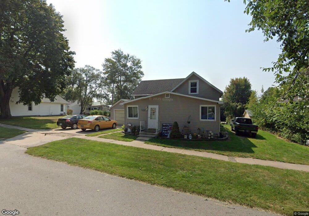
209 W Elm St Lone Tree, IA 52755
Estimated Value: $73,000 - $183,000
3
Beds
2
Baths
944
Sq Ft
$147/Sq Ft
Est. Value
About This Home
This home is located at 209 W Elm St, Lone Tree, IA 52755 and is currently estimated at $138,721, approximately $146 per square foot. 209 W Elm St is a home located in Johnson County with nearby schools including Lone Tree Elementary School and Lone Tree Junior/Senior High School.
Ownership History
Date
Name
Owned For
Owner Type
Purchase Details
Closed on
May 7, 2013
Sold by
Sywassink Kimberly D and Jones Kimberly
Bought by
Kopf Kory
Current Estimated Value
Purchase Details
Closed on
May 12, 2011
Sold by
Diewold Anthony L and Diewold Deborah S
Bought by
Kopf Kory E
Home Financials for this Owner
Home Financials are based on the most recent Mortgage that was taken out on this home.
Original Mortgage
$53,500
Interest Rate
4.91%
Mortgage Type
New Conventional
Purchase Details
Closed on
Aug 15, 2006
Sold by
Huff Patricia L
Bought by
Diewold Anthony L
Home Financials for this Owner
Home Financials are based on the most recent Mortgage that was taken out on this home.
Original Mortgage
$81,331
Interest Rate
6.83%
Mortgage Type
New Conventional
Create a Home Valuation Report for This Property
The Home Valuation Report is an in-depth analysis detailing your home's value as well as a comparison with similar homes in the area
Home Values in the Area
Average Home Value in this Area
Purchase History
| Date | Buyer | Sale Price | Title Company |
|---|---|---|---|
| Kopf Kory | $16,500 | None Available | |
| Kopf Kory E | $83,500 | None Available | |
| Diewold Anthony L | $82,000 | None Available |
Source: Public Records
Mortgage History
| Date | Status | Borrower | Loan Amount |
|---|---|---|---|
| Previous Owner | Kopf Kory E | $53,500 | |
| Previous Owner | Diewold Anthony L | $81,331 |
Source: Public Records
Tax History Compared to Growth
Tax History
| Year | Tax Paid | Tax Assessment Tax Assessment Total Assessment is a certain percentage of the fair market value that is determined by local assessors to be the total taxable value of land and additions on the property. | Land | Improvement |
|---|---|---|---|---|
| 2025 | $1,602 | $117,200 | $34,900 | $82,300 |
| 2024 | $1,556 | $115,900 | $34,900 | $81,000 |
| 2023 | $1,334 | $115,900 | $34,900 | $81,000 |
| 2022 | $1,318 | $84,600 | $27,600 | $57,000 |
| 2021 | $1,380 | $84,600 | $27,600 | $57,000 |
| 2020 | $1,380 | $84,600 | $27,600 | $57,000 |
| 2019 | $1,280 | $84,600 | $27,600 | $57,000 |
| 2018 | $1,258 | $77,100 | $27,600 | $49,500 |
| 2017 | $1,260 | $77,100 | $27,600 | $49,500 |
| 2016 | $1,062 | $72,500 | $27,600 | $44,900 |
| 2015 | $1,062 | $72,500 | $27,600 | $44,900 |
| 2014 | $1,144 | $76,900 | $27,600 | $49,300 |
Source: Public Records
Map
Nearby Homes
- 221 W Commercial St
- 201 N Devoe St
- 500 S Center St
- 407 E Elm St
- 106 Dorothy Ln
- 745 N Perkins St
- 5888 Sand Rd SE
- 25840 Golden Oak Ln Lot 1
- 25838 Golden Oak Ln Lot 7
- 25836 Golden Oak Ln Lot 8
- 25832 Golden Oak Ln Lot 12
- 25736 Golden Pond Ln Se Lot 17
- 25738 Golden Pond Ln Se Lot 16
- 25824 Golden Oak Ln Lot 9
- 1092 Walnut Ave Unit 209
- 1092 Walnut Ave Unit 114 Bld D
- Lot 2 116th Cir
- Lot 39 Walter Mapp Dr
- 2 Commercial Dr
- 1436 Vine Ave