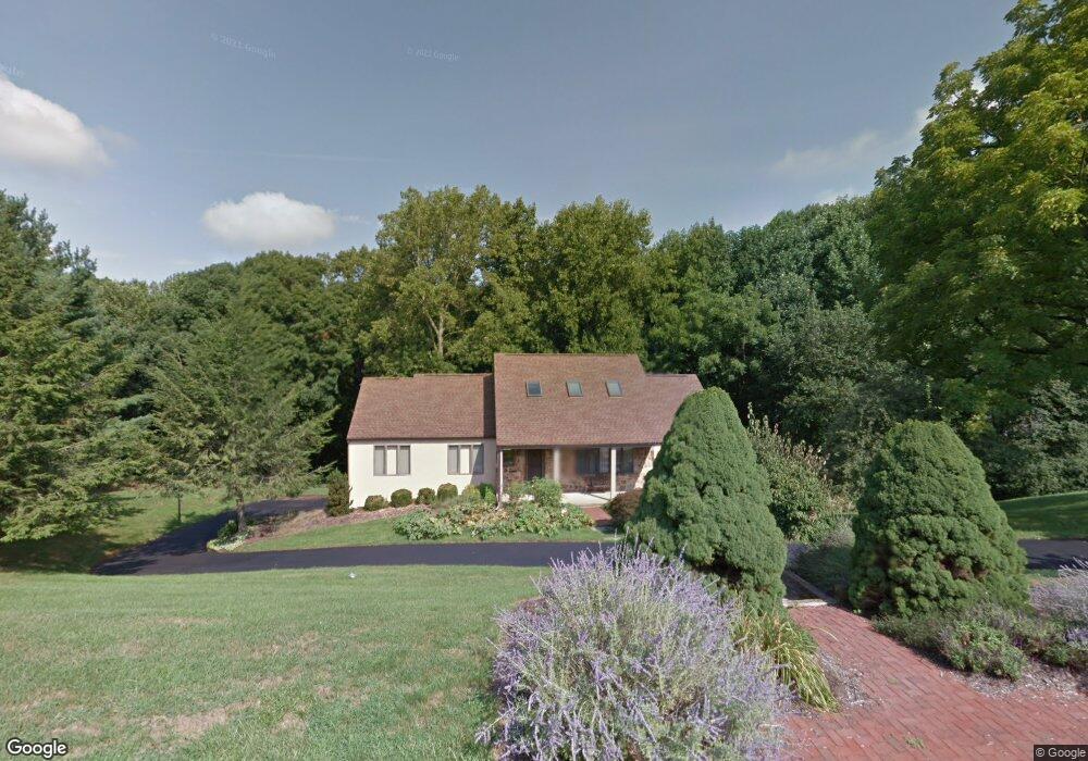
209 Walnut Ridge Rd Chadds Ford, PA 19317
Estimated Value: $401,000 - $806,000
4
Beds
3
Baths
2,505
Sq Ft
$274/Sq Ft
Est. Value
About This Home
This home is located at 209 Walnut Ridge Rd, Chadds Ford, PA 19317 and is currently estimated at $687,005, approximately $274 per square foot. 209 Walnut Ridge Rd is a home located in Delaware County with nearby schools including Chadds Ford Elementary School, Charles F. Patton Middle School, and Unionville High School.
Ownership History
Date
Name
Owned For
Owner Type
Purchase Details
Closed on
Jun 24, 1999
Sold by
Linsen Ellen A and Eschborn Ellen A
Bought by
Smiddy Lynn and Smiddy David
Current Estimated Value
Home Financials for this Owner
Home Financials are based on the most recent Mortgage that was taken out on this home.
Original Mortgage
$150,000
Outstanding Balance
$39,690
Interest Rate
7.09%
Estimated Equity
$647,315
Purchase Details
Closed on
Mar 27, 1995
Sold by
Eschborn Ralph J and Eschborn Ellen A
Bought by
Eschborn Ellen A
Create a Home Valuation Report for This Property
The Home Valuation Report is an in-depth analysis detailing your home's value as well as a comparison with similar homes in the area
Home Values in the Area
Average Home Value in this Area
Purchase History
| Date | Buyer | Sale Price | Title Company |
|---|---|---|---|
| Smiddy Lynn | $300,000 | T A Title Insurance Company | |
| Eschborn Ellen A | -- | -- |
Source: Public Records
Mortgage History
| Date | Status | Borrower | Loan Amount |
|---|---|---|---|
| Open | Smiddy Lynn | $150,000 |
Source: Public Records
Tax History Compared to Growth
Tax History
| Year | Tax Paid | Tax Assessment Tax Assessment Total Assessment is a certain percentage of the fair market value that is determined by local assessors to be the total taxable value of land and additions on the property. | Land | Improvement |
|---|---|---|---|---|
| 2025 | $8,865 | $432,560 | $150,060 | $282,500 |
| 2024 | $8,865 | $432,560 | $150,060 | $282,500 |
| 2023 | $8,466 | $432,560 | $150,060 | $282,500 |
| 2022 | $8,212 | $432,560 | $150,060 | $282,500 |
| 2021 | $12,767 | $432,560 | $150,060 | $282,500 |
| 2020 | $8,950 | $279,220 | $85,040 | $194,180 |
| 2019 | $8,793 | $279,220 | $85,040 | $194,180 |
| 2018 | $8,408 | $279,220 | $0 | $0 |
| 2017 | $8,388 | $279,220 | $0 | $0 |
| 2016 | $1,532 | $279,220 | $0 | $0 |
| 2015 | $1,564 | $279,220 | $0 | $0 |
| 2014 | $1,532 | $279,220 | $0 | $0 |
Source: Public Records
Map
Nearby Homes
- 38 Ringfield Rd
- 80 Heyburn Rd
- 6 Southview Path
- 1392 Baltimore Pike
- 101 Ridings Blvd
- 45 Ridings Way
- 124 Commons Ct Unit 124
- 8 Atwater Rd Unit NT4
- 88 Summit Ave
- 86 Summit Ave
- 410 Painters Crossing Unit 410
- 602 Painters Crossing Unit 3602
- 1602 Painters Crossing Unit 1602
- 815 Painters Crossing Unit 815
- 135 S Buck Tavern Way Unit 11501
- 348 Milton Stamp Dr
- 129 S Buck Tavern Way Unit 11504
- 119 S Buck Tavern Way
- 124 S Buck Tavern Way Unit 10903
- 210 N Buck Tavern Way Unit 10603
- 207 Walnut Ridge Rd
- 211 Walnut Ridge Rd
- 214 Walnut Ridge Rd
- 213 Walnut Ridge Rd
- 205 Walnut Ridge Rd
- 212 Walnut Ridge Rd
- 216 Walnut Ridge Rd
- 100 High Ridge Rd
- 35 Ringfield Rd Unit 2838
- 34 Ringfield Rd Unit 2838
- 280 Ridge Rd
- 350 High Ridge Rd
- 33 Ringfield Rd
- 32 Ringfield Rd
- 352 High Ridge Rd
- 341 High Ridge Rd
- 343 High Ridge Rd
- 339 High Ridge Rd
- 339 Ridge Rd
- 30 Ringfield Rd