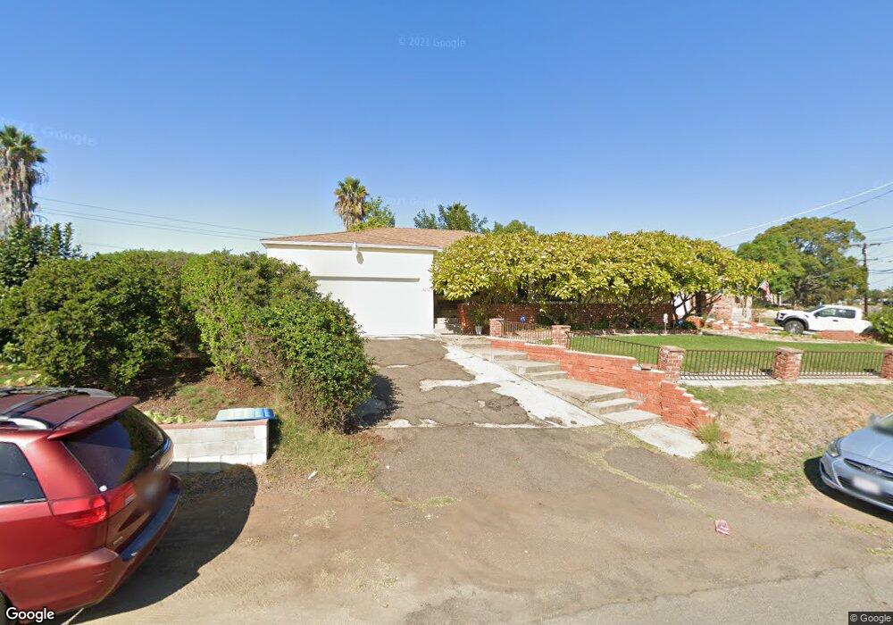
2090 Madera St Lemon Grove, CA 91945
Estimated Value: $719,577 - $764,000
2
Beds
2
Baths
1,285
Sq Ft
$574/Sq Ft
Est. Value
About This Home
This home is located at 2090 Madera St, Lemon Grove, CA 91945 and is currently estimated at $737,394, approximately $573 per square foot. 2090 Madera St is a home located in San Diego County with nearby schools including San Altos Elementary, Mount Miguel High School, and Lighthouse Christian Academy.
Ownership History
Date
Name
Owned For
Owner Type
Purchase Details
Closed on
Mar 6, 2003
Sold by
Servin Jimmy Lee
Bought by
Servin Jimmy Lee
Current Estimated Value
Home Financials for this Owner
Home Financials are based on the most recent Mortgage that was taken out on this home.
Original Mortgage
$178,000
Outstanding Balance
$76,354
Interest Rate
5.85%
Estimated Equity
$661,040
Purchase Details
Closed on
Oct 8, 1993
Sold by
Servin Donna Elizabeth
Bought by
Servin Jimmy Lee
Purchase Details
Closed on
Mar 30, 1989
Create a Home Valuation Report for This Property
The Home Valuation Report is an in-depth analysis detailing your home's value as well as a comparison with similar homes in the area
Home Values in the Area
Average Home Value in this Area
Purchase History
| Date | Buyer | Sale Price | Title Company |
|---|---|---|---|
| Servin Jimmy Lee | -- | Commonwealth Land Title Co | |
| Servin Jimmy Lee | -- | -- | |
| -- | $138,000 | -- |
Source: Public Records
Mortgage History
| Date | Status | Borrower | Loan Amount |
|---|---|---|---|
| Open | Servin Jimmy Lee | $178,000 |
Source: Public Records
Tax History
| Year | Tax Paid | Tax Assessment Tax Assessment Total Assessment is a certain percentage of the fair market value that is determined by local assessors to be the total taxable value of land and additions on the property. | Land | Improvement |
|---|---|---|---|---|
| 2025 | $4,069 | $293,758 | $138,093 | $155,665 |
| 2024 | $4,069 | $287,999 | $135,386 | $152,613 |
| 2023 | $3,970 | $282,353 | $132,732 | $149,621 |
| 2022 | $3,949 | $276,818 | $130,130 | $146,688 |
| 2021 | $3,898 | $271,391 | $127,579 | $143,812 |
| 2020 | $3,850 | $268,609 | $126,271 | $142,338 |
| 2019 | $3,786 | $263,344 | $123,796 | $139,548 |
| 2018 | $3,785 | $258,181 | $121,369 | $136,812 |
| 2017 | $3,727 | $253,120 | $118,990 | $134,130 |
| 2016 | $3,594 | $248,157 | $116,657 | $131,500 |
| 2015 | $3,574 | $244,430 | $114,905 | $129,525 |
| 2014 | $3,439 | $239,643 | $112,655 | $126,988 |
Source: Public Records
Map
Nearby Homes
- 2049 Madera St
- 7083 Berry Park Ln
- 7065 Berry Park Ln
- 2315 Berry St
- 2371-75 Berry St
- 0 Dartmoor Dr Unit 1
- 2523 Pergl St
- 1670 Primera St
- 1905 El Dora St
- 6964 Mount Vernon St
- 2641 Massachusetts Ave
- 1607 Watwood Rd
- 6855 Radio Dr
- 2673 Massachusetts Ave
- 1992 Ensenada St
- 2610 Sheri Ln
- 1511 Primera St
- 7001 Lemonwood Ln
- 1062 Armacost Rd
- 7587 Roosevelt Ave
- 2110 Mcknight Dr
- 2050 Madera St
- 2047 Massachusetts Ave
- 2138 Mcknight Dr
- 2085 Massachusetts Ave
- 2041 Madera St
- 2055 Massachusetts Ave
- 2033 Madera St
- 2168 Mcknight Dr
- 2090 Berryland Ct
- 2070 Berryland Ct
- 2100 Berryland Ct
- 2025 Madera St
- 2042 Madera St
- 2060 Berryland Ct
- 2120 Berryland Ct
- 2172 Mcknight Dr
- 2017 Madera St
- 1946 Primera St
- 1998 Calle Entre
Your Personal Tour Guide
Ask me questions while you tour the home.