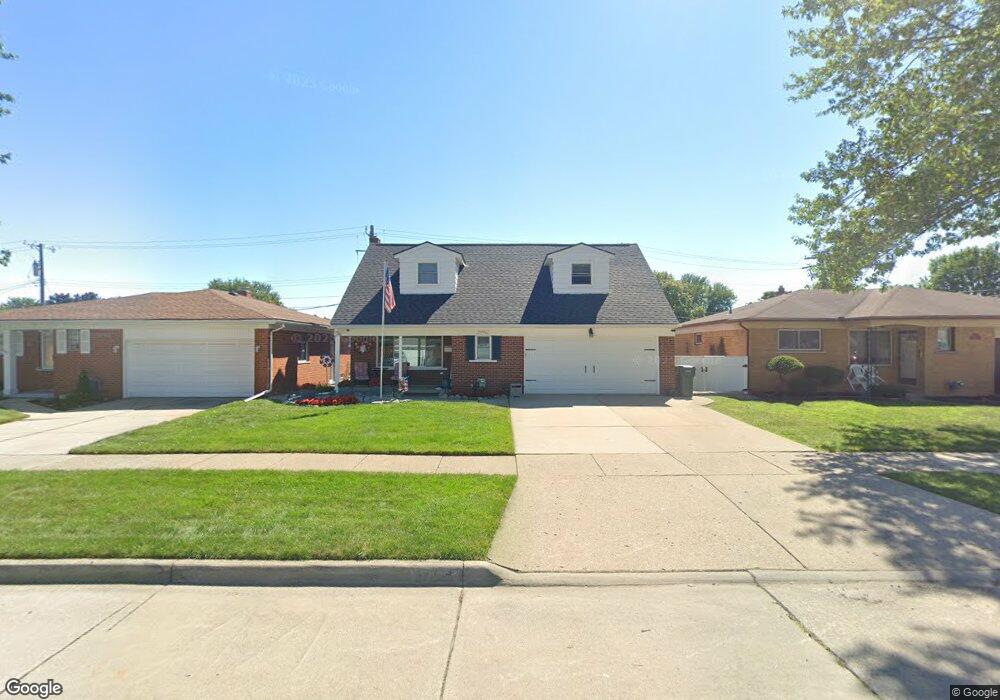
20906 Michael Ct Saint Clair Shores, MI 48081
Estimated Value: $308,470 - $346,000
5
Beds
2
Baths
2,012
Sq Ft
$164/Sq Ft
Est. Value
About This Home
This home is located at 20906 Michael Ct, Saint Clair Shores, MI 48081 and is currently estimated at $330,118, approximately $164 per square foot. 20906 Michael Ct is a home located in Macomb County with nearby schools including Rodgers Elementary School, Kennedy Middle School, and Lake Shore High School.
Ownership History
Date
Name
Owned For
Owner Type
Purchase Details
Closed on
May 15, 2013
Sold by
Phillips Daryl and Phillips Jennifer
Bought by
Phillips Daryl and Phillips Jennifer
Current Estimated Value
Home Financials for this Owner
Home Financials are based on the most recent Mortgage that was taken out on this home.
Original Mortgage
$101,900
Outstanding Balance
$73,584
Interest Rate
3.91%
Mortgage Type
New Conventional
Estimated Equity
$256,534
Purchase Details
Closed on
Sep 28, 2009
Sold by
Rbs Citizens Na
Bought by
Federal National Mortgage Association
Purchase Details
Closed on
Sep 25, 2009
Sold by
Hyek Dennis Martin and Hyek Peggy Marie
Bought by
Rbs Citizens Na and Citizens Bank Na
Create a Home Valuation Report for This Property
The Home Valuation Report is an in-depth analysis detailing your home's value as well as a comparison with similar homes in the area
Home Values in the Area
Average Home Value in this Area
Purchase History
| Date | Buyer | Sale Price | Title Company |
|---|---|---|---|
| Phillips Daryl | -- | Hbi Title Services Inc | |
| Federal National Mortgage Association | -- | None Available | |
| Rbs Citizens Na | $88,487 | None Available |
Source: Public Records
Mortgage History
| Date | Status | Borrower | Loan Amount |
|---|---|---|---|
| Open | Phillips Daryl | $101,900 |
Source: Public Records
Tax History Compared to Growth
Tax History
| Year | Tax Paid | Tax Assessment Tax Assessment Total Assessment is a certain percentage of the fair market value that is determined by local assessors to be the total taxable value of land and additions on the property. | Land | Improvement |
|---|---|---|---|---|
| 2025 | $3,839 | $152,000 | $0 | $0 |
| 2024 | $3,720 | $143,300 | $0 | $0 |
| 2023 | $3,536 | $133,100 | $0 | $0 |
| 2022 | $3,461 | $122,300 | $0 | $0 |
| 2021 | $3,397 | $110,100 | $0 | $0 |
| 2020 | $3,305 | $102,400 | $0 | $0 |
| 2019 | $3,240 | $94,600 | $0 | $0 |
| 2018 | $3,070 | $88,300 | $0 | $0 |
| 2017 | $3,070 | $82,600 | $8,500 | $74,100 |
| 2016 | $2,849 | $82,600 | $0 | $0 |
| 2015 | $2,780 | $75,900 | $0 | $0 |
| 2012 | -- | $61,300 | $8,800 | $52,500 |
Source: Public Records
Map
Nearby Homes
- 20918 Michael Ct
- 28710 Little MacK Ave
- 20924 Saint Gertrude St
- 28930 Little MacK Ave
- 28413 Ruehle St
- 28824 Boston St
- 28316 Little MacK Ave
- 405 Pineview Ct Unit 9
- 21136 E 12 Mile Rd
- 29243 Boston St
- 28113 Shock St
- 28131 Elmdale St
- 28813 Beste St
- 28906 Hughes St
- 29254 Harding St
- 20101 Meier Rd
- 20825 Washington St
- 28004 Joan St
- 28107 Ursuline St
- 19791 Martin Rd Unit 11
- 20912 Michael Ct
- 20900 Michael Ct
- 28624 Kimberly Ln
- 20907 Winkel St
- 20924 Michael Ct
- 28618 Kimberly Ln
- 20913 Michael Ct
- 20901 Michael Ct
- 20919 Michael Ct
- 20913 Winkel St
- 28631 Kimberly Ln
- 28639 Kimberly Ln
- 28645 Kimberly Ln
- 20930 Michael Ct
- 20925 Michael Ct
- 28625 Kimberly Ln
- 28649 Kimberly Ln
- 28655 Kimberly Ln
- 28619 Kimberly Ln
- 20931 Michael Ct