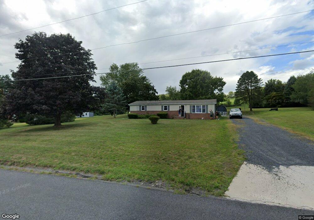
2091 Airport Rd Elysburg, PA 17824
Estimated Value: $105,000 - $191,000
--
Bed
--
Bath
--
Sq Ft
1.02
Acres
About This Home
This home is located at 2091 Airport Rd, Elysburg, PA 17824 and is currently estimated at $138,190. 2091 Airport Rd is a home located in Northumberland County with nearby schools including Hartman Elementary Center, Southern Columbia Middle School, and Southern Columbia High School.
Ownership History
Date
Name
Owned For
Owner Type
Purchase Details
Closed on
Jan 18, 2012
Sold by
Simeone John R and Simeone Karen L
Bought by
Balsama Barbara A
Current Estimated Value
Home Financials for this Owner
Home Financials are based on the most recent Mortgage that was taken out on this home.
Original Mortgage
$37,446
Outstanding Balance
$28,008
Interest Rate
6%
Mortgage Type
Adjustable Rate Mortgage/ARM
Estimated Equity
$110,182
Purchase Details
Closed on
Aug 22, 2008
Sold by
Lubinski Deneen M
Bought by
Simeone John R and Simeone Karen L
Home Financials for this Owner
Home Financials are based on the most recent Mortgage that was taken out on this home.
Original Mortgage
$33,000
Interest Rate
7.5%
Mortgage Type
Assumption
Purchase Details
Closed on
Apr 29, 2005
Sold by
Higgins John J and Higgins Norma M
Bought by
Lubinski Deneen M
Home Financials for this Owner
Home Financials are based on the most recent Mortgage that was taken out on this home.
Original Mortgage
$28,000
Interest Rate
5.94%
Mortgage Type
New Conventional
Create a Home Valuation Report for This Property
The Home Valuation Report is an in-depth analysis detailing your home's value as well as a comparison with similar homes in the area
Home Values in the Area
Average Home Value in this Area
Purchase History
| Date | Buyer | Sale Price | Title Company |
|---|---|---|---|
| Balsama Barbara A | $46,808 | None Available | |
| Simeone John R | $30,609 | None Available | |
| Lubinski Deneen M | $52,500 | None Available |
Source: Public Records
Mortgage History
| Date | Status | Borrower | Loan Amount |
|---|---|---|---|
| Open | Balsama Barbara A | $37,446 | |
| Previous Owner | Simeone John R | $33,000 | |
| Previous Owner | Lubinski Deneen M | $28,000 |
Source: Public Records
Tax History Compared to Growth
Tax History
| Year | Tax Paid | Tax Assessment Tax Assessment Total Assessment is a certain percentage of the fair market value that is determined by local assessors to be the total taxable value of land and additions on the property. | Land | Improvement |
|---|---|---|---|---|
| 2025 | $1,122 | $9,500 | $3,040 | $6,460 |
| 2024 | $1,036 | $9,500 | $3,040 | $6,460 |
| 2023 | $1,036 | $9,500 | $3,040 | $6,460 |
| 2022 | $1,038 | $9,500 | $3,040 | $6,460 |
| 2021 | $1,015 | $9,500 | $3,040 | $6,460 |
| 2020 | $990 | $9,500 | $3,040 | $6,460 |
| 2019 | $965 | $9,500 | $3,040 | $6,460 |
| 2018 | $930 | $9,500 | $3,040 | $6,460 |
| 2017 | $858 | $9,500 | $3,040 | $6,460 |
| 2016 | -- | $9,500 | $3,040 | $6,460 |
| 2015 | -- | $9,500 | $3,040 | $6,460 |
| 2014 | -- | $9,500 | $3,040 | $6,460 |
Source: Public Records
Map
Nearby Homes
- 186 Fallen Pines
- 78 Ridge Acres Rd
- 385 Hemlock Ln
- 344 Hemlock Ln
- 151 Hillside Ave
- 151 Birchwyn Dr
- 261 Hillside Ave
- 189 Hemlock Ln
- LOT# 5 Hemlock Ln
- 0 Heartland Blvd Unit WB-101932
- LOT 8 Mountain Rd
- 0 W Valley Ave
- 22 Wood Ave
- 404 W Center St
- 45 5th Ave
- 534 W Center St
- 0 2nd Ave
- 39 Circle View Dr
- 41 Circle View Dr
- LOT 13 Oak Grove Rd
- 2077 Airport Rd
- 2098 Airport Rd
- 2078 Airport Rd
- 2103 Airport Rd
- 2104 Airport Rd
- 2127 Airport Rd
- 2053 Airport Rd
- 2070 Airport Rd
- 2135 Airport Rd
- 2039 Airport Rd
- 2038 Airport Rd
- 2038 Airport Rd
- 111 All Saints Rd
- 139 All Saints Rd
- 1986 Airport Rd
- 1986 Airport Rd
- 157 All Saints Rd
- 197 All Saints Rd
- 3324 State Route 54
- 3346 State Route 54