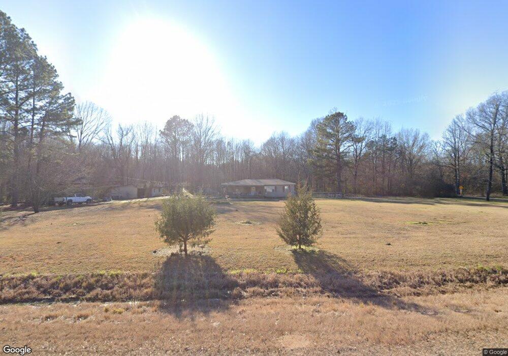
2091 Highway 43 N Pelahatchie, MS 39145
Estimated Value: $120,000 - $191,000
3
Beds
3
Baths
1,284
Sq Ft
$117/Sq Ft
Est. Value
About This Home
This home is located at 2091 Highway 43 N, Pelahatchie, MS 39145 and is currently estimated at $150,704, approximately $117 per square foot. 2091 Highway 43 N is a home with nearby schools including Pisgah Elementary School and Pisgah High School.
Ownership History
Date
Name
Owned For
Owner Type
Purchase Details
Closed on
Jun 8, 2016
Bought by
Bates Christopher and Bates Rhonda
Current Estimated Value
Home Financials for this Owner
Home Financials are based on the most recent Mortgage that was taken out on this home.
Original Mortgage
$74,000
Outstanding Balance
$59,068
Interest Rate
3.66%
Estimated Equity
$91,636
Purchase Details
Closed on
May 27, 2016
Sold by
Gilmore Leslie Scott and Gilmore Rhonda D
Bought by
Bates Rhonda K and Bates Christopher A
Home Financials for this Owner
Home Financials are based on the most recent Mortgage that was taken out on this home.
Original Mortgage
$74,000
Outstanding Balance
$59,068
Interest Rate
3.66%
Estimated Equity
$91,636
Create a Home Valuation Report for This Property
The Home Valuation Report is an in-depth analysis detailing your home's value as well as a comparison with similar homes in the area
Home Values in the Area
Average Home Value in this Area
Purchase History
| Date | Buyer | Sale Price | Title Company |
|---|---|---|---|
| Bates Christopher | -- | -- | |
| Bates Rhonda K | -- | Attorney |
Source: Public Records
Mortgage History
| Date | Status | Borrower | Loan Amount |
|---|---|---|---|
| Open | Bates Christopher | $74,000 | |
| Closed | Bates Christopher | -- | |
| Closed | Bates Rhonda K | $74,400 |
Source: Public Records
Tax History Compared to Growth
Tax History
| Year | Tax Paid | Tax Assessment Tax Assessment Total Assessment is a certain percentage of the fair market value that is determined by local assessors to be the total taxable value of land and additions on the property. | Land | Improvement |
|---|---|---|---|---|
| 2024 | $390 | $6,691 | $0 | $0 |
| 2023 | $303 | $5,194 | $0 | $0 |
| 2022 | $295 | $5,194 | $0 | $0 |
| 2021 | $283 | $4,944 | $0 | $0 |
| 2020 | $283 | $4,944 | $0 | $0 |
| 2019 | $258 | $4,383 | $0 | $0 |
| 2018 | $249 | $4,383 | $0 | $0 |
| 2017 | $249 | $4,383 | $0 | $0 |
| 2016 | $244 | $4,626 | $0 | $0 |
| 2015 | $244 | $4,626 | $0 | $0 |
| 2014 | $234 | $4,626 | $0 | $0 |
| 2013 | -- | $4,626 | $0 | $0 |
Source: Public Records
Map
Nearby Homes
- 0 Holly Bush Rd Unit 4096435
- 170 Harrell Rd
- 337 J C Prestage Rd
- 2162 Leesburg Rd
- 1603 Holly Bush Rd
- 0 Mink Branch Rd
- 3131 Mississippi 43
- 0 Parker Rd
- 0 Munn Rd Unit 4124825
- 00 Stump Ridge Rd
- Lot 7 Stump Ridge Rd
- 1188 Stump Ridge Rd
- 0 Lewis Prestage Rd
- 742 Freedom Ridge Ln
- 0 Taylor Way Unit 4124949
- 0 Taylor Way Unit 4124946
- 753 Freedom Ridge Ln
- 737 Freedom Ridge Ln
- 733 Freedom Ridge Ln
- 1204 Patriotic Cir
- 2079 Highway 43 N
- 0 Highway 43 N Unit 286898
- 2067 Highway 43 N
- 2117 Highway 43 N
- 2187 Highway 43 N
- 119 Shedd Ln
- 125 Shedd Ln
- 2046 Highway 43 N
- 2046 Mississippi 43
- 2128 Highway 43 N
- 174 Mckay Place
- 2140 Highway 43 N
- 2141 Highway 43 N
- 135 Shedd Ln
- 174 Mckays Place
- 142 Mckay Cir
- 180 Mckay Place
- 180 Mckay Cir
- 133 Mckay Cir
- 2155 Highway 43 N