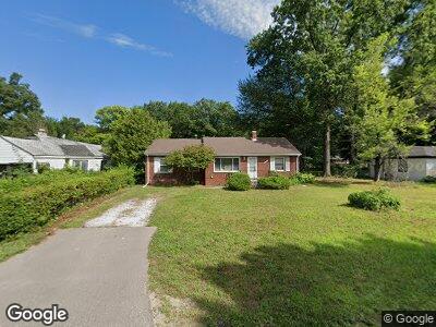
20920 Westhampton Ave Unit Bldg-Unit Southfield, MI 48075
Estimated Value: $162,000 - $182,000
--
Bed
2
Baths
1,470
Sq Ft
$116/Sq Ft
Est. Value
About This Home
This home is located at 20920 Westhampton Ave Unit Bldg-Unit, Southfield, MI 48075 and is currently estimated at $171,131, approximately $116 per square foot. 20920 Westhampton Ave Unit Bldg-Unit is a home located in Oakland County with nearby schools including Madison-Carver Academy, Agbu Alex-Marie Manoogian School, and Corpus Christi.
Ownership History
Date
Name
Owned For
Owner Type
Purchase Details
Closed on
Jun 22, 2016
Sold by
Desert Income Digmi Llc
Bought by
Shulimill Llc
Current Estimated Value
Purchase Details
Closed on
Jun 3, 2016
Sold by
Nl Investments Llc
Bought by
Desert Income Digmi Llc
Purchase Details
Closed on
May 29, 2014
Sold by
Bellulo 3 Llc
Bought by
Nl Investments Llc
Purchase Details
Closed on
Apr 10, 2014
Sold by
The Bank Of New York Mellon
Bought by
Bellulo 3 Llc
Purchase Details
Closed on
Mar 26, 2013
Sold by
Clark Robert and Clark Thelma
Bought by
The Bank Of New York Mellon and The Bank Of New York
Create a Home Valuation Report for This Property
The Home Valuation Report is an in-depth analysis detailing your home's value as well as a comparison with similar homes in the area
Home Values in the Area
Average Home Value in this Area
Purchase History
| Date | Buyer | Sale Price | Title Company |
|---|---|---|---|
| Shulimill Llc | $67,890 | Liberty Title | |
| Desert Income Digmi Llc | $50,000 | None Available | |
| Nl Investments Llc | -- | None Available | |
| Bellulo 3 Llc | $23,400 | Servicelink Llc | |
| The Bank Of New York Mellon | $143,776 | None Available |
Source: Public Records
Tax History Compared to Growth
Tax History
| Year | Tax Paid | Tax Assessment Tax Assessment Total Assessment is a certain percentage of the fair market value that is determined by local assessors to be the total taxable value of land and additions on the property. | Land | Improvement |
|---|---|---|---|---|
| 2022 | $3,729 | $59,090 | $7,880 | $51,210 |
| 2021 | $4,389 | $55,650 | $7,880 | $47,770 |
| 2020 | $3,355 | $47,240 | $7,880 | $39,360 |
| 2018 | $2,399 | $35,790 | $7,880 | $27,910 |
| 2015 | -- | $28,300 | $0 | $0 |
| 2014 | -- | $26,150 | $0 | $0 |
| 2011 | -- | $32,110 | $0 | $0 |
Source: Public Records
Map
Nearby Homes
- 20711 Westhaven Ave
- 20746 Westland Dr
- 20427 Westland Dr Unit 4
- 20566 Patton St
- 20533 Braile St
- 20568 Trinity St
- 20511 Pierson St
- 20581 Kentfield St
- 20521 Stout St
- 20550 Blackstone Ct
- 20240 Burt Rd
- 20240 Patton St
- 21105 Midway Ave
- 20120 Braile St
- 20450 Midway Ave
- 21311 Evergreen Rd
- 21246 8 1 2 Mile Rd
- 20980 Evergreen Rd
- 21128 Evergreen Rd
- 20110 Westbrook St
- 20920 Westhampton Ave Unit Bldg-Unit
- 20920 Westhampton Ave
- 20930 Westhampton Ave
- 20820 Westhampton Ave
- 20950 Westhampton Ave
- 20710 Westhampton Ave
- 20851 Westhampton Ave
- 20915 Westhampton Ave
- 20925 Westhampton Ave
- 20715 Westhampton Ave
- 20908 Westover Ave
- 20935 Westhampton Ave
- 20704 Westhampton Ave
- 20945 Westhampton Ave
- 20910 Westover Ave
- 20955 Westhampton Ave
- 20726 Westover Ave
- 21001 Westover Ave
- 20940 Westover Ave
- 20705 Westhampton Ave