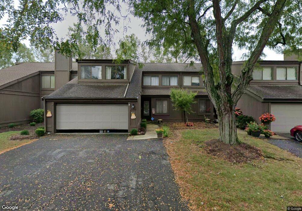
2093 Brookhurst Ave Unit 38B Columbus, OH 43229
Northgate NeighborhoodEstimated Value: $274,000 - $298,000
4
Beds
4
Baths
2,455
Sq Ft
$115/Sq Ft
Est. Value
About This Home
This home is located at 2093 Brookhurst Ave Unit 38B, Columbus, OH 43229 and is currently estimated at $283,495, approximately $115 per square foot. 2093 Brookhurst Ave Unit 38B is a home located in Franklin County with nearby schools including Northgate Intermediate, Alpine Elementary School, and Woodward Park Middle School.
Ownership History
Date
Name
Owned For
Owner Type
Purchase Details
Closed on
May 17, 2006
Sold by
Anderson Michael P and Anderson Dawn R
Bought by
Zand Caron
Current Estimated Value
Purchase Details
Closed on
Sep 11, 2001
Sold by
Anderson Michael P
Bought by
Anderson Michael P and Anderson Dawn R
Home Financials for this Owner
Home Financials are based on the most recent Mortgage that was taken out on this home.
Original Mortgage
$142,300
Interest Rate
6.55%
Mortgage Type
Purchase Money Mortgage
Purchase Details
Closed on
Oct 3, 1997
Sold by
Richert Holly E and Jones Herbert M
Bought by
Anderson Michael P
Home Financials for this Owner
Home Financials are based on the most recent Mortgage that was taken out on this home.
Original Mortgage
$138,975
Interest Rate
10.2%
Purchase Details
Closed on
Jun 20, 1989
Purchase Details
Closed on
Jul 1, 1978
Create a Home Valuation Report for This Property
The Home Valuation Report is an in-depth analysis detailing your home's value as well as a comparison with similar homes in the area
Home Values in the Area
Average Home Value in this Area
Purchase History
| Date | Buyer | Sale Price | Title Company |
|---|---|---|---|
| Zand Caron | $164,000 | Lawyers Tit | |
| Anderson Michael P | -- | Chicago Title | |
| Anderson Michael P | $163,500 | Celtic Title Agency Inc | |
| -- | $115,000 | -- | |
| -- | $91,500 | -- |
Source: Public Records
Mortgage History
| Date | Status | Borrower | Loan Amount |
|---|---|---|---|
| Previous Owner | Anderson Michael P | $142,300 | |
| Previous Owner | Anderson Michael P | $138,975 |
Source: Public Records
Tax History Compared to Growth
Tax History
| Year | Tax Paid | Tax Assessment Tax Assessment Total Assessment is a certain percentage of the fair market value that is determined by local assessors to be the total taxable value of land and additions on the property. | Land | Improvement |
|---|---|---|---|---|
| 2024 | $3,282 | $82,920 | $16,100 | $66,820 |
| 2023 | $3,268 | $82,915 | $16,100 | $66,815 |
| 2022 | $2,625 | $59,370 | $7,110 | $52,260 |
| 2021 | $2,630 | $59,370 | $7,110 | $52,260 |
| 2020 | $2,633 | $59,370 | $7,110 | $52,260 |
| 2019 | $2,136 | $43,960 | $5,250 | $38,710 |
| 2018 | $2,339 | $43,960 | $5,250 | $38,710 |
| 2017 | $2,067 | $43,960 | $5,250 | $38,710 |
| 2016 | $2,805 | $42,350 | $6,020 | $36,330 |
| 2015 | $2,547 | $42,350 | $6,020 | $36,330 |
| 2014 | $2,553 | $42,350 | $6,020 | $36,330 |
| 2013 | $1,326 | $44,590 | $6,335 | $38,255 |
Source: Public Records
Map
Nearby Homes
- 2120 Willowick Dr Unit B
- 6658 Walbridge St
- 6448 Sharon Woods Blvd Unit B
- 1947 Rockdale Dr Unit 33
- 6496 Hearthstone Ave
- 6355 Johnanne St
- 2197 Bayfield Dr
- 6407 Skywae Dr
- 6245 Sharon Woods Blvd
- 1635 Tendril Ct
- 2292 Laurelwood Dr Unit 2292L
- 6048 Pinemoor St
- 6342 Bellmeadow Dr
- 6458 Faircrest Rd
- 6407 Faircrest Rd
- 2250 Webster Canyon Ct
- 2721 Woodland Trail Dr Unit 2721
- 1421 Bosworth Place
- 2727 Patrick Ave
- 1409 Bosworth Place
- 2091 Brookhurst Ave Unit 38C
- 2095 Brookhurst Ave Unit 38A
- 2089 Brookhurst Ave
- 2099 Brookhurst Ave
- 2101 Brookhurst Ave
- 2101 Brookhurst Ave Unit C
- 2090 Brookhurst Ave
- 2092 Brookhurst Ave Unit 45B
- 2103 Brookhurst Ave Unit B39
- 2094 Brookhurst Ave
- 2094 Brookhurst Ave Unit C
- 2083 Brookhurst Ave
- 2081 Brookhurst Ave Unit 37C
- 2081 Brookhurst Ave Unit C
- 2096 Brookhurst Ave Unit D
- 2105 Brookhurst Ave Unit 39A
- 2079 Brookhurst Ave Unit 37D
- 2079 Brookhurst Ave Unit D
- 2075 Brookhurst Ave