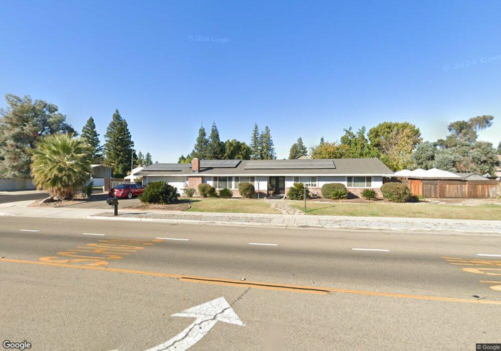
2093 Gettysburg Ave Clovis, CA 93611
Estimated Value: $523,000 - $562,425
4
Beds
2
Baths
2,172
Sq Ft
$247/Sq Ft
Est. Value
About This Home
This home is located at 2093 Gettysburg Ave, Clovis, CA 93611 and is currently estimated at $536,808, approximately $247 per square foot. 2093 Gettysburg Ave is a home located in Fresno County with nearby schools including Gettysburg Elementary School, Reyburn Intermediate School, and Clovis East High School.
Ownership History
Date
Name
Owned For
Owner Type
Purchase Details
Closed on
Oct 6, 2023
Sold by
Hotlen Elizabeth Kay
Bought by
Hulbert Sandra K
Current Estimated Value
Purchase Details
Closed on
Mar 9, 2023
Sold by
Hulbert Sandra K
Bought by
Hulbert Sandra K and Hotlen Elizabeth Kay
Purchase Details
Closed on
Sep 15, 2022
Sold by
Hulbert John F
Bought by
John F Hulbert Revocable Trust
Purchase Details
Closed on
Oct 1, 2010
Sold by
Apex Real Estate & Development Inc
Bought by
Hulbert John F and Hulbert Sandra K
Home Financials for this Owner
Home Financials are based on the most recent Mortgage that was taken out on this home.
Original Mortgage
$251,289
Interest Rate
4.33%
Mortgage Type
VA
Purchase Details
Closed on
Mar 31, 2010
Sold by
The Bank Of New York Mellon
Bought by
Apex Real Estate & Development Inc
Purchase Details
Closed on
Oct 29, 2009
Sold by
Baker Robert
Bought by
The Bank Of New York Mellon
Purchase Details
Closed on
May 23, 2007
Sold by
Baker Hayley
Bought by
Baker Robert
Home Financials for this Owner
Home Financials are based on the most recent Mortgage that was taken out on this home.
Original Mortgage
$220,000
Interest Rate
6.62%
Mortgage Type
Purchase Money Mortgage
Purchase Details
Closed on
May 22, 2007
Sold by
Baker Robert
Bought by
Baker Robert
Home Financials for this Owner
Home Financials are based on the most recent Mortgage that was taken out on this home.
Original Mortgage
$220,000
Interest Rate
6.62%
Mortgage Type
Purchase Money Mortgage
Purchase Details
Closed on
May 2, 2005
Sold by
Salmon Martha Jean
Bought by
Baker Robert
Home Financials for this Owner
Home Financials are based on the most recent Mortgage that was taken out on this home.
Original Mortgage
$190,000
Interest Rate
6.71%
Mortgage Type
Purchase Money Mortgage
Purchase Details
Closed on
May 13, 1997
Sold by
Morse John B
Bought by
Salmon William Odell and Salmon Martha Jean
Create a Home Valuation Report for This Property
The Home Valuation Report is an in-depth analysis detailing your home's value as well as a comparison with similar homes in the area
Home Values in the Area
Average Home Value in this Area
Purchase History
| Date | Buyer | Sale Price | Title Company |
|---|---|---|---|
| Hulbert Sandra K | -- | None Listed On Document | |
| Hulbert Sandra K | -- | -- | |
| John F Hulbert Revocable Trust | -- | -- | |
| Hulbert John F | $254,000 | Placer Title Company | |
| Apex Real Estate & Development Inc | $144,000 | Landsafe Title | |
| The Bank Of New York Mellon | $167,832 | Landsafe Title | |
| Baker Robert | -- | First American Title Company | |
| Baker Robert | -- | First American Title Company | |
| Baker Robert | $350,000 | First American Title Co La | |
| Salmon William Odell | $142,500 | Chicago Title Co |
Source: Public Records
Mortgage History
| Date | Status | Borrower | Loan Amount |
|---|---|---|---|
| Previous Owner | Hulbert John F | $251,289 | |
| Previous Owner | Baker Robert | $220,000 | |
| Previous Owner | Baker Robert | $220,000 | |
| Previous Owner | Baker Robert | $190,000 |
Source: Public Records
Tax History
| Year | Tax Paid | Tax Assessment Tax Assessment Total Assessment is a certain percentage of the fair market value that is determined by local assessors to be the total taxable value of land and additions on the property. | Land | Improvement |
|---|---|---|---|---|
| 2025 | $3,763 | $325,406 | $81,990 | $243,416 |
| 2023 | $3,617 | $312,772 | $78,807 | $233,965 |
| 2022 | $3,568 | $306,640 | $77,262 | $229,378 |
| 2021 | $3,466 | $300,629 | $75,748 | $224,881 |
| 2020 | $3,452 | $297,548 | $74,972 | $222,576 |
| 2019 | $3,383 | $291,714 | $73,502 | $218,212 |
| 2018 | $3,308 | $285,995 | $72,061 | $213,934 |
| 2017 | $3,250 | $280,389 | $70,649 | $209,740 |
| 2016 | $3,138 | $274,892 | $69,264 | $205,628 |
| 2015 | $3,089 | $270,764 | $68,224 | $202,540 |
| 2014 | $3,031 | $265,461 | $66,888 | $198,573 |
Source: Public Records
Map
Nearby Homes
- 2468 Laverne Ave
- 2645 Fowler Ave
- 3060 Evergreen Ave
- 3074 Burgan Ave
- 1707 Gettysburg Ave
- 2612 Renn Ave
- 1715 Donner Ave
- 1721 Holland Ave
- 3497 Shaw Ave
- 1608 Gettysburg Ave
- 2627 Stanford Ave
- 2853 Carolina Ave
- 1555 Pico Ave
- 3099 Ezie Ave
- 2306 Stanford Ave
- 3110 Ezie Ave
- 2506 Swift Ave
- 2614 Indianapolis Ave
- 2214 Fordham Ave
- 1488 Alamos Ave
- 2679 Burl Ave
- 2113 Gettysburg Ave
- 2682 Cypress Ave
- 2659 Burl Ave
- 2678 Burl Ave
- 2662 Cypress Ave
- 2658 Burl Ave
- 2639 Burl Ave
- 2642 Cypress Ave
- 2638 Burl Ave
- 2043 Gettysburg Ave
- 2685 Cypress Ave
- 2619 Burl Ave
- 2665 Cypress Ave
- 2622 Cypress Ave
- 2618 Burl Ave
- 2034 Rialto Ave
- 2645 Cypress Ave
- 2024 Rialto Ave
- 2607 Burl Ave
Your Personal Tour Guide
Ask me questions while you tour the home.