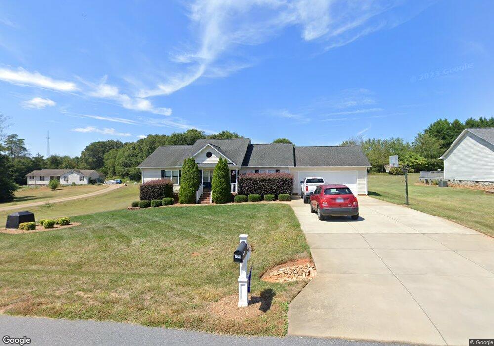
2093 Oklahoma Ct Lincolnton, NC 28092
Estimated Value: $280,000 - $388,000
3
Beds
2
Baths
1,377
Sq Ft
$243/Sq Ft
Est. Value
About This Home
This home is located at 2093 Oklahoma Ct, Lincolnton, NC 28092 and is currently estimated at $334,000, approximately $242 per square foot. 2093 Oklahoma Ct is a home located in Lincoln County with nearby schools including Norris S. Childers Elementary School, West Lincoln Middle, and West Lincoln High School.
Ownership History
Date
Name
Owned For
Owner Type
Purchase Details
Closed on
Mar 23, 2012
Sold by
Wells Fargo Bank Na
Bought by
Secretary Of Housing & Urban Development
Current Estimated Value
Purchase Details
Closed on
Feb 23, 2012
Sold by
Dellinger Kelly M
Bought by
Wells Fargo Bank Na
Purchase Details
Closed on
Apr 8, 2005
Sold by
Gold Roger Dale and Gold Kristine D
Bought by
Mcfarlin Titus
Purchase Details
Closed on
Oct 6, 1999
Bought by
Gold Roger Dale and Gold Kristine D
Create a Home Valuation Report for This Property
The Home Valuation Report is an in-depth analysis detailing your home's value as well as a comparison with similar homes in the area
Home Values in the Area
Average Home Value in this Area
Purchase History
| Date | Buyer | Sale Price | Title Company |
|---|---|---|---|
| Secretary Of Housing & Urban Development | -- | None Available | |
| Wells Fargo Bank Na | $108,000 | None Available | |
| Mcfarlin Titus | $12,000 | None Available | |
| Gold Roger Dale | $9,000 | -- |
Source: Public Records
Tax History Compared to Growth
Tax History
| Year | Tax Paid | Tax Assessment Tax Assessment Total Assessment is a certain percentage of the fair market value that is determined by local assessors to be the total taxable value of land and additions on the property. | Land | Improvement |
|---|---|---|---|---|
| 2025 | $1,891 | $280,614 | $33,000 | $247,614 |
| 2024 | $1,871 | $280,614 | $33,000 | $247,614 |
| 2023 | $1,866 | $280,614 | $33,000 | $247,614 |
| 2022 | $1,314 | $161,210 | $22,000 | $139,210 |
| 2021 | $1,314 | $161,210 | $22,000 | $139,210 |
| 2020 | $1,167 | $161,210 | $22,000 | $139,210 |
| 2019 | $1,167 | $161,210 | $22,000 | $139,210 |
| 2018 | $1,152 | $142,749 | $20,000 | $122,749 |
| 2017 | $1,051 | $142,749 | $20,000 | $122,749 |
| 2016 | $1,001 | $142,749 | $20,000 | $122,749 |
| 2015 | $1,067 | $142,749 | $20,000 | $122,749 |
| 2014 | $1,000 | $136,264 | $20,000 | $116,264 |
Source: Public Records
Map
Nearby Homes
- 2064 Colorado Ct
- 2614 Reepsville Rd
- 1712 Cline Farm Rd
- 2238 Mintew Cir
- 2156 River Rd
- 1939 River Rd
- 2508 Rock Dam Rd
- 0 Hillard Ln
- 1865 Rockdam Creek Ct
- 3817 Spike Ln
- 000 Flag Ln Unit 53
- 00 Pleasant Grove Church Rd
- 1643 Flag Ln
- #168 Rolling Rd
- 146 Gallup Ln
- 000 Better Brook Ln
- 1231 Better Brook Ln
- 536 Lincolnview Rd
- 701 Hallman Branch Ln
- 700 Hallman Branch Ln
- 2107 Oklahoma Ct
- 2117 Oklahoma Ct
- 1836 Tennessee Ct
- 2096 Oklahoma Ct
- 2081 Oklahoma Ct
- 2110 Oklahoma Ct
- 2084 Oklahoma Ct
- 2131 Oklahoma Ct
- 1835 Tennessee Ct
- 1844 Tennessee Ct
- 2120 Oklahoma Ct
- 1845 Tennessee Ct
- 2142 Oklahoma Ct
- 1854 Tennessee Ct
- 2074 Oklahoma Ct
- 2147 Oklahoma Ct
- 1855 Tennessee Ct
- 2154 Oklahoma Ct
- 2163 Oklahoma Ct
- 1834 Appalachian Ct