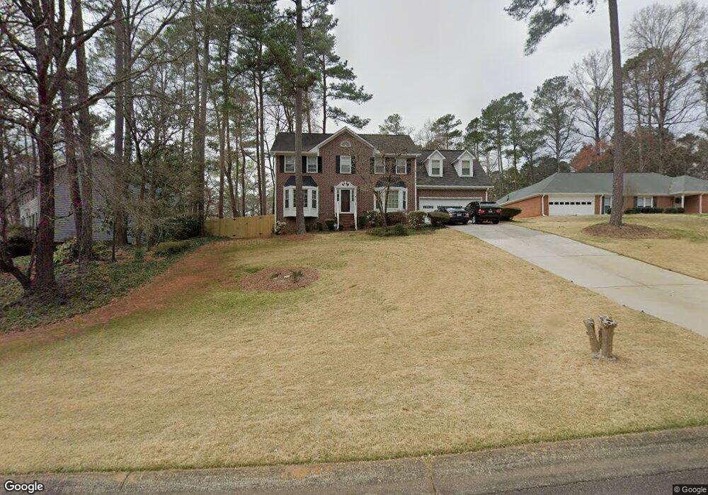
2094 Arrington Ct SW Unit 1 Marietta, GA 30064
West Cobb NeighborhoodEstimated Value: $465,157 - $520,000
4
Beds
3
Baths
2,286
Sq Ft
$214/Sq Ft
Est. Value
About This Home
This home is located at 2094 Arrington Ct SW Unit 1, Marietta, GA 30064 and is currently estimated at $489,289, approximately $214 per square foot. 2094 Arrington Ct SW Unit 1 is a home located in Cobb County with nearby schools including Cheatham Hill Elementary School, Lovinggood Middle School, and Hillgrove High School.
Ownership History
Date
Name
Owned For
Owner Type
Purchase Details
Closed on
Sep 20, 1994
Sold by
Bogus Paul I Ilene P
Bought by
Taylor Arrick W Karen H
Current Estimated Value
Home Financials for this Owner
Home Financials are based on the most recent Mortgage that was taken out on this home.
Original Mortgage
$130,900
Interest Rate
6.87%
Create a Home Valuation Report for This Property
The Home Valuation Report is an in-depth analysis detailing your home's value as well as a comparison with similar homes in the area
Home Values in the Area
Average Home Value in this Area
Purchase History
| Date | Buyer | Sale Price | Title Company |
|---|---|---|---|
| Taylor Arrick W Karen H | $139,900 | -- |
Source: Public Records
Mortgage History
| Date | Status | Borrower | Loan Amount |
|---|---|---|---|
| Closed | Taylor Arrick W Karen H | $130,900 |
Source: Public Records
Tax History Compared to Growth
Tax History
| Year | Tax Paid | Tax Assessment Tax Assessment Total Assessment is a certain percentage of the fair market value that is determined by local assessors to be the total taxable value of land and additions on the property. | Land | Improvement |
|---|---|---|---|---|
| 2025 | $1,030 | $171,848 | $40,000 | $131,848 |
| 2024 | $1,009 | $163,872 | $16,000 | $147,872 |
| 2023 | $803 | $163,872 | $16,000 | $147,872 |
| 2022 | $918 | $133,196 | $16,000 | $117,196 |
| 2021 | $869 | $116,920 | $16,000 | $100,920 |
| 2020 | $848 | $109,892 | $16,000 | $93,892 |
| 2019 | $851 | $110,784 | $16,000 | $94,784 |
| 2018 | $800 | $93,996 | $16,000 | $77,996 |
| 2017 | $705 | $93,996 | $16,000 | $77,996 |
| 2016 | $643 | $73,424 | $16,000 | $57,424 |
| 2015 | $690 | $73,424 | $16,000 | $57,424 |
| 2014 | $705 | $73,232 | $0 | $0 |
Source: Public Records
Map
Nearby Homes
- 2093 Breconridge Dr SW
- 1505 Old John Ward Rd SW
- 1646 Desford Ct SW
- 1533 Fallen Leaf Dr SW
- 2040 Hardwood Cir SW Unit 3
- 1537 Mcadoo Dr SW
- 994 Gentry Ln SW
- 1265 Channel Park SW
- 2403 Bonshaw Ln
- 1830 MacLand Rd SW
- 1946 MacLand Rd SW
- 1239 Bonshaw Trail Unit 3
- 1227 Bonshaw Trail
- 2002 MacLand Square Dr Unit 1
- 1214 Bonshaw Trail
- 1952 Freestone Way
- Monteluce Plan at Freestone Station
- Hillside Plan at Freestone Station
- Oakshire Plan at Freestone Station
- Hendricks Plan at Freestone Station
- 2096 Arrington Ct SW
- 2092 Arrington Ct SW
- 1503 Walker Ridge Dr SW
- 2090 Arrington Ct SW Unit 1
- 2091 Arrington Ct SW
- 1505 Walker Ridge Dr SW
- 2093 Arrington Ct SW
- 2089 Arrington Ct SW
- 2095 Arrington Ct SW
- 2097 Arrington Ct SW Unit 1
- 2087 Arrington Ct SW
- 1507 Walker Ridge Dr SW
- 2086 Breconridge Dr SW
- 1504 Walker Ridge Dr SW
- 2080 Breconridge Dr SW Unit 2
- 2088 Breconridge Dr SW
- 1506 Walker Ridge Dr SW
- 1502 Walker Ridge Dr SW Unit 2
- 1502 Walker Ridge Dr SW
- 2003 Hascall Ridge Ct SW