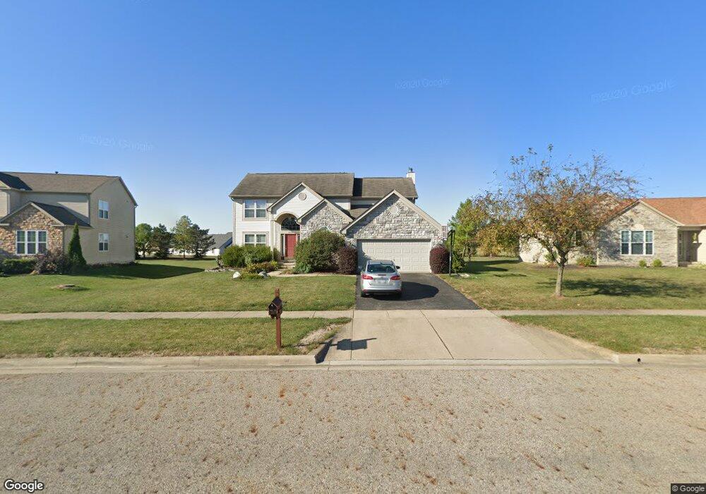
2094 Maxwell Ave Lewis Center, OH 43035
Orange NeighborhoodEstimated Value: $509,000 - $562,000
4
Beds
3
Baths
2,608
Sq Ft
$204/Sq Ft
Est. Value
About This Home
This home is located at 2094 Maxwell Ave, Lewis Center, OH 43035 and is currently estimated at $531,865, approximately $203 per square foot. 2094 Maxwell Ave is a home located in Delaware County with nearby schools including Freedom Trail Elementary School, Olentangy Orange Middle School, and Orange High School.
Ownership History
Date
Name
Owned For
Owner Type
Purchase Details
Closed on
Jun 20, 2003
Sold by
Volzke Richard and Volzke Dawnel
Bought by
Villanti Nicholas E and Villanti Sharon L
Current Estimated Value
Home Financials for this Owner
Home Financials are based on the most recent Mortgage that was taken out on this home.
Original Mortgage
$200,000
Outstanding Balance
$83,403
Interest Rate
5.12%
Mortgage Type
Purchase Money Mortgage
Estimated Equity
$448,462
Purchase Details
Closed on
Mar 12, 2001
Sold by
Rockford Homes Inc
Bought by
Volzke Richard and Volzke Downel
Create a Home Valuation Report for This Property
The Home Valuation Report is an in-depth analysis detailing your home's value as well as a comparison with similar homes in the area
Home Values in the Area
Average Home Value in this Area
Purchase History
| Date | Buyer | Sale Price | Title Company |
|---|---|---|---|
| Villanti Nicholas E | $257,000 | Chicago Title | |
| Volzke Richard | $223,430 | -- |
Source: Public Records
Mortgage History
| Date | Status | Borrower | Loan Amount |
|---|---|---|---|
| Open | Villanti Nicholas E | $200,000 | |
| Closed | Volzke Richard | -- | |
| Closed | Villanti Nicholas E | $25,000 |
Source: Public Records
Tax History Compared to Growth
Tax History
| Year | Tax Paid | Tax Assessment Tax Assessment Total Assessment is a certain percentage of the fair market value that is determined by local assessors to be the total taxable value of land and additions on the property. | Land | Improvement |
|---|---|---|---|---|
| 2024 | $8,178 | $147,350 | $34,300 | $113,050 |
| 2023 | $8,200 | $147,350 | $34,300 | $113,050 |
| 2022 | $7,259 | $106,120 | $24,150 | $81,970 |
| 2021 | $7,292 | $106,120 | $24,150 | $81,970 |
| 2020 | $7,327 | $106,120 | $24,150 | $81,970 |
| 2019 | $6,268 | $94,190 | $21,000 | $73,190 |
| 2018 | $6,297 | $94,190 | $21,000 | $73,190 |
| 2017 | $6,225 | $88,070 | $16,140 | $71,930 |
| 2016 | $6,264 | $88,070 | $16,140 | $71,930 |
| 2015 | $5,701 | $88,070 | $16,140 | $71,930 |
| 2014 | $5,783 | $88,070 | $16,140 | $71,930 |
| 2013 | $5,732 | $85,300 | $16,140 | $69,160 |
Source: Public Records
Map
Nearby Homes
- 2216 Reeves Ave
- 1923 Myrtle St
- 2165 Ben Brush Place
- 1955 Royal Oak Dr
- 8322 Aurora Ct
- 1746 E Powell Rd
- 1520 Aniko Ave
- 7631 Pleasant Colony Ct
- 2383 Bold Venture Dr
- 1143 Little Bear Place
- 975 Adara Dr Unit 6975
- 1245 Little Bear Loop
- 7633 Storrington Place
- 2715 Tucker Trail
- 8749 Paulden Ct
- 8910 Sedona Ct
- 0 E Orange Rd Unit lot 1
- 0 E Orange Rd
- 1326 Westwood Dr
- 7742 Holderman St
- 2100 Maxwell Ave
- 2088 Maxwell Ave
- 2082 Maxwell Ave
- 2110 Maxwell Ave
- 2093 Maxwell Ave
- 2101 Maxwell Ave
- 2083 Maxwell Ave
- 2072 Maxwell Ave
- 2122 Maxwell Ave
- 2121 Maxwell Ave
- 2075 Maxwell Ave
- 2161 Barnet Ct
- 2132 Maxwell Ave
- 2166 Barnet Ct
- 2060 Maxwell Ave
- 2145 Maxwell Ave
- 2069 Maxwell Ave
- 2148 Maxwell Ave
- 2167 Barnet Ct
- 2163 Maxwell Ave