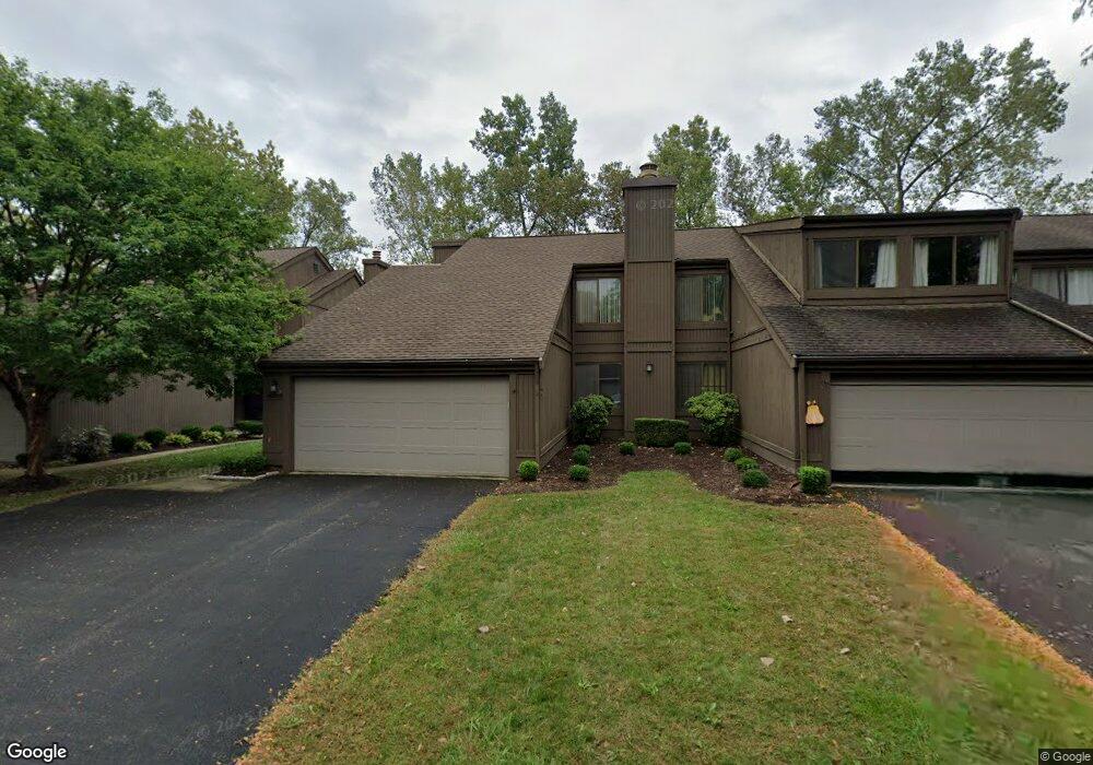
2095 Brookhurst Ave Unit 38A Columbus, OH 43229
Northgate NeighborhoodEstimated Value: $259,000 - $311,000
3
Beds
3
Baths
1,768
Sq Ft
$159/Sq Ft
Est. Value
About This Home
This home is located at 2095 Brookhurst Ave Unit 38A, Columbus, OH 43229 and is currently estimated at $281,794, approximately $159 per square foot. 2095 Brookhurst Ave Unit 38A is a home located in Franklin County with nearby schools including Northgate Intermediate, Alpine Elementary School, and Woodward Park Middle School.
Ownership History
Date
Name
Owned For
Owner Type
Purchase Details
Closed on
Apr 30, 2001
Sold by
Pappas Lucas and Pappas Wanda J
Bought by
Wilson Pamela J
Current Estimated Value
Home Financials for this Owner
Home Financials are based on the most recent Mortgage that was taken out on this home.
Original Mortgage
$145,250
Outstanding Balance
$51,451
Interest Rate
6.99%
Mortgage Type
FHA
Estimated Equity
$230,343
Purchase Details
Closed on
Jun 20, 1991
Bought by
Pappas Lucas and Pappas Wanda J
Purchase Details
Closed on
Oct 1, 1978
Create a Home Valuation Report for This Property
The Home Valuation Report is an in-depth analysis detailing your home's value as well as a comparison with similar homes in the area
Home Values in the Area
Average Home Value in this Area
Purchase History
| Date | Buyer | Sale Price | Title Company |
|---|---|---|---|
| Wilson Pamela J | $149,000 | Title First Agency Inc | |
| Pappas Lucas | -- | -- | |
| -- | $82,200 | -- |
Source: Public Records
Mortgage History
| Date | Status | Borrower | Loan Amount |
|---|---|---|---|
| Open | Wilson Pamela J | $145,250 |
Source: Public Records
Tax History
| Year | Tax Paid | Tax Assessment Tax Assessment Total Assessment is a certain percentage of the fair market value that is determined by local assessors to be the total taxable value of land and additions on the property. | Land | Improvement |
|---|---|---|---|---|
| 2025 | $3,663 | $81,620 | $16,100 | $65,520 |
| 2024 | $3,663 | $81,620 | $16,100 | $65,520 |
| 2023 | $3,616 | $81,620 | $16,100 | $65,520 |
| 2022 | $2,848 | $54,920 | $7,110 | $47,810 |
| 2021 | $2,853 | $54,920 | $7,110 | $47,810 |
| 2020 | $2,857 | $54,920 | $7,110 | $47,810 |
| 2019 | $2,467 | $40,670 | $5,250 | $35,420 |
| 2018 | $2,353 | $40,670 | $5,250 | $35,420 |
| 2017 | $2,466 | $40,670 | $5,250 | $35,420 |
| 2016 | $2,472 | $37,310 | $6,020 | $31,290 |
| 2015 | $2,244 | $37,310 | $6,020 | $31,290 |
| 2014 | $2,249 | $37,310 | $6,020 | $31,290 |
| 2013 | $1,168 | $39,270 | $6,335 | $32,935 |
Source: Public Records
Map
Nearby Homes
- 1946 Rockdale Dr Unit 57
- 6348 Birkewood St
- 2125 Keltonshire Ave
- 2154-2156 Jewett Dr
- 1281 Home Acre Dr
- 1755 Hillandale Ave
- 6425 Deer Ridge Ln
- 2197 Bayfield Dr
- 6245 Sharon Woods Blvd
- 2292 Laurelwood Dr Unit 2292L
- 1852 Balsamridge Rd
- 1635 Tendril Ct
- 2326 Laurelwood Dr Unit 2
- 6048 Pinemoor St
- 6416 Faircrest Rd
- 6019 Beechcroft Rd
- 6148 Sharon Woods Blvd
- 5972 Maple Canyon Ave
- 2750 Lauffer Ravines Dr
- 6166 Harrington Ct
- 2093 Brookhurst Ave Unit 38B
- 2099 Brookhurst Ave
- 2091 Brookhurst Ave Unit 38C
- 2101 Brookhurst Ave
- 2101 Brookhurst Ave Unit C
- 2089 Brookhurst Ave
- 2103 Brookhurst Ave Unit B39
- 2090 Brookhurst Ave
- 2092 Brookhurst Ave Unit 45B
- 2105 Brookhurst Ave Unit 39A
- 2094 Brookhurst Ave
- 2094 Brookhurst Ave Unit C
- 2096 Brookhurst Ave Unit D
- 2083 Brookhurst Ave
- 2081 Brookhurst Ave Unit 37C
- 2081 Brookhurst Ave Unit C
- 2104 Brookhurst Ave
- 2104 Brookhurst Ave Unit C
- 2102 Brookhurst Ave Unit 44B
Your Personal Tour Guide
Ask me questions while you tour the home.