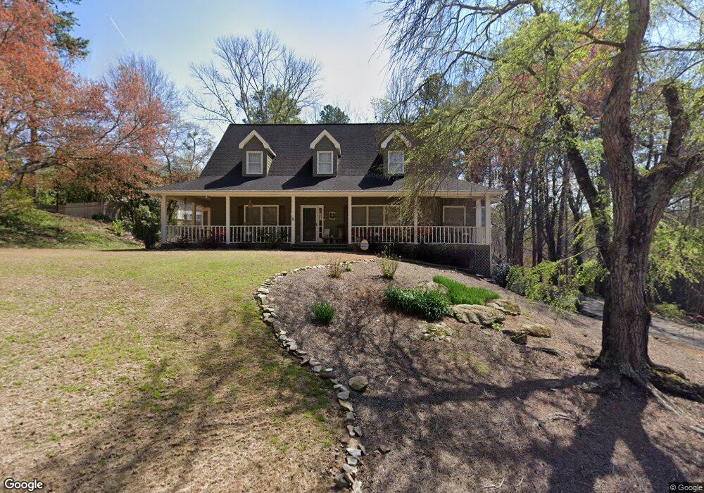
2095 Wilshire Dr SW Unit V Marietta, GA 30064
West Cobb NeighborhoodEstimated Value: $502,000 - $545,000
3
Beds
3
Baths
2,768
Sq Ft
$187/Sq Ft
Est. Value
About This Home
This home is located at 2095 Wilshire Dr SW Unit V, Marietta, GA 30064 and is currently estimated at $517,531, approximately $186 per square foot. 2095 Wilshire Dr SW Unit V is a home located in Cobb County with nearby schools including Cheatham Hill Elementary School, Lovinggood Middle School, and Hillgrove High School.
Ownership History
Date
Name
Owned For
Owner Type
Purchase Details
Closed on
Dec 30, 1997
Sold by
Bradford Howard A and Bradford Valee J
Bought by
Hamilton Freda G
Current Estimated Value
Home Financials for this Owner
Home Financials are based on the most recent Mortgage that was taken out on this home.
Original Mortgage
$91,500
Outstanding Balance
$15,412
Interest Rate
7.18%
Mortgage Type
New Conventional
Estimated Equity
$502,119
Create a Home Valuation Report for This Property
The Home Valuation Report is an in-depth analysis detailing your home's value as well as a comparison with similar homes in the area
Home Values in the Area
Average Home Value in this Area
Purchase History
| Date | Buyer | Sale Price | Title Company |
|---|---|---|---|
| Hamilton Freda G | $175,000 | -- |
Source: Public Records
Mortgage History
| Date | Status | Borrower | Loan Amount |
|---|---|---|---|
| Open | Hamilton Freda G | $91,500 |
Source: Public Records
Tax History Compared to Growth
Tax History
| Year | Tax Paid | Tax Assessment Tax Assessment Total Assessment is a certain percentage of the fair market value that is determined by local assessors to be the total taxable value of land and additions on the property. | Land | Improvement |
|---|---|---|---|---|
| 2025 | $4,855 | $209,768 | $40,000 | $169,768 |
| 2024 | $4,189 | $178,872 | $16,000 | $162,872 |
| 2023 | $3,647 | $178,872 | $16,000 | $162,872 |
| 2022 | $3,958 | $166,768 | $16,000 | $150,768 |
| 2021 | $3,388 | $140,716 | $16,000 | $124,716 |
| 2020 | $3,369 | $139,864 | $16,000 | $123,864 |
| 2019 | $3,236 | $133,788 | $16,000 | $117,788 |
| 2018 | $2,791 | $113,444 | $16,000 | $97,444 |
| 2017 | $2,702 | $113,444 | $16,000 | $97,444 |
| 2016 | $2,511 | $104,544 | $16,000 | $88,544 |
| 2015 | $2,564 | $104,544 | $16,000 | $88,544 |
| 2014 | $1,996 | $78,404 | $0 | $0 |
Source: Public Records
Map
Nearby Homes
- 2040 Hardwood Cir SW Unit 3
- 1646 Desford Ct SW
- 2093 Breconridge Dr SW
- 1533 Fallen Leaf Dr SW
- 1505 Old John Ward Rd SW
- 1830 MacLand Rd SW
- 1946 MacLand Rd SW
- 2002 MacLand Square Dr Unit 1
- 1952 Freestone Way
- Monteluce Plan at Freestone Station
- Hillside Plan at Freestone Station
- Oakshire Plan at Freestone Station
- Hendricks Plan at Freestone Station
- Hedgerow Plan at Freestone Station
- Antioch Plan at Freestone Station
- 1985 Freestone Way
- 1537 Mcadoo Dr SW
- 2028 MacLand Square Dr Unit 4
- 2009 Freestone Way
- 2409 Caneridge Point SW
- 2097 Wilshire Dr SW
- 1815 Windcrest Cir SW
- 2093 Wilshire Dr SW
- 1825 Windcrest Cir SW Unit 5
- 1380 Wilshire Ct SW
- 1823 Windcrest Cir SW
- 2092 Wilshire Dr SW
- 1827 Windcrest Cir SW
- 1381 Wilshire Ct SW
- 2099 Wilshire Dr SW
- 1382 Wilshire Ct SW
- 1814 Windcrest Cir SW
- 2090 Wilshire Dr SW Unit 5
- 2098 Wilshire Dr SW
- 1812 Windcrest Cir SW
- 2088 Wilshire Dr SW
- 1816 Windcrest Cir SW
- 1820 Windcrest Cir SW
- 1822 Windcrest Cir SW Unit 341
- 1822 Windcrest Cir SW