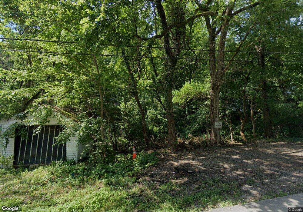
2095 Yoast Ave Cincinnati, OH 45225
East Westwood NeighborhoodEstimated Value: $22,000
Studio
--
Bath
--
Sq Ft
2,614
Sq Ft Lot
About This Home
This home is located at 2095 Yoast Ave, Cincinnati, OH 45225 and is currently priced at $22,000. 2095 Yoast Ave is a home located in Hamilton County with nearby schools including Western Hills High School, Gilbert A. Dater High School, and Robert A. Taft Information Technology High School.
Ownership History
Date
Name
Owned For
Owner Type
Purchase Details
Closed on
Mar 30, 2022
Sold by
Cincy Urban Ridgeway Llc
Bought by
Hamilton County Land Reutilization Corporatio
Current Estimated Value
Purchase Details
Closed on
Jul 25, 2009
Sold by
Rhodes Dusty
Bought by
Weinberger David
Purchase Details
Closed on
Mar 1, 2006
Sold by
Brenner & Jansen Properties Inc
Bought by
Forlansa Inc
Purchase Details
Closed on
Jun 30, 2003
Sold by
Gilbert Gardy and Gilbert Zulande
Bought by
Brenner & Jansen Properties Inc
Create a Home Valuation Report for This Property
The Home Valuation Report is an in-depth analysis detailing your home's value as well as a comparison with similar homes in the area
Home Values in the Area
Average Home Value in this Area
Purchase History
| Date | Buyer | Sale Price | Title Company |
|---|---|---|---|
| Hamilton County Land Reutilization Corporatio | -- | Port Of Greater Cincinnati Dev | |
| Weinberger David | -- | None Available | |
| Forlansa Inc | -- | None Available | |
| Brenner & Jansen Properties Inc | -- | None Available |
Source: Public Records
Tax History
| Year | Tax Paid | Tax Assessment Tax Assessment Total Assessment is a certain percentage of the fair market value that is determined by local assessors to be the total taxable value of land and additions on the property. | Land | Improvement |
|---|---|---|---|---|
| 2025 | -- | $154 | $154 | -- |
| 2024 | -- | $154 | $154 | -- |
| 2023 | $8 | $154 | $154 | $0 |
| 2022 | $15 | $123 | $123 | $0 |
| 2021 | $14 | $123 | $123 | $0 |
| 2020 | $14 | $123 | $123 | $0 |
| 2019 | $15 | $123 | $123 | $0 |
| 2018 | $15 | $123 | $123 | $0 |
| 2017 | $14 | $123 | $123 | $0 |
| 2016 | $17 | $161 | $161 | $0 |
| 2015 | $16 | $161 | $161 | $0 |
| 2014 | $16 | $161 | $161 | $0 |
| 2013 | $16 | $165 | $165 | $0 |
Source: Public Records
Map
Nearby Homes
- 2163 Baltimore Ave
- 3384 Ninann Ct
- 2183 Westwood Northern Blvd
- 1965 Baltimore Ave
- 3295 Fyffe Ave
- 2043 E Teralta Cir
- 1970 Westwood Northern Blvd
- 3111 Cavanaugh Ave
- 2114 Saint Leo Place
- 3312 Mchenry Ave
- 2843 Robert Ave
- 2962 Aquadale Ln
- 3521 Mchenry Ave
- 3519 Mchenry Ave
- 2082 Harrison Ave
- 3041 Westknolls Ln
- 2711 Baker Ave
- 2065 Harrison Ave
- 2424 Westwood Northern Blvd
- 2109 Harrison Ave
- 2041 Yoast Ave
- 2040 Yoast Ave
- 2039 Yoast Ave
- 2048 Yoast Ave
- 2049 Yoast Ave
- 2036 Yoast Ave
- 2054 Yoast Ave
- 2032 Yoast Ave
- 2058 Yoast Ave
- 2047 Harkness St
- 2062 Yoast Ave
- 2077 Harkness St
- 2063 Yoast Ave
- 2067 Yoast Ave
- 2045 Harkness St
- 2079 Harkness St
- 2081 Harkness St
- 2080 Harkness St
- 2042 Harkness St
- 2079 Baltimore Ave
Your Personal Tour Guide
Ask me questions while you tour the home.