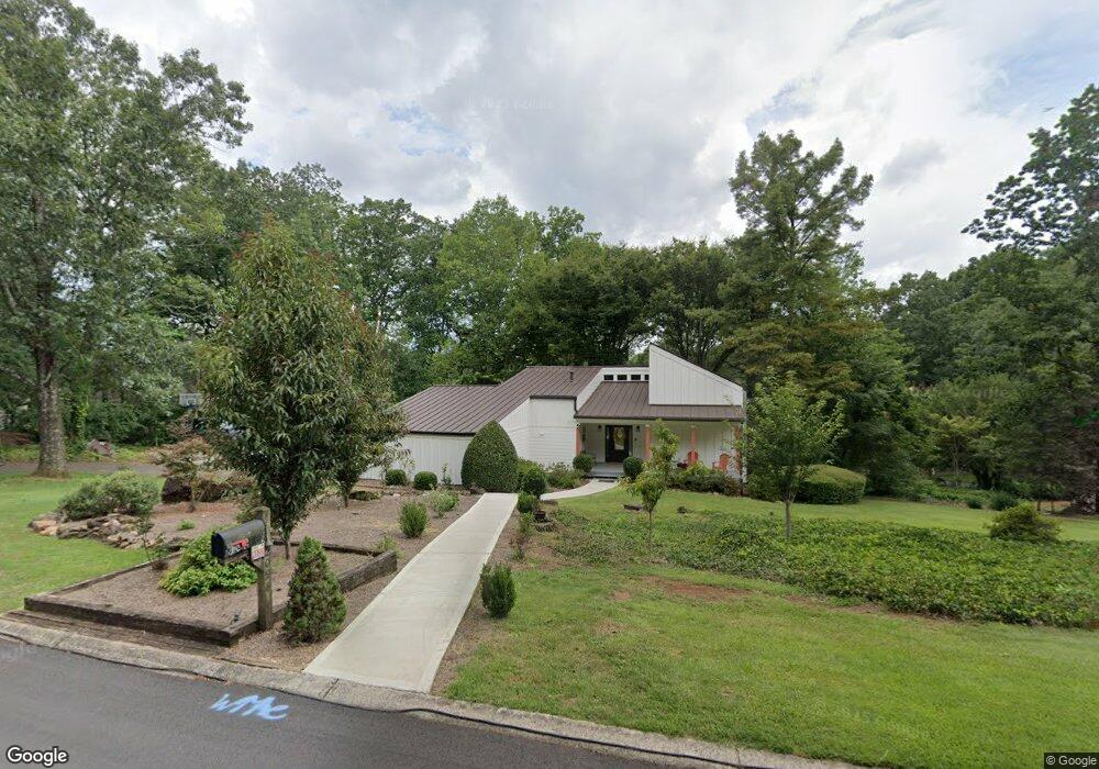
2096 Kinridge Ct Unit 2 Marietta, GA 30062
Eastern Marietta NeighborhoodEstimated Value: $382,000 - $416,566
3
Beds
2
Baths
1,342
Sq Ft
$299/Sq Ft
Est. Value
About This Home
This home is located at 2096 Kinridge Ct Unit 2, Marietta, GA 30062 and is currently estimated at $401,142, approximately $298 per square foot. 2096 Kinridge Ct Unit 2 is a home located in Cobb County with nearby schools including Kincaid Elementary School, Simpson Middle School, and Sprayberry High School.
Ownership History
Date
Name
Owned For
Owner Type
Purchase Details
Closed on
Mar 12, 2021
Sold by
Kip Thompson
Bought by
Thompson Cassandra D and Thompson Kip K
Current Estimated Value
Purchase Details
Closed on
Oct 10, 2007
Sold by
Heiman Mark J
Bought by
Thompson Kip
Home Financials for this Owner
Home Financials are based on the most recent Mortgage that was taken out on this home.
Original Mortgage
$193,300
Interest Rate
6.44%
Mortgage Type
New Conventional
Purchase Details
Closed on
Jun 5, 1997
Sold by
Watson Sarah B and Leblanc Robert G
Bought by
Heiman Mark J
Home Financials for this Owner
Home Financials are based on the most recent Mortgage that was taken out on this home.
Original Mortgage
$102,400
Interest Rate
8.01%
Mortgage Type
New Conventional
Create a Home Valuation Report for This Property
The Home Valuation Report is an in-depth analysis detailing your home's value as well as a comparison with similar homes in the area
Home Values in the Area
Average Home Value in this Area
Purchase History
| Date | Buyer | Sale Price | Title Company |
|---|---|---|---|
| Thompson Cassandra D | -- | Jones Richard M | |
| Thompson Kip | $193,300 | -- | |
| Heiman Mark J | $128,000 | -- |
Source: Public Records
Mortgage History
| Date | Status | Borrower | Loan Amount |
|---|---|---|---|
| Previous Owner | Thompson Kip | $193,300 | |
| Previous Owner | Heiman Mark J | $102,400 |
Source: Public Records
Tax History Compared to Growth
Tax History
| Year | Tax Paid | Tax Assessment Tax Assessment Total Assessment is a certain percentage of the fair market value that is determined by local assessors to be the total taxable value of land and additions on the property. | Land | Improvement |
|---|---|---|---|---|
| 2025 | $3,929 | $163,636 | $36,000 | $127,636 |
| 2024 | $3,596 | $148,116 | $36,000 | $112,116 |
| 2023 | $2,899 | $141,028 | $36,000 | $105,028 |
| 2022 | $2,699 | $105,904 | $28,000 | $77,904 |
| 2021 | $2,699 | $105,904 | $28,000 | $77,904 |
| 2020 | $2,496 | $96,636 | $28,000 | $68,636 |
| 2019 | $2,366 | $90,692 | $22,400 | $68,292 |
| 2018 | $1,942 | $73,012 | $20,800 | $52,212 |
| 2017 | $1,843 | $73,012 | $20,800 | $52,212 |
| 2016 | $1,468 | $59,956 | $16,800 | $43,156 |
| 2015 | $1,506 | $59,956 | $16,800 | $43,156 |
| 2014 | $1,519 | $59,956 | $0 | $0 |
Source: Public Records
Map
Nearby Homes
- 1991 Kinridge Rd
- 2020 Starlight Dr
- 1822 Hasty Rd
- 1833 Tree Top Ct
- 2289 Glenridge Dr
- 1780 Kinridge Rd
- 1701 Smithwood Dr
- 1900 Branch View Dr
- 2255 Abbey Cove Ct
- 2072 Fairport Way
- 1972 Granite Mill Rd
- 2252 Carefree Cir Unit 3
- 2265 Piedmont Glen Ct Unit 1
- 2116 Morgan Rd NE
- 2314 Sandy Oaks Dr
- 2065 Mozelle Dr
- 1854 Butterfly Way
- 1850 Butterfly Way NE
- 1958 Kinridge Rd Unit 2
- 2094 Kinridge Ct Unit 2
- 2095 Kinridge Ct Unit 2
- 2091 Kinridge Ct
- 2086 Kinridge Ct
- 1951 Kinridge Rd
- 1968 Starlight Dr
- 1969 Kinridge Rd
- 1960 Starlight Dr
- 1998 Kinridge Rd Unit 2
- 0 Kinridge Ct Unit 7227176
- 0 Kinridge Ct Unit 8391246
- 0 Kinridge Ct Unit 8456304
- 1990 Kinridge Rd
- 2097 Kinridge Rd
- 1952 Starlight Dr
- 1980 Starlight Dr
- 1971 Kinridge Rd
- 2098 Kinridge Ct
- 2081 Kinridge Ct Unit 3